Viola Topo Map Washington
To zoom in, hover over the map of Viola
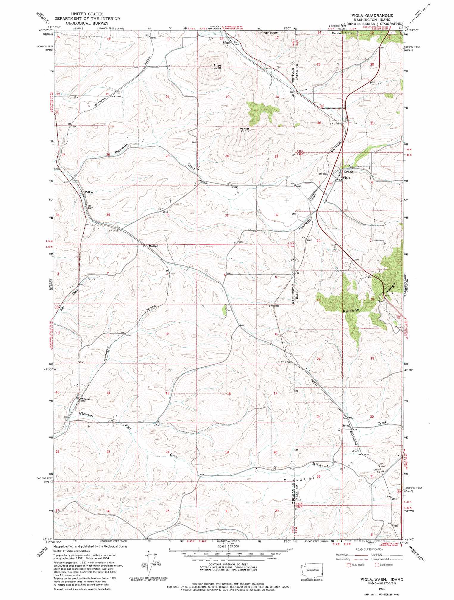
USGS Topo Quad 46117g1 - 1:24,000 scale
| Topo Map Name: | Viola |
| USGS Topo Quad ID: | 46117g1 |
| Print Size: | ca. 21 1/4" wide x 27" high |
| Southeast Coordinates: | 46.75° N latitude / 117° W longitude |
| Map Center Coordinates: | 46.8125° N latitude / 117.0625° W longitude |
| U.S. States: | WA, ID |
| Filename: | o46117g1.jpg |
| Download Map JPG Image: | Viola topo map 1:24,000 scale |
| Map Type: | Topographic |
| Topo Series: | 7.5´ |
| Map Scale: | 1:24,000 |
| Source of Map Images: | United States Geological Survey (USGS) |
| Alternate Map Versions: |
Viola ID 1964, updated 1965 Download PDF Buy paper map Viola ID 1964, updated 1980 Download PDF Buy paper map Viola ID 2011 Download PDF Buy paper map Viola ID 2013 Download PDF Buy paper map |
1:24,000 Topo Quads surrounding Viola
Steptoe |
Garfield |
Farmington |
Mission Mountain |
Sanders |
Colfax North |
Elberton |
Palouse |
Potlatch |
Princeton |
Colfax South |
Albion |
Viola |
Robinson Lake |
Moscow Mountain |
Ewartsville |
Pullman |
Moscow West |
Moscow East |
Troy |
Granite Point |
Colton |
Uniontown |
Genesee |
Green Knob |
> Back to 46117e1 at 1:100,000 scale
> Back to 46116a1 at 1:250,000 scale
> Back to U.S. Topo Maps home
Viola topo map: Gazetteer
Viola: Flats
Missouri Flat elevation 794m 2604′Missouri Flat elevation 797m 2614′
Viola: Populated Places
Buswell (historical) elevation 799m 2621′Estes elevation 804m 2637′
Fallon elevation 758m 2486′
Madson elevation 773m 2536′
Ringo elevation 784m 2572′
Viola elevation 802m 2631′
Whelan elevation 767m 2516′
Viola: Summits
Angel Butte elevation 950m 3116′Parker Butte elevation 1006m 3300′
Randall Butte elevation 1005m 3297′
Viola digital topo map on disk
Buy this Viola topo map showing relief, roads, GPS coordinates and other geographical features, as a high-resolution digital map file on DVD: