Page Topo Map Washington
To zoom in, hover over the map of Page
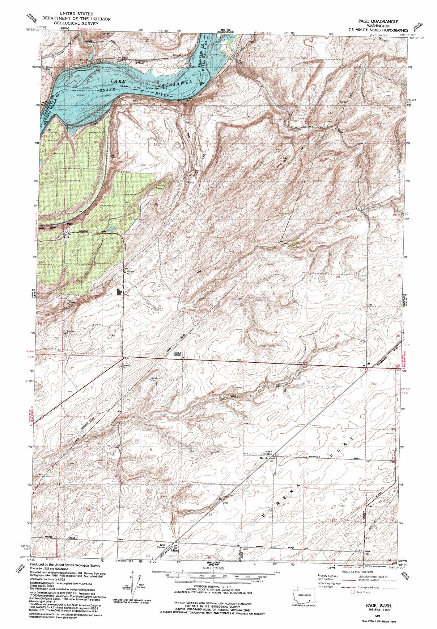
USGS Topo Quad 46118c6 - 1:24,000 scale
| Topo Map Name: | Page |
| USGS Topo Quad ID: | 46118c6 |
| Print Size: | ca. 21 1/4" wide x 27" high |
| Southeast Coordinates: | 46.25° N latitude / 118.625° W longitude |
| Map Center Coordinates: | 46.3125° N latitude / 118.6875° W longitude |
| U.S. State: | WA |
| Filename: | o46118c6.jpg |
| Download Map JPG Image: | Page topo map 1:24,000 scale |
| Map Type: | Topographic |
| Topo Series: | 7.5´ |
| Map Scale: | 1:24,000 |
| Source of Map Images: | United States Geological Survey (USGS) |
| Alternate Map Versions: |
Page WA 1966, updated 1967 Download PDF Buy paper map Page WA 1991, updated 1992 Download PDF Buy paper map Page WA 2011 Download PDF Buy paper map Page WA 2013 Download PDF Buy paper map |
1:24,000 Topo Quads surrounding Page
Mesa East |
Connell Se |
Burr Canyon |
Lower Monumental Dam |
Monumental Rock |
Rye Grass Coulee |
Levey Ne |
Snake River |
Elwood |
Clyde |
Levey Sw |
Levey Se |
Page |
Eureka |
Harsha |
Humorist |
Slater |
Welland |
Rulo |
Hadley |
Wallula |
Zangar Junction |
Touchet |
Lowden |
College Place |
> Back to 46118a1 at 1:100,000 scale
> Back to 46118a1 at 1:250,000 scale
> Back to U.S. Topo Maps home
Page digital topo map on disk
Buy this Page topo map showing relief, roads, GPS coordinates and other geographical features, as a high-resolution digital map file on DVD: