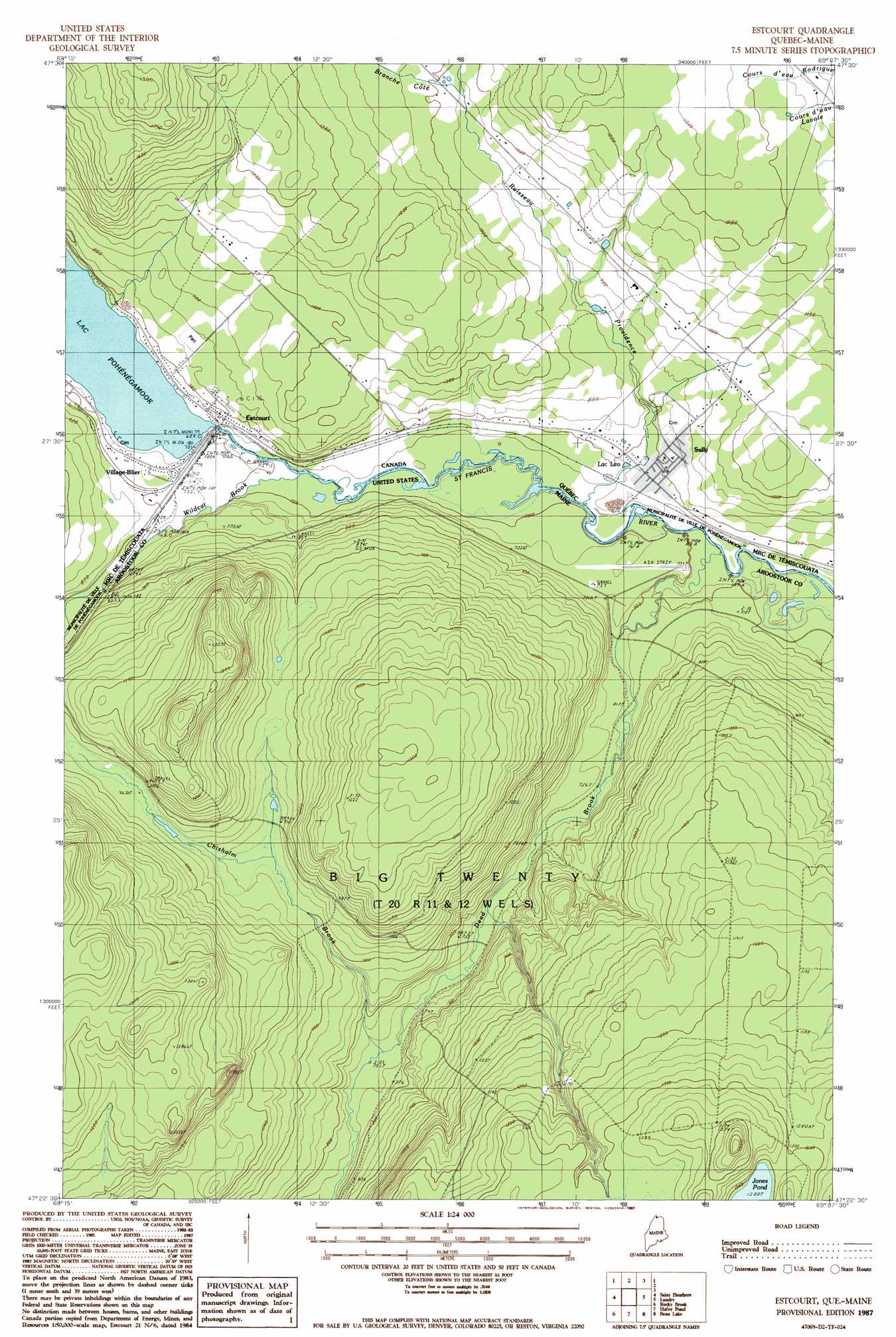
Estcourt Topo Map Maine
To zoom in, hover over the map of Estcourt
USGS Topo Quad 47069d2 - 1:24,000 scale
| Topo Map Name: | Estcourt |
| USGS Topo Quad ID: | 47069d2 |
| Print Size: | ca. 21 1/4" wide x 27" high |
| Southeast Coordinates: | 47.375° N latitude / 69.125° W longitude |
| Map Center Coordinates: | 47.4375° N latitude / 69.1875° W longitude |
| U.S. State: | ME |
| Filename: | o47069d2.jpg |
| Download Map JPG Image: | Estcourt topo map 1:24,000 scale |
| Map Type: | Topographic |
| Topo Series: | 7.5´ |
| Map Scale: | 1:24,000 |
| Source of Map Images: | United States Geological Survey (USGS) |
| Alternate Map Versions: |
Estcourt QC 1987, updated 1987 Download PDF Buy paper map Estcourt QC 2011 Download PDF Buy paper map Estcourt QC 2014 Download PDF Buy paper map |
1:24,000 Topo Quads surrounding Estcourt
Saint Eleuthere |
Estcourt |
Landry |
||
Morrison Brook |
Rocky Brook |
Hafey Pond |
Beau Lake |
|
Rocky Mountain Nw |
Rocky Mountain |
Johnson Brook Mountain |
Falls Brook Lake |
Saint Francis |
> Back to 47069a1 at 1:100,000 scale
> Back to 47068a1 at 1:250,000 scale
> Back to U.S. Topo Maps home
Estcourt topo map: Gazetteer
Estcourt: Lakes
Jones Pond elevation 392m 1286′Estcourt: Populated Places
Estcourt elevation 213m 698′Estcourt: Streams
Chisholm Brook elevation 227m 744′Dead Brook elevation 202m 662′
Wildcat Brook elevation 211m 692′
Estcourt digital topo map on disk
Buy this Estcourt topo map showing relief, roads, GPS coordinates and other geographical features, as a high-resolution digital map file on DVD:
Maine, New Hampshire, Rhode Island & Eastern Massachusetts
Buy digital topo maps: Maine, New Hampshire, Rhode Island & Eastern Massachusetts