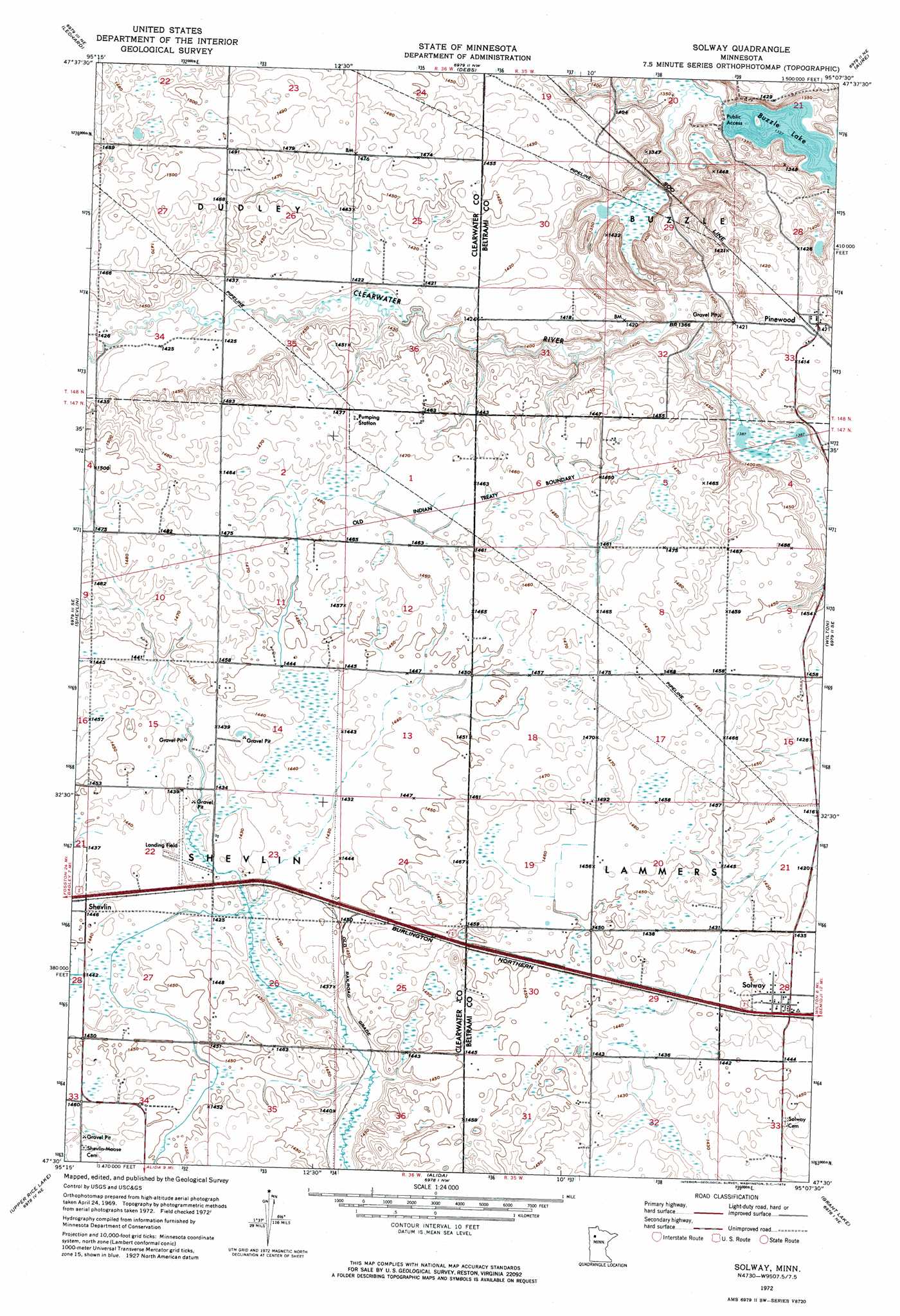
Solway Topo Map Minnesota
To zoom in, hover over the map of Solway
USGS Topo Quad 47095e2 - 1:24,000 scale
| Topo Map Name: | Solway |
| USGS Topo Quad ID: | 47095e2 |
| Print Size: | ca. 21 1/4" wide x 27" high |
| Southeast Coordinates: | 47.5° N latitude / 95.125° W longitude |
| Map Center Coordinates: | 47.5625° N latitude / 95.1875° W longitude |
| U.S. State: | MN |
| Filename: | p47095e2.jpg |
| Download Map JPG Image: | Solway topo map 1:24,000 scale |
| Map Type: | Orthophoto |
| Topo Series: | 7.5´ |
| Map Scale: | 1:24,000 |
| Source of Map Images: | United States Geological Survey (USGS) |
| Alternate Map Versions: |
Solway MN 1972, updated 1974 Download PDF Buy paper map Solway MN 2010 Download PDF Buy paper map Solway MN 2013 Download PDF Buy paper map Solway MN 2016 Download PDF Buy paper map |
1:24,000 Topo Quads surrounding Solway
Berner |
Gurneau Lake |
Bagley Lake |
Red Lake |
Redby |
Clearbrook |
Leonard |
Debs |
Aure |
Puposky Lake |
Bagley |
Shevlin |
Solway |
Wilton |
Peterson Lake |
Zerkel Nw |
Upper Rice Lake |
Alida |
Grant Lake |
Bemidji West |
Zerkel |
Heart Lake |
La Salle Lake |
Lake Hattie |
Frontenac Lake |
> Back to 47095e1 at 1:100,000 scale
> Back to 47094a1 at 1:250,000 scale
> Back to U.S. Topo Maps home
Solway topo map: Gazetteer
Solway: Lakes
Buzzle Lake elevation 408m 1338′Solway: Populated Places
Pinewood elevation 433m 1420′Solway elevation 442m 1450′
Solway: Post Offices
Buzzle Post Office (historical) elevation 419m 1374′Pinewood Post Office (historical) elevation 433m 1420′
Solway Post Office elevation 442m 1450′
Solway digital topo map on disk
Buy this Solway topo map showing relief, roads, GPS coordinates and other geographical features, as a high-resolution digital map file on DVD: