Drake Se Topo Map North Dakota
To zoom in, hover over the map of Drake Se
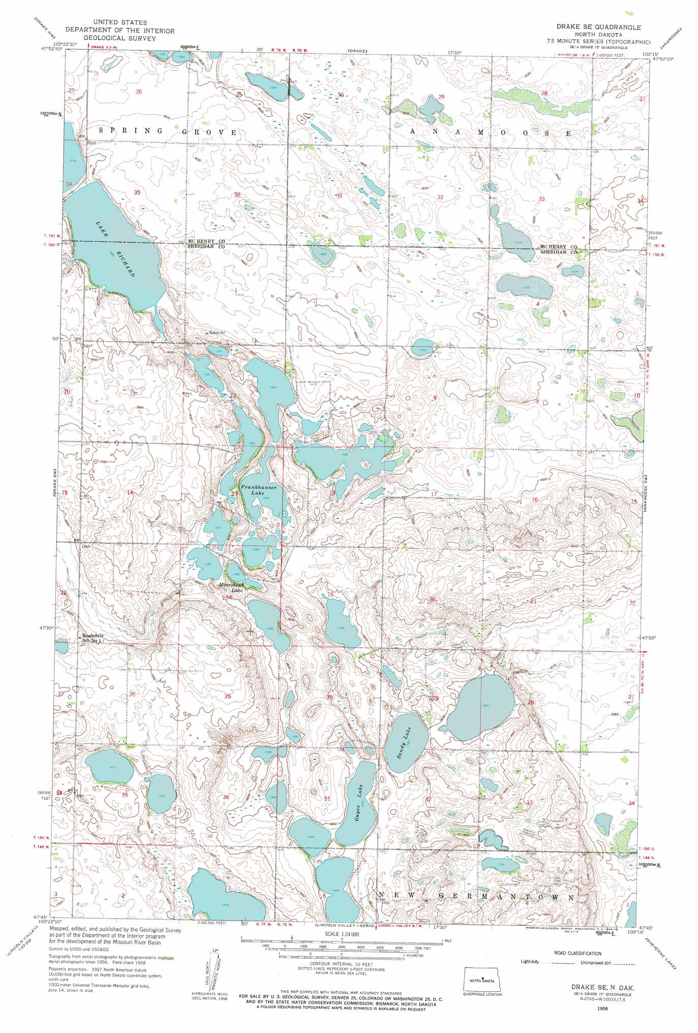
USGS Topo Quad 47100g3 - 1:24,000 scale
| Topo Map Name: | Drake Se |
| USGS Topo Quad ID: | 47100g3 |
| Print Size: | ca. 21 1/4" wide x 27" high |
| Southeast Coordinates: | 47.75° N latitude / 100.25° W longitude |
| Map Center Coordinates: | 47.8125° N latitude / 100.3125° W longitude |
| U.S. State: | ND |
| Filename: | O47100G3.jpg |
| Download Map JPG Image: | Drake Se topo map 1:24,000 scale |
| Map Type: | Topographic |
| Topo Series: | 7.5´ |
| Map Scale: | 1:24,000 |
| Source of Map Images: | United States Geological Survey (USGS) |
| Alternate Map Versions: |
Drake SE ND 1958, updated 1959 Download PDF Buy paper map Drake SE ND 2011 Download PDF Buy paper map Drake SE ND 2014 Download PDF Buy paper map |
1:24,000 Topo Quads surrounding Drake Se
Karlsruhe |
Rangeley |
Rangeley Se |
Orrin |
Balta Se |
Balfour |
Drake Nw |
Drake |
Anamoose |
Clifton |
Kief |
Drake Sw |
Drake Se |
Anamoose Sw |
Martin |
Siebold Lake |
Lincoln Valley Nw |
Lincoln Valley |
Sheyenne Lake |
Sheyenne Lake Ne |
Pelican Lake Se |
Lincoln Valley Sw |
Lincoln Valley Se |
Mertz Slough |
Pony Gulch |
> Back to 47100e1 at 1:100,000 scale
> Back to 47100a1 at 1:250,000 scale
> Back to U.S. Topo Maps home
Drake Se topo map: Gazetteer
Drake Se: Lakes
Frankhauser Lake elevation 483m 1584′Guyes Lake elevation 483m 1584′
Lake Richard elevation 482m 1581′
Moorehead Lake elevation 483m 1584′
Sand Lake elevation 483m 1584′
Drake Se digital topo map on disk
Buy this Drake Se topo map showing relief, roads, GPS coordinates and other geographical features, as a high-resolution digital map file on DVD:
Eastern North Dakota & Eastern South Dakota
Buy digital topo maps: Eastern North Dakota & Eastern South Dakota