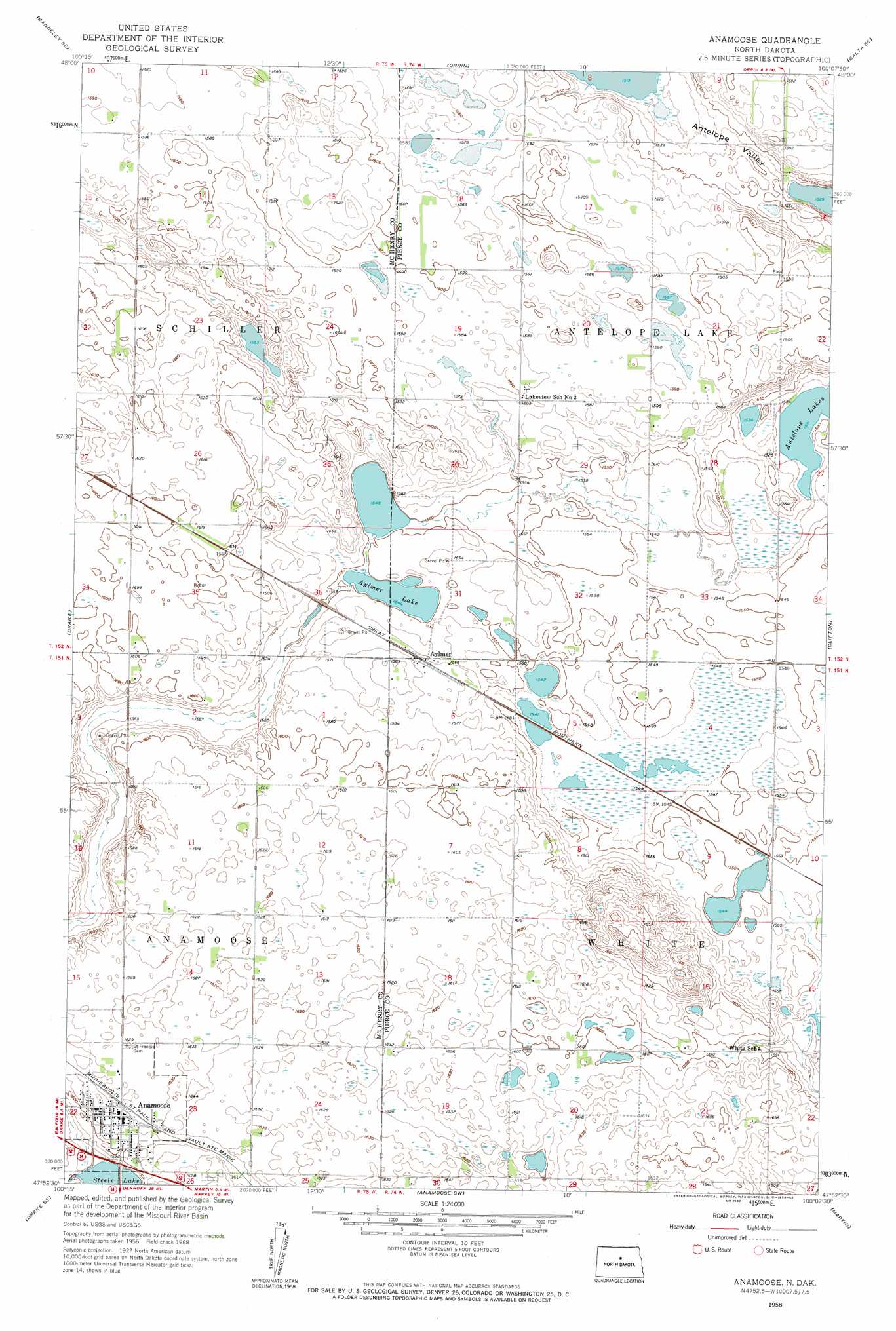
Anamoose Topo Map North Dakota
To zoom in, hover over the map of Anamoose
USGS Topo Quad 47100h2 - 1:24,000 scale
| Topo Map Name: | Anamoose |
| USGS Topo Quad ID: | 47100h2 |
| Print Size: | ca. 21 1/4" wide x 27" high |
| Southeast Coordinates: | 47.875° N latitude / 100.125° W longitude |
| Map Center Coordinates: | 47.9375° N latitude / 100.1875° W longitude |
| U.S. State: | ND |
| Filename: | O47100H2.jpg |
| Download Map JPG Image: | Anamoose topo map 1:24,000 scale |
| Map Type: | Topographic |
| Topo Series: | 7.5´ |
| Map Scale: | 1:24,000 |
| Source of Map Images: | United States Geological Survey (USGS) |
| Alternate Map Versions: |
Anamoose ND 1958, updated 1959 Download PDF Buy paper map Anamoose ND 2011 Download PDF Buy paper map Anamoose ND 2014 Download PDF Buy paper map |
1:24,000 Topo Quads surrounding Anamoose
Rangeley Nw |
Rangeley Ne |
Balta Nw |
Balta |
Silva |
Rangeley |
Rangeley Se |
Orrin |
Balta Se |
Petrified Lake |
Drake Nw |
Drake |
Anamoose |
Clifton |
Selz Nw |
Drake Sw |
Drake Se |
Anamoose Sw |
Martin |
Harvey |
Lincoln Valley Nw |
Lincoln Valley |
Sheyenne Lake |
Sheyenne Lake Ne |
Manfred Nw |
> Back to 47100e1 at 1:100,000 scale
> Back to 47100a1 at 1:250,000 scale
> Back to U.S. Topo Maps home
Anamoose topo map: Gazetteer
Anamoose: Lakes
Aylmer Lake elevation 473m 1551′Anamoose: Populated Places
Anamoose elevation 494m 1620′Aylmer elevation 482m 1581′
Anamoose: Valleys
Antelope Valley elevation 467m 1532′Anamoose digital topo map on disk
Buy this Anamoose topo map showing relief, roads, GPS coordinates and other geographical features, as a high-resolution digital map file on DVD:
Eastern North Dakota & Eastern South Dakota
Buy digital topo maps: Eastern North Dakota & Eastern South Dakota