Rocky Lake Topo Map Montana
To zoom in, hover over the map of Rocky Lake
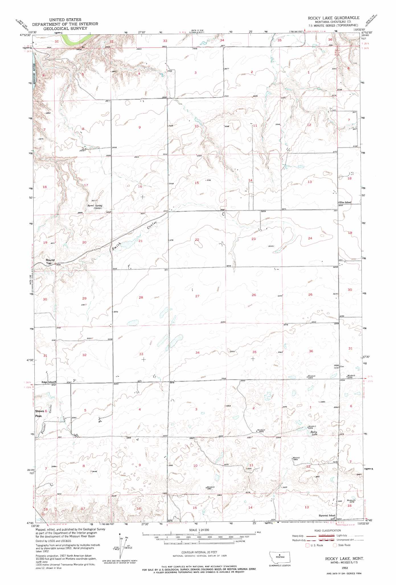
USGS Topo Quad 47110g4 - 1:24,000 scale
| Topo Map Name: | Rocky Lake |
| USGS Topo Quad ID: | 47110g4 |
| Print Size: | ca. 21 1/4" wide x 27" high |
| Southeast Coordinates: | 47.75° N latitude / 110.375° W longitude |
| Map Center Coordinates: | 47.8125° N latitude / 110.4375° W longitude |
| U.S. State: | MT |
| Filename: | o47110g4.jpg |
| Download Map JPG Image: | Rocky Lake topo map 1:24,000 scale |
| Map Type: | Topographic |
| Topo Series: | 7.5´ |
| Map Scale: | 1:24,000 |
| Source of Map Images: | United States Geological Survey (USGS) |
| Alternate Map Versions: |
Rocky Lake MT 1953, updated 1954 Download PDF Buy paper map Rocky Lake MT 1953, updated 1976 Download PDF Buy paper map Rocky Lake MT 2011 Download PDF Buy paper map Rocky Lake MT 2014 Download PDF Buy paper map |
1:24,000 Topo Quads surrounding Rocky Lake
Day School Sw |
Day School |
Kenilworth Sw |
Boggs Island |
Verona |
Fort Benton Nw |
Loma West |
Loma East |
Stranahan |
Big Bend School |
Fort Benton |
O'Hanlon Coulee |
Rocky Lake |
Stranahan Se |
Eagle Buttes Sw |
Shonkin Nw |
Shonkin |
Montague |
Geraldine Ne |
Dammel Reservoir |
Big Sag |
Carter Mountain |
Lepleys Creek |
Geraldine |
Square Butte |
> Back to 47110e1 at 1:100,000 scale
> Back to 47110a1 at 1:250,000 scale
> Back to U.S. Topo Maps home
Rocky Lake topo map: Gazetteer
Rocky Lake: Dams
Godfather Dam elevation 956m 3136′Rocky Lake: Lakes
Rocky Lake elevation 1025m 3362′Rocky Lake: Springs
Barrel Spring elevation 907m 2975′Rocky Lake: Summits
Round Top elevation 948m 3110′Rocky Lake digital topo map on disk
Buy this Rocky Lake topo map showing relief, roads, GPS coordinates and other geographical features, as a high-resolution digital map file on DVD: