Porcupine Creek Topo Map Montana
To zoom in, hover over the map of Porcupine Creek
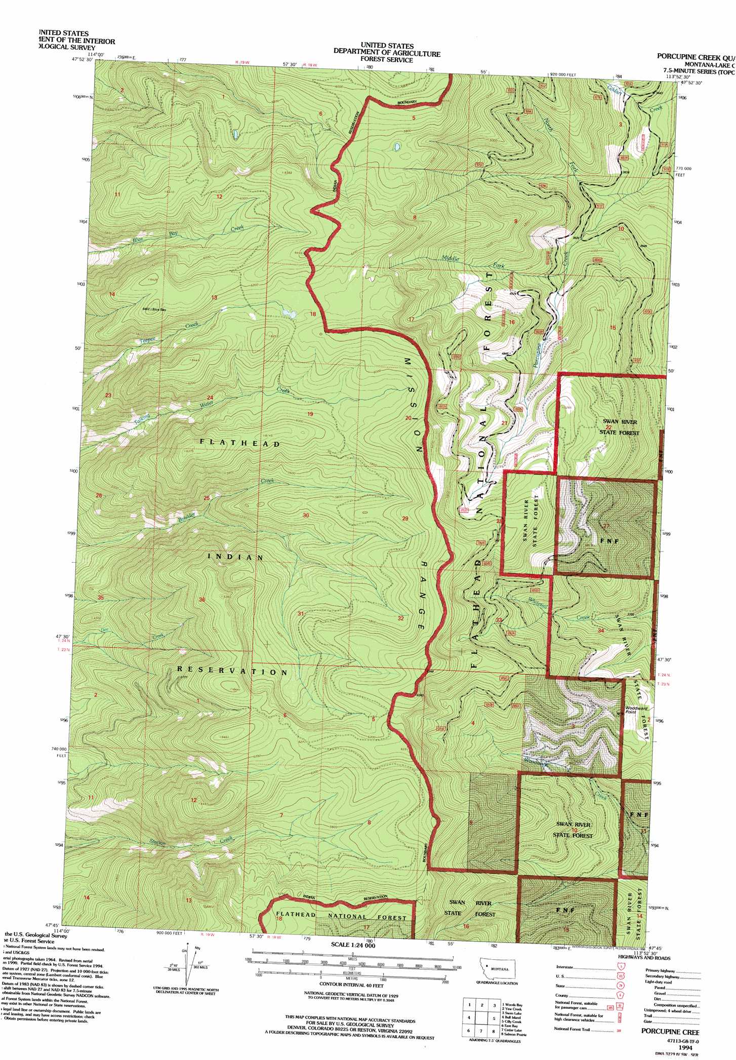
USGS Topo Quad 47113g8 - 1:24,000 scale
| Topo Map Name: | Porcupine Creek |
| USGS Topo Quad ID: | 47113g8 |
| Print Size: | ca. 21 1/4" wide x 27" high |
| Southeast Coordinates: | 47.75° N latitude / 113.875° W longitude |
| Map Center Coordinates: | 47.8125° N latitude / 113.9375° W longitude |
| U.S. State: | MT |
| Filename: | o47113g8.jpg |
| Download Map JPG Image: | Porcupine Creek topo map 1:24,000 scale |
| Map Type: | Topographic |
| Topo Series: | 7.5´ |
| Map Scale: | 1:24,000 |
| Source of Map Images: | United States Geological Survey (USGS) |
| Alternate Map Versions: |
Porcupine Creek MT 1965, updated 1968 Download PDF Buy paper map Porcupine Creek MT 1965, updated 1988 Download PDF Buy paper map Porcupine Creek MT 1994, updated 1996 Download PDF Buy paper map Porcupine Creek MT 2011 Download PDF Buy paper map Porcupine Creek MT 2014 Download PDF Buy paper map |
| FStopo: | US Forest Service topo Porcupine Creek is available: Download FStopo PDF Download FStopo TIF |
1:24,000 Topo Quads surrounding Porcupine Creek
Somers |
Bigfork |
Crater Lake |
Big Hawk Mountain |
Quintonkon |
Rollins |
Woods Bay |
Yew Creek |
Swan Lake |
Connor Creek |
Wild Horse Island |
Bull Island |
Porcupine Creek |
Cilly Creek |
Thunderbolt Mountain |
Polson |
East Bay |
Cedar Lake |
Salmon Prairie |
Swan Peak |
Lower Crow Reservoir |
Ronan |
Piper-Crow Pass |
Peck Lake |
Condon |
> Back to 47113e1 at 1:100,000 scale
> Back to 47112a1 at 1:250,000 scale
> Back to U.S. Topo Maps home
Porcupine Creek topo map: Gazetteer
Porcupine Creek: Forests
Swan River State Forest elevation 1364m 4475′Porcupine Creek: Ranges
Mission Range elevation 1848m 6062′Porcupine Creek: Streams
Middle Fork Porcupine Creek elevation 1205m 3953′North Fork Porcupine Creek elevation 1075m 3526′
Porcupine Creek: Summits
Woodward Point elevation 1467m 4812′Porcupine Creek digital topo map on disk
Buy this Porcupine Creek topo map showing relief, roads, GPS coordinates and other geographical features, as a high-resolution digital map file on DVD: