Martin Lake Topo Map Montana
To zoom in, hover over the map of Martin Lake
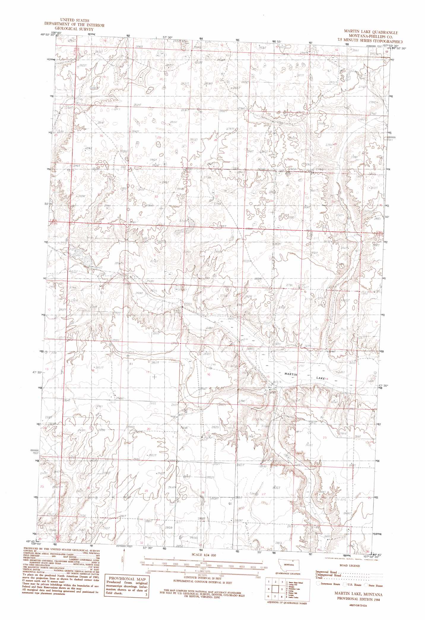
USGS Topo Quad 48107g8 - 1:24,000 scale
| Topo Map Name: | Martin Lake |
| USGS Topo Quad ID: | 48107g8 |
| Print Size: | ca. 21 1/4" wide x 27" high |
| Southeast Coordinates: | 48.75° N latitude / 107.875° W longitude |
| Map Center Coordinates: | 48.8125° N latitude / 107.9375° W longitude |
| U.S. State: | MT |
| Filename: | o48107g8.jpg |
| Download Map JPG Image: | Martin Lake topo map 1:24,000 scale |
| Map Type: | Topographic |
| Topo Series: | 7.5´ |
| Map Scale: | 1:24,000 |
| Source of Map Images: | United States Geological Survey (USGS) |
| Alternate Map Versions: |
Martin Lake MT 1984, updated 1984 Download PDF Buy paper map Martin Lake MT 2011 Download PDF Buy paper map Martin Lake MT 2014 Download PDF Buy paper map |
1:24,000 Topo Quads surrounding Martin Lake
Chapman Nw |
Sunny Slope School |
Loring Nw |
Morgan |
Gustin Coulee |
Chapman |
Horseshoe Lake |
Martin Lake |
Loring |
Whitewater West |
Emerick Bench |
Hubert Hill |
Lovejoy |
Austin Coulee |
Austin Lake |
Hubert Hill Sw |
Hubert Hill Se |
Garland Creek |
Fanny Hill |
Hewitt Lake Sw |
> Back to 48107e1 at 1:100,000 scale
> Back to 48106a1 at 1:250,000 scale
> Back to U.S. Topo Maps home
Martin Lake topo map: Gazetteer
Martin Lake: Dams
Watkins Number 2 Dam elevation 834m 2736′Martin Lake: Populated Places
Loring Colony elevation 873m 2864′Martin Lake: Post Offices
Rolefield Post Office (historical) elevation 881m 2890′Martin Lake: Reservoirs
Martin Lake elevation 808m 2650′Martin Lake: Valleys
Barton Coulee elevation 820m 2690′Dry Sag Coulee elevation 809m 2654′
Lake Coulee elevation 810m 2657′
Martin Lake Coulee elevation 810m 2657′
Martin Lake digital topo map on disk
Buy this Martin Lake topo map showing relief, roads, GPS coordinates and other geographical features, as a high-resolution digital map file on DVD:
Eastern Montana & Western North Dakota
Buy digital topo maps: Eastern Montana & Western North Dakota