Carlyle Lake Topo Map Illinois
To zoom in, hover over the map of Carlyle Lake
USGS Topo Map 38089e1 - 1:100,000 scale
| Topo Map Name: | Carlyle Lake |
| USGS Topo Quad ID: | 38089e1 |
| Print Size: | ca. 39" wide x 24" high |
| Southeast Coordinates: | 38.5° N latitude / 89° W longitude |
| Map Center Coordinates: | 38.75° N latitude / 89.5° W longitude |
| U.S. State: | IL |
| Filename: | 38089e1.jpg |
| Download Map JPG Image: | Carlyle Lake topo map 1:100,000 scale |
| Map Type: | Topographic |
| Topo Series: | 30´x60´ |
| Map Scale: | 1:100,000 |
| Source of Map Images: | United States Geological Survey (USGS) |
| Alternate Map Versions: |
Carlyle Lake IL 1985, updated 1985 Download PDF Buy paper map Carlyle Lake IL 1985, updated 1988 Download PDF Buy paper map |
1:100,000 Topos surrounding Carlyle Lake
Jerseyville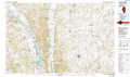 |
Litchfield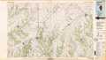 |
Effingham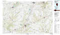 |
Saint Louis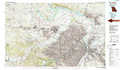 |
Carlyle Lake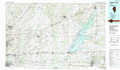 |
Olney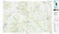 |
Festus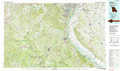 |
Pinckneyville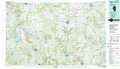 |
Mount Vernon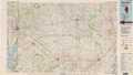 |
> Back to 38088a1 at 1:250,000 scale
> Back to U.S. Topo Maps home
1:24,000 Topo Quads covered by the spatial extent of this 100k map (Carlyle Lake)
|
Prairietown 
|
Worden 
|
New Douglas 
|
Sorento South 
|
Greenville 
|
Mulberry Grove 
|
Hagarstown 
|
Vandalia 
|
|
Edwardsville 
|
Marine 
|
Grantfork 
|
Pocahontas 
|
Beaver Creek 
|
Pleasant Mound 
|
Wildcat Lake 
|
Patoka 
|
|
Collinsville 
|
Saint Jacob 
|
Highland 
|
Saint Rose 
|
Stolletown 
|
Keyesport 
|
Boulder 
|
Fairman 
|
|
O'Fallon 
|
Lebanon 
|
Trenton 
|
Breese 
|
Beckemeyer 
|
Carlyle 
|
Centralia West 
|
Centralia East 
|
