Guthrie Center Topo Map Iowa
To zoom in, hover over the map of Guthrie Center
USGS Topo Map 41094e1 - 1:100,000 scale
| Topo Map Name: | Guthrie Center |
| USGS Topo Quad ID: | 41094e1 |
| Print Size: | ca. 39" wide x 24" high |
| Southeast Coordinates: | 41.5° N latitude / 94° W longitude |
| Map Center Coordinates: | 41.75° N latitude / 94.5° W longitude |
| U.S. State: | IA |
| Filename: | 41094e1.jpg |
| Download Map JPG Image: | Guthrie Center topo map 1:100,000 scale |
| Map Type: | Topographic |
| Topo Series: | 30´x60´ |
| Map Scale: | 1:100,000 |
| Source of Map Images: | United States Geological Survey (USGS) |
| Alternate Map Versions: |
Guthrie Center IA 1984, updated 1985 Download PDF Buy paper map Guthrie Center IA 1993, updated 1993 Download PDF Buy paper map |
1:100,000 Topos surrounding Guthrie Center
Ida Grove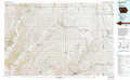 |
Carroll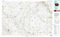 |
Ames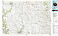 |
Harlan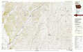 |
Guthrie Center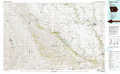 |
Des Moines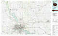 |
Omaha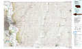 |
Creston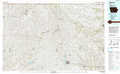 |
Indianola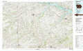 |
> Back to 41094a1 at 1:250,000 scale
> Back to U.S. Topo Maps home
1:24,000 Topo Quads covered by the spatial extent of this 100k map (Guthrie Center)
|
Templeton 
|
Dedham 
|
Coon Rapids North 
|
Coon Rapids Ne 
|
Bagley Nw 
|
Cooper 
|
Rippey 
|
Berkley 
|
|
Gray 
|
Viola Center 
|
Coon Rapids South 
|
Bayard 
|
Bagley 
|
Yale 
|
Dawson 
|
Perry 
|
|
Audubon 
|
Gardner 
|
North Branch 
|
Guthrie Center West 
|
Guthrie Center East 
|
Panora 
|
Adel Nw 
|
Panther 
|
|
Exira West 
|
Exira East 
|
Adair North 
|
Casey 
|
Menlo 
|
Stuart North 
|
Redfield 
|
Adel 
|
