Lake Marian Ne Topo Map Florida
To zoom in, hover over the map of Lake Marian Ne
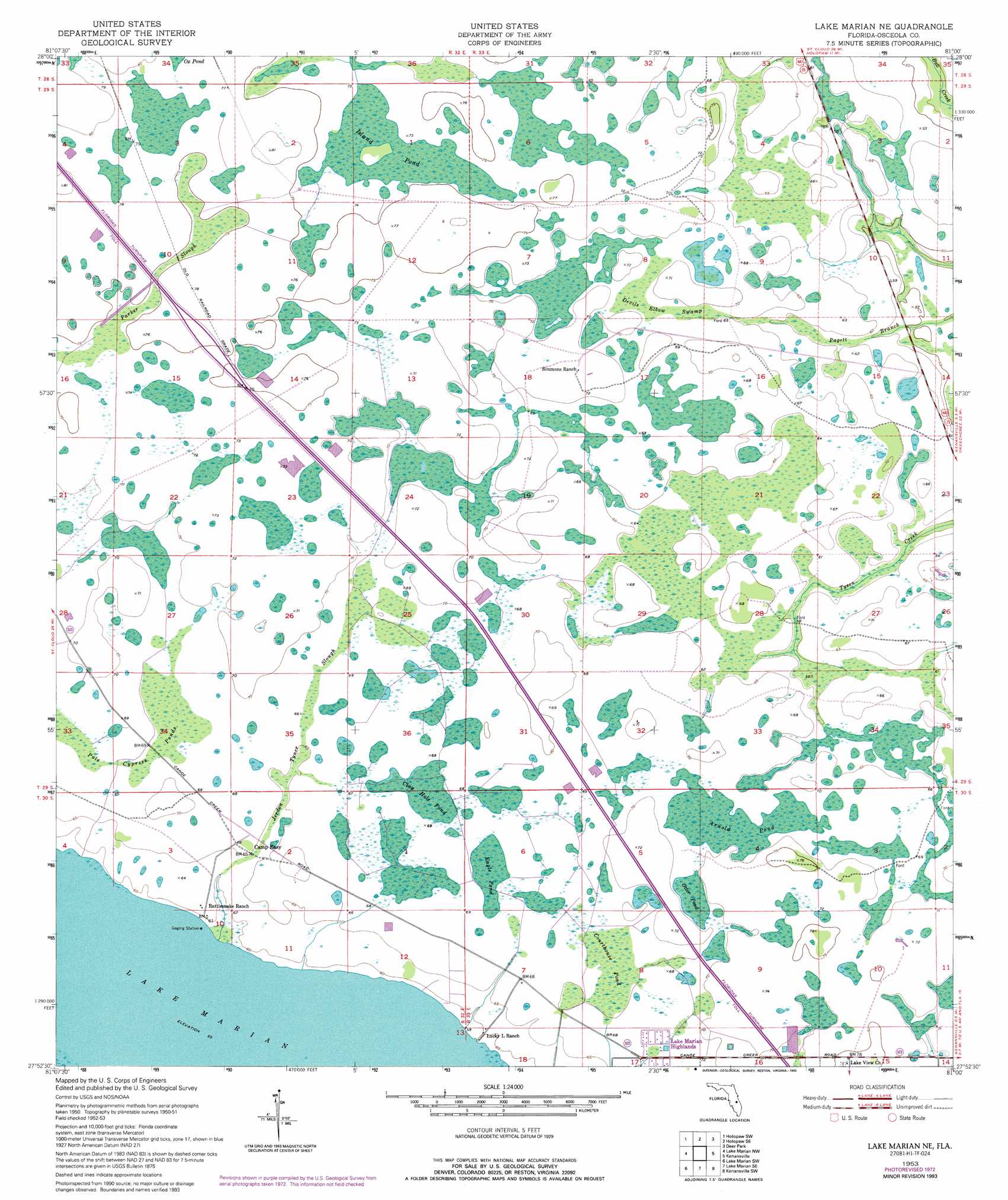
USGS Topo Quad 27081h1 - 1:24,000 scale
| Topo Map Name: | Lake Marian Ne |
| USGS Topo Quad ID: | 27081h1 |
| Print Size: | ca. 21 1/4" wide x 27" high |
| Southeast Coordinates: | 27.875° N latitude / 81° W longitude |
| Map Center Coordinates: | 27.9375° N latitude / 81.0625° W longitude |
| U.S. State: | FL |
| Filename: | O27081H1.jpg |
| Download Map JPG Image: | Lake Marian Ne topo map 1:24,000 scale |
| Map Type: | Topographic |
| Topo Series: | 7.5´ |
| Map Scale: | 1:24,000 |
| Source of Map Images: | United States Geological Survey (USGS) |
| Alternate Map Versions: |
Lake Marian NE FL 1953, updated 1954 Download PDF Buy paper map Lake Marian NE FL 1953, updated 1968 Download PDF Buy paper map Lake Marian NE FL 1953, updated 1973 Download PDF Buy paper map Lake Marian NE FL 1953, updated 1984 Download PDF Buy paper map Lake Marian NE FL 1953, updated 1993 Download PDF Buy paper map Lake Marian NE FL 2012 Download PDF Buy paper map Lake Marian NE FL 2015 Download PDF Buy paper map |
1:24,000 Topo Quads surrounding Lake Marian Ne
Saint Cloud South |
Ashton |
Holopaw |
Deer Park Nw |
Deer Park Ne |
Cypress Lake |
Holopaw Sw |
Holopaw Se |
Deer Park |
Deer Park Se |
Lake Weohyakapka Ne |
Lake Marian Nw |
Lake Marian Ne |
Kenansville |
Kenansville Ne |
Lake Weohyakpka Se |
Lake Marian Sw |
Lake Marian Se |
Kenansville Sw |
Kenansville Se |
Lake Arbuckle Ne |
Fort Kissimmee Nw |
Fort Kissimmee Ne |
Fort Drum Nw |
Fort Drum Ne |
> Back to 27081e1 at 1:100,000 scale
> Back to 27080a1 at 1:250,000 scale
> Back to U.S. Topo Maps home
Lake Marian Ne topo map: Gazetteer
Lake Marian Ne: Guts
Jerdon Tyner Slough elevation 20m 65′Lake Marian Ne: Lakes
Arnold Pond elevation 20m 65′Clay Hole Pond elevation 20m 65′
Eagle Pond elevation 20m 65′
Island Pond elevation 22m 72′
Lake Marian elevation 18m 59′
Otter Pond elevation 21m 68′
Lake Marian Ne: Parks
Three Lakes Wildlife Management Area elevation 21m 68′Lake Marian Ne: Populated Places
Lake Marian Highlands elevation 21m 68′Lake Marian Ne: Swamps
Courthouse Pond elevation 20m 65′Devils Elbow Swamp elevation 21m 68′
Pole Cypress Ponds elevation 20m 65′
Lake Marian Ne digital topo map on disk
Buy this Lake Marian Ne topo map showing relief, roads, GPS coordinates and other geographical features, as a high-resolution digital map file on DVD: