Bay Courant Topo Map Louisiana
To zoom in, hover over the map of Bay Courant
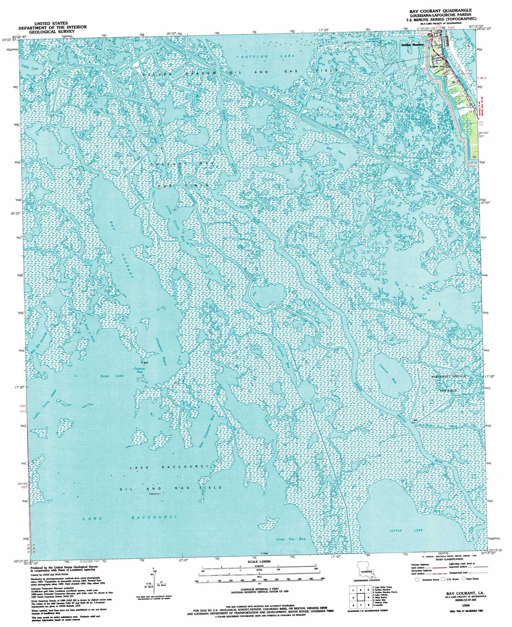
USGS Topo Quad 29090c3 - 1:24,000 scale
| Topo Map Name: | Bay Courant |
| USGS Topo Quad ID: | 29090c3 |
| Print Size: | ca. 21 1/4" wide x 27" high |
| Southeast Coordinates: | 29.25° N latitude / 90.25° W longitude |
| Map Center Coordinates: | 29.3125° N latitude / 90.3125° W longitude |
| U.S. State: | LA |
| Filename: | o29090c3.jpg |
| Download Map JPG Image: | Bay Courant topo map 1:24,000 scale |
| Map Type: | Topographic |
| Topo Series: | 7.5´ |
| Map Scale: | 1:24,000 |
| Source of Map Images: | United States Geological Survey (USGS) |
| Alternate Map Versions: |
Bay Courant LA 1964, updated 1965 Download PDF Buy paper map Bay Courant LA 1964, updated 1980 Download PDF Buy paper map Bay Courant LA 1994, updated 1994 Download PDF Buy paper map Bay Courant LA 1998, updated 2002 Download PDF Buy paper map Bay Courant LA 2012 Download PDF Buy paper map Bay Courant LA 2015 Download PDF Buy paper map |
1:24,000 Topo Quads surrounding Bay Courant
Bourg |
Larose |
Cut Off |
Bay L'Ours |
Three Bayou Bay |
Montegut |
Lake Bully Camp |
Golden Meadow |
Golden Meadow Farms |
Bay Dosgris |
Lake Tambour |
Lake Felicity |
Bay Courant |
Mink Bayou |
Bay Tambour |
Lake La Graisse |
Jacko Bay |
Pelican Pass |
Leeville |
Caminada Pass |
Cat Island Pass |
Timbalier Island |
Calumet Island |
Belle Pass |
> Back to 29090a1 at 1:100,000 scale
> Back to 29090a1 at 1:250,000 scale
> Back to U.S. Topo Maps home
Bay Courant topo map: Gazetteer
Bay Courant: Bays
Chinaman Bayou elevation 0m 0′Deep Lake elevation 0m 0′
Jean Plaisance Bay elevation 0m 0′
Lake Trois Jeans elevation 0m 0′
Bay Courant: Canals
Jean Plaisance Canal elevation 0m 0′Bay Courant: Channels
Bay des Conards elevation 0m 0′Chinois Pass elevation 0m 0′
Pass a Jean elevation 0m 0′
Bay Courant: Guts
Bayou Courant elevation 0m 0′Bayou de la Valle elevation 0m 0′
Bayou Grisgris elevation 0m 0′
Bayou Sevin elevation 0m 0′
Bayou Tete De Ours elevation 0m 0′
China Bayou elevation 0m 0′
Grand Bayou Blue elevation 0m 0′
Lacroix Bay elevation 0m 0′
Laurier Bayou elevation 0m 0′
Bay Courant: Lakes
Bay Courant elevation 0m 0′Bay Sevin elevation 0m 0′
Calm Lake elevation 0m 0′
Laurier Bay elevation 0m 0′
Little Grand Bay elevation 0m 0′
Bay Courant: Oilfields
Courant Bay Gas Field elevation 0m 0′Golden Meadow Oil and Gas Field elevation 0m 0′
Lake Raccourci Oil and Gas Field elevation 0m 0′
Northwest Leeville Gas Field elevation 1m 3′
Bay Courant digital topo map on disk
Buy this Bay Courant topo map showing relief, roads, GPS coordinates and other geographical features, as a high-resolution digital map file on DVD: