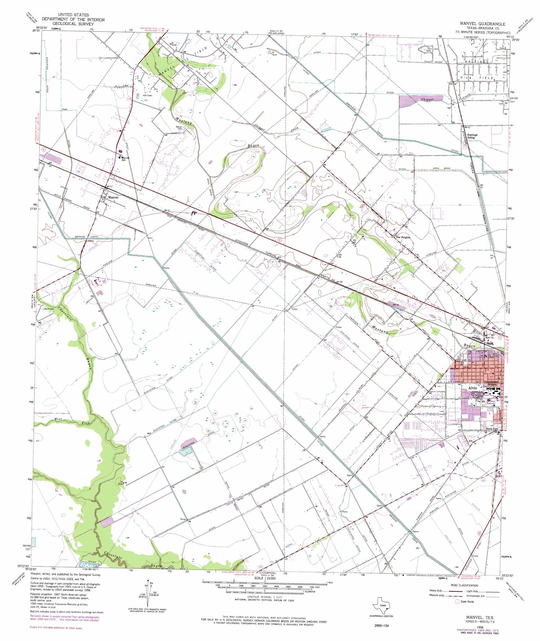
Manvel Topo Map Texas
To zoom in, hover over the map of Manvel
USGS Topo Quad 29095d3 - 1:24,000 scale
| Topo Map Name: | Manvel |
| USGS Topo Quad ID: | 29095d3 |
| Print Size: | ca. 21 1/4" wide x 27" high |
| Southeast Coordinates: | 29.375° N latitude / 95.25° W longitude |
| Map Center Coordinates: | 29.4375° N latitude / 95.3125° W longitude |
| U.S. State: | TX |
| Filename: | o29095d3.jpg |
| Download Map JPG Image: | Manvel topo map 1:24,000 scale |
| Map Type: | Topographic |
| Topo Series: | 7.5´ |
| Map Scale: | 1:24,000 |
| Source of Map Images: | United States Geological Survey (USGS) |
| Alternate Map Versions: |
Manvel TX 1956, updated 1957 Download PDF Buy paper map Manvel TX 1956, updated 1970 Download PDF Buy paper map Manvel TX 1959, updated 1977 Download PDF Buy paper map Manvel TX 2010 Download PDF Buy paper map Manvel TX 2013 Download PDF Buy paper map Manvel TX 2016 Download PDF Buy paper map |
1:24,000 Topo Quads surrounding Manvel
Alief |
Bellaire |
Park Place |
Pasadena |
La Porte |
Missouri City |
Almeda |
Pearland |
Friendswood |
League City |
Thompsons |
Juliff |
Manvel |
Algoa |
Dickinson |
Otey |
Rosharon |
Liverpool |
Mustang Bayou |
Hitchcock |
East Columbia |
Angleton |
Danbury |
Hoskins Mound |
Sea Isle |
> Back to 29095a1 at 1:100,000 scale
> Back to 29094a1 at 1:250,000 scale
> Back to U.S. Topo Maps home
Manvel topo map: Gazetteer
Manvel: Airports
Alvin Airpark elevation 12m 39′CIG 812 Heliport elevation 14m 45′
Wolfe Air Park elevation 16m 52′
Manvel: Canals
Briscoe Canal elevation 10m 32′Manvel: Parks
Alvin Memorial Stadium elevation 13m 42′Morgan Park elevation 12m 39′
Newman Park elevation 13m 42′
Manvel: Populated Places
Hillcrest elevation 10m 32′Manvel elevation 17m 55′
Manvel: Streams
Hayes Creek elevation 8m 26′West Fork Chocolate Bayou elevation 10m 32′
Manvel digital topo map on disk
Buy this Manvel topo map showing relief, roads, GPS coordinates and other geographical features, as a high-resolution digital map file on DVD: