Choctaw Bluff Topo Map Alabama
To zoom in, hover over the map of Choctaw Bluff
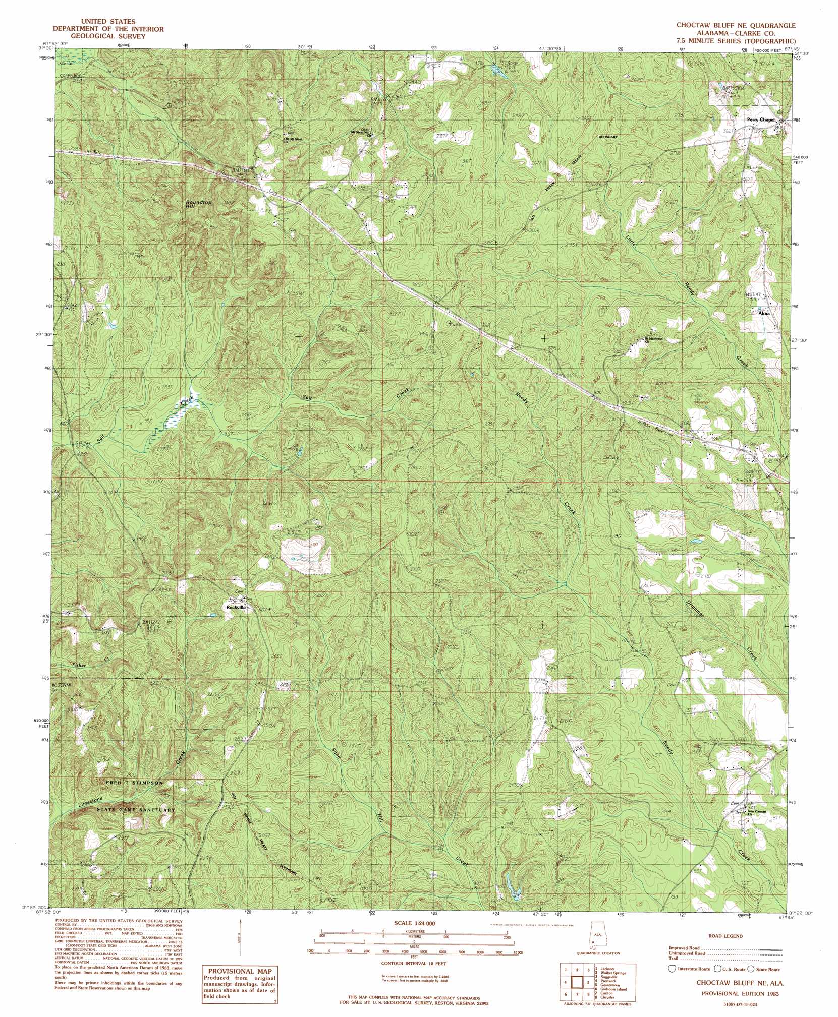
USGS Topo Quad 31087d7 - 1:24,000 scale
| Topo Map Name: | Choctaw Bluff |
| USGS Topo Quad ID: | 31087d7 |
| Print Size: | ca. 21 1/4" wide x 27" high |
| Southeast Coordinates: | 31.375° N latitude / 87.75° W longitude |
| Map Center Coordinates: | 31.4375° N latitude / 87.8125° W longitude |
| U.S. State: | AL |
| Filename: | o31087d7.jpg |
| Download Map JPG Image: | Choctaw Bluff topo map 1:24,000 scale |
| Map Type: | Topographic |
| Topo Series: | 7.5´ |
| Map Scale: | 1:24,000 |
| Source of Map Images: | United States Geological Survey (USGS) |
| Alternate Map Versions: |
Alma AL 1983 Download PDF Buy paper map Choctaw Bluff NE AL 1983 Download PDF Buy paper map Alma AL 2011 Download PDF Buy paper map Alma AL 2014 Download PDF Buy paper map |
1:24,000 Topo Quads surrounding Choctaw Bluff
Tattlersville |
Winn |
Grove Hill |
Whatley |
Chance |
Saint Stephens |
Jackson |
Walker Springs |
Suggsville |
Claiborne |
Wagarville |
Prestwick |
Choctaw Bluff |
Gainestown |
Flynns Lake |
Mcintosh |
Gin House Island |
Carlton |
Chrysler |
Uriah West |
Calvert |
Bilbo Island |
Tensaw |
Blacksher |
Mccullough |
> Back to 31087a1 at 1:100,000 scale
> Back to 31086a1 at 1:250,000 scale
> Back to U.S. Topo Maps home
Choctaw Bluff topo map: Gazetteer
Choctaw Bluff: Parks
Fred T Stimpson State Game Sanctuary elevation 33m 108′Choctaw Bluff: Populated Places
Alma elevation 79m 259′Choctaw Bluff elevation 49m 160′
Rockville elevation 94m 308′
Choctaw Bluff: Summits
Roundtop Hill elevation 105m 344′Choctaw Bluff digital topo map on disk
Buy this Choctaw Bluff topo map showing relief, roads, GPS coordinates and other geographical features, as a high-resolution digital map file on DVD:
Gulf Coast (LA, MS, AL, FL) & Southwestern Georgia
Buy digital topo maps: Gulf Coast (LA, MS, AL, FL) & Southwestern Georgia
 & Southwestern Georgia map DVD")