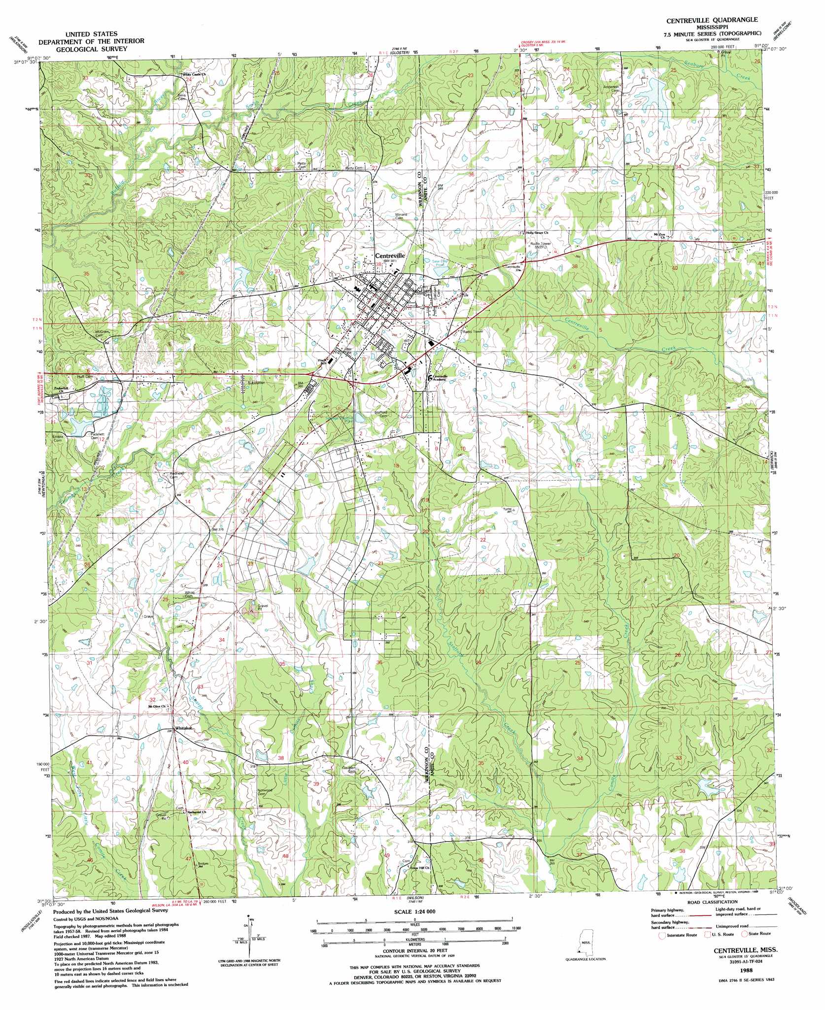
Centreville Topo Map Mississippi
To zoom in, hover over the map of Centreville
USGS Topo Quad 31091a1 - 1:24,000 scale
| Topo Map Name: | Centreville |
| USGS Topo Quad ID: | 31091a1 |
| Print Size: | ca. 21 1/4" wide x 27" high |
| Southeast Coordinates: | 31° N latitude / 91° W longitude |
| Map Center Coordinates: | 31.0625° N latitude / 91.0625° W longitude |
| U.S. State: | MS |
| Filename: | o31091a1.jpg |
| Download Map JPG Image: | Centreville topo map 1:24,000 scale |
| Map Type: | Topographic |
| Topo Series: | 7.5´ |
| Map Scale: | 1:24,000 |
| Source of Map Images: | United States Geological Survey (USGS) |
| Alternate Map Versions: |
Centreville MS 1988, updated 1988 Download PDF Buy paper map Centreville MS 2012 Download PDF Buy paper map Centreville MS 2015 Download PDF Buy paper map |
1:24,000 Topo Quads surrounding Centreville
Doloroso |
Garden City |
Crosby |
Homochitto |
Busy Corner |
Laneheart |
Wilkinson |
Gloster |
Bewelcome |
Liberty |
Woodville |
Newtonia |
Centreville |
Berwick |
Street |
Laurel Hill |
Rogillioville |
Wilson |
Woodland |
Chipola |
Elm Park |
Jackson |
Clinton |
Bluff Creek |
Hatchersville |
> Back to 31091a1 at 1:100,000 scale
> Back to 31090a1 at 1:250,000 scale
> Back to U.S. Topo Maps home
Centreville topo map: Gazetteer
Centreville: Dams
Henry W Darden Lake Dam elevation 98m 321′Lorio Lake Dam elevation 93m 305′
Lyons Lake Dam elevation 122m 400′
Centreville: Populated Places
Centreville elevation 117m 383′Whitaker elevation 104m 341′
Centreville: Streams
Smith Creek elevation 81m 265′Stafford Creek elevation 74m 242′
West Fork Little Comite Creek elevation 81m 265′
Centreville digital topo map on disk
Buy this Centreville topo map showing relief, roads, GPS coordinates and other geographical features, as a high-resolution digital map file on DVD: