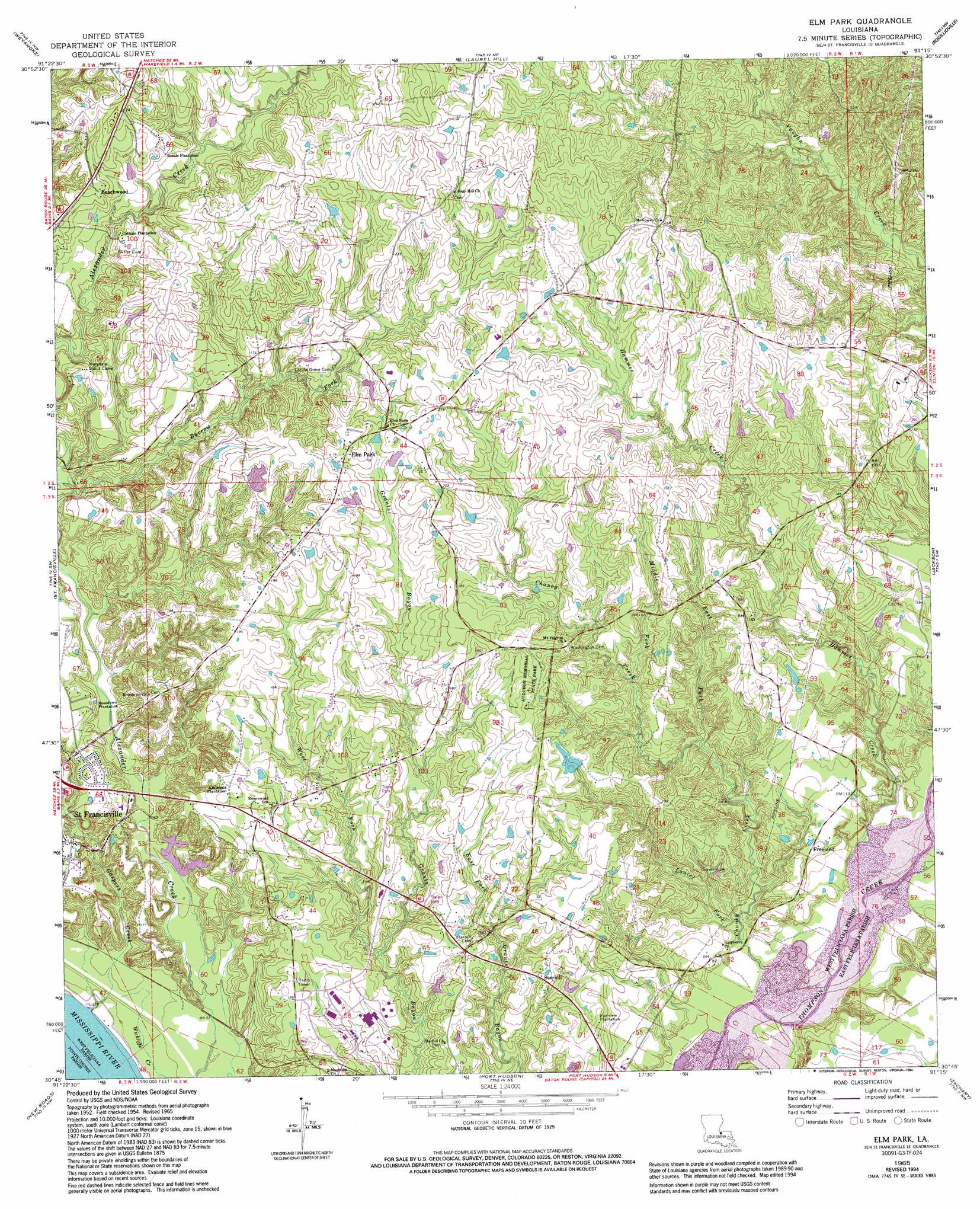
Elm Park Topo Map Louisiana
To zoom in, hover over the map of Elm Park
USGS Topo Quad 30091g3 - 1:24,000 scale
| Topo Map Name: | Elm Park |
| USGS Topo Quad ID: | 30091g3 |
| Print Size: | ca. 21 1/4" wide x 27" high |
| Southeast Coordinates: | 30.75° N latitude / 91.25° W longitude |
| Map Center Coordinates: | 30.8125° N latitude / 91.3125° W longitude |
| U.S. State: | LA |
| Filename: | o30091g3.jpg |
| Download Map JPG Image: | Elm Park topo map 1:24,000 scale |
| Map Type: | Topographic |
| Topo Series: | 7.5´ |
| Map Scale: | 1:24,000 |
| Source of Map Images: | United States Geological Survey (USGS) |
| Alternate Map Versions: |
Elm Park LA 1954, updated 1955 Download PDF Buy paper map Elm Park LA 1965, updated 1966 Download PDF Buy paper map Elm Park LA 1965, updated 1977 Download PDF Buy paper map Elm Park LA 1965, updated 1994 Download PDF Buy paper map Elm Park LA 2012 Download PDF Buy paper map Elm Park LA 2015 Download PDF Buy paper map |
1:24,000 Topo Quads surrounding Elm Park
Fort Adams |
Pinckneyville |
Woodville |
Newtonia |
Centreville |
Tunica |
Weyanoke |
Laurel Hill |
Rogillioville |
Wilson |
Lacour |
Saint Francisville |
Elm Park |
Jackson |
Clinton |
Morganza |
New Roads |
Port Hudson |
Zachary |
Fred |
Fordoche |
Erwinville |
Walls |
Scotlandville |
Comite |
> Back to 30091e1 at 1:100,000 scale
> Back to 30090a1 at 1:250,000 scale
> Back to U.S. Topo Maps home
Elm Park topo map: Gazetteer
Elm Park: Parks
Audubon State Historic Site elevation 55m 180′Locust Grove State Historic Site elevation 54m 177′
Rosedown Plantation State Historic Site elevation 40m 131′
Elm Park: Populated Places
Beachwood elevation 66m 216′Carney elevation 67m 219′
Elm Park elevation 63m 206′
Freeland elevation 35m 114′
Hamilton elevation 60m 196′
Starhill elevation 44m 144′
Elm Park: Streams
Barrow Fork elevation 33m 108′Chaney Creek elevation 16m 52′
East Fork Caney Creek elevation 27m 88′
Gaspers Creek elevation 10m 32′
Hammer Creek elevation 17m 55′
Laurel Fork elevation 18m 59′
Middle Fork Caney Creek elevation 34m 111′
West Fork Grants Bayou elevation 25m 82′
Elm Park digital topo map on disk
Buy this Elm Park topo map showing relief, roads, GPS coordinates and other geographical features, as a high-resolution digital map file on DVD: