Fort Adams Topo Map Mississippi
To zoom in, hover over the map of Fort Adams
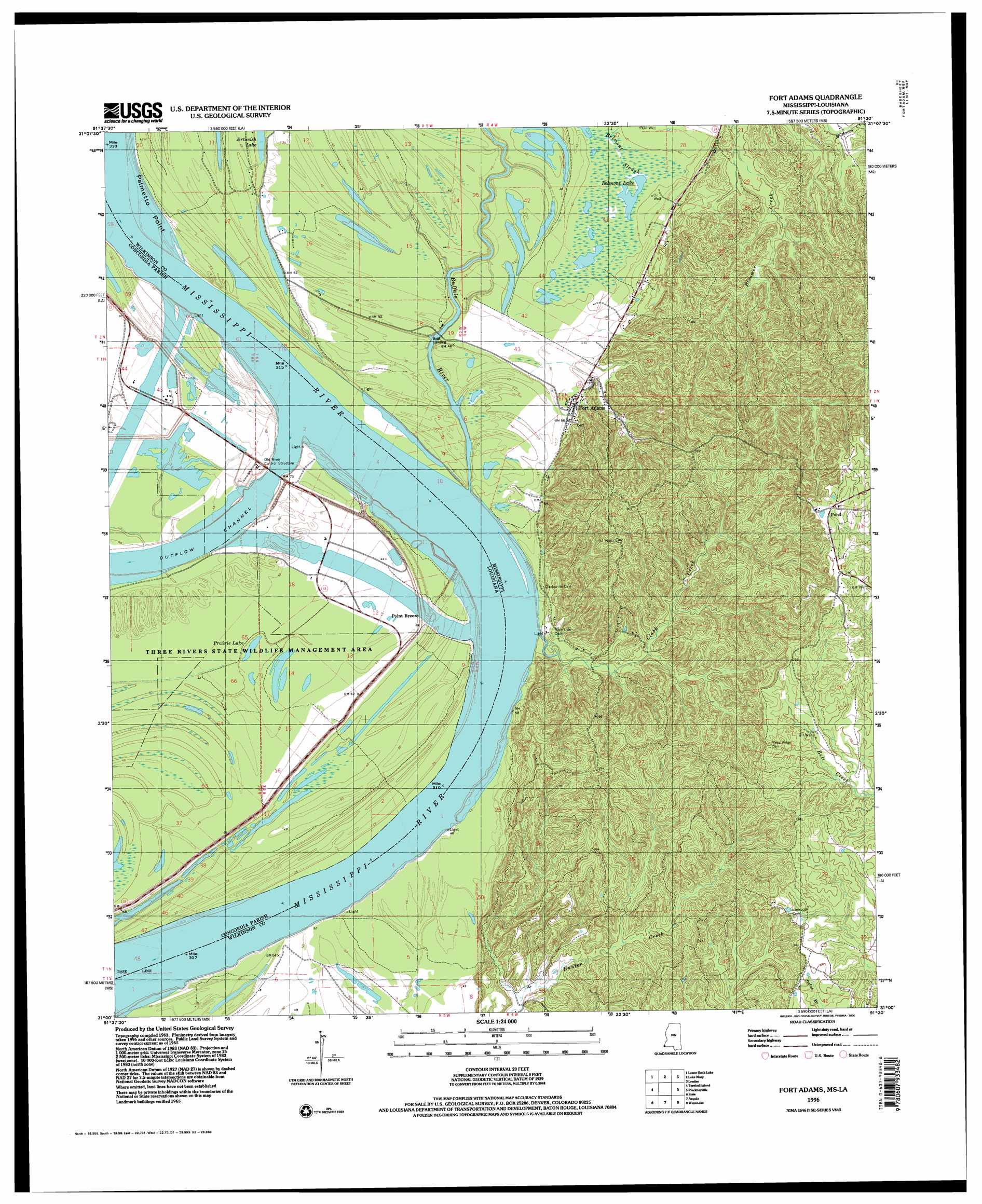
USGS Topo Quad 31091a5 - 1:24,000 scale
| Topo Map Name: | Fort Adams |
| USGS Topo Quad ID: | 31091a5 |
| Print Size: | ca. 21 1/4" wide x 27" high |
| Southeast Coordinates: | 31° N latitude / 91.5° W longitude |
| Map Center Coordinates: | 31.0625° N latitude / 91.5625° W longitude |
| U.S. States: | MS, LA |
| Filename: | o31091a5.jpg |
| Download Map JPG Image: | Fort Adams topo map 1:24,000 scale |
| Map Type: | Topographic |
| Topo Series: | 7.5´ |
| Map Scale: | 1:24,000 |
| Source of Map Images: | United States Geological Survey (USGS) |
| Alternate Map Versions: |
Fort Adams MS 1965, updated 1966 Download PDF Buy paper map Fort Adams MS 1965, updated 1966 Download PDF Buy paper map Fort Adams MS 1996, updated 2000 Download PDF Buy paper map Fort Adams MS 2012 Download PDF Buy paper map Fort Adams MS 2015 Download PDF Buy paper map |
1:24,000 Topo Quads surrounding Fort Adams
Acme |
Slocum |
Fairview |
Buck Island |
Doloroso |
Ile Natchitoches |
Shaw |
Lake Mary |
Lessley |
Laneheart |
Big Bend |
Turnbull Island |
Fort Adams |
Pinckneyville |
Woodville |
Simmesport |
Innis |
Tunica |
Weyanoke |
Laurel Hill |
Bayou Current |
Batchelor |
Lacour |
Saint Francisville |
Elm Park |
> Back to 31091a1 at 1:100,000 scale
> Back to 31090a1 at 1:250,000 scale
> Back to U.S. Topo Maps home
Fort Adams topo map: Gazetteer
Fort Adams: Airports
Old River Ctl Auxillary Structure Heliport elevation 16m 52′Fort Adams: Bars
Fort Adams Bar elevation 13m 42′Fort Adams: Capes
Palmetto Point elevation 14m 45′Point Breeze elevation 13m 42′
Fort Adams: Channels
Fort Adams Reach elevation 13m 42′Fort Adams: Lakes
Belmont Lake elevation 13m 42′Prairie Lake elevation 12m 39′
Fort Adams: Levees
Fort Adams Reach Revetment elevation 13m 42′Point Breeze Revetment elevation 13m 42′
South Bank Revetment elevation 9m 29′
Fort Adams: Oilfields
Belmont Lake Oil Field elevation 13m 42′Cochie Oil Field elevation 13m 42′
Fort Adams Oil Field elevation 20m 65′
North Fort Adams Oil Field elevation 27m 88′
Pickneyville Oil Field elevation 90m 295′
Pond Oil Field elevation 116m 380′
Stamps Oil Field elevation 13m 42′
Fort Adams: Parks
Three Rivers State Wildlife Management Area elevation 12m 39′Fort Adams: Populated Places
Coochie (historical) elevation 14m 45′Fort Adams elevation 18m 59′
Point Breeze elevation 16m 52′
Fort Adams: Streams
Buffalo River elevation 13m 42′Clark Creek elevation 13m 42′
Fort Adams: Summits
Blockhouse Hill elevation 104m 341′Rock Hill elevation 93m 305′
Fort Adams digital topo map on disk
Buy this Fort Adams topo map showing relief, roads, GPS coordinates and other geographical features, as a high-resolution digital map file on DVD: