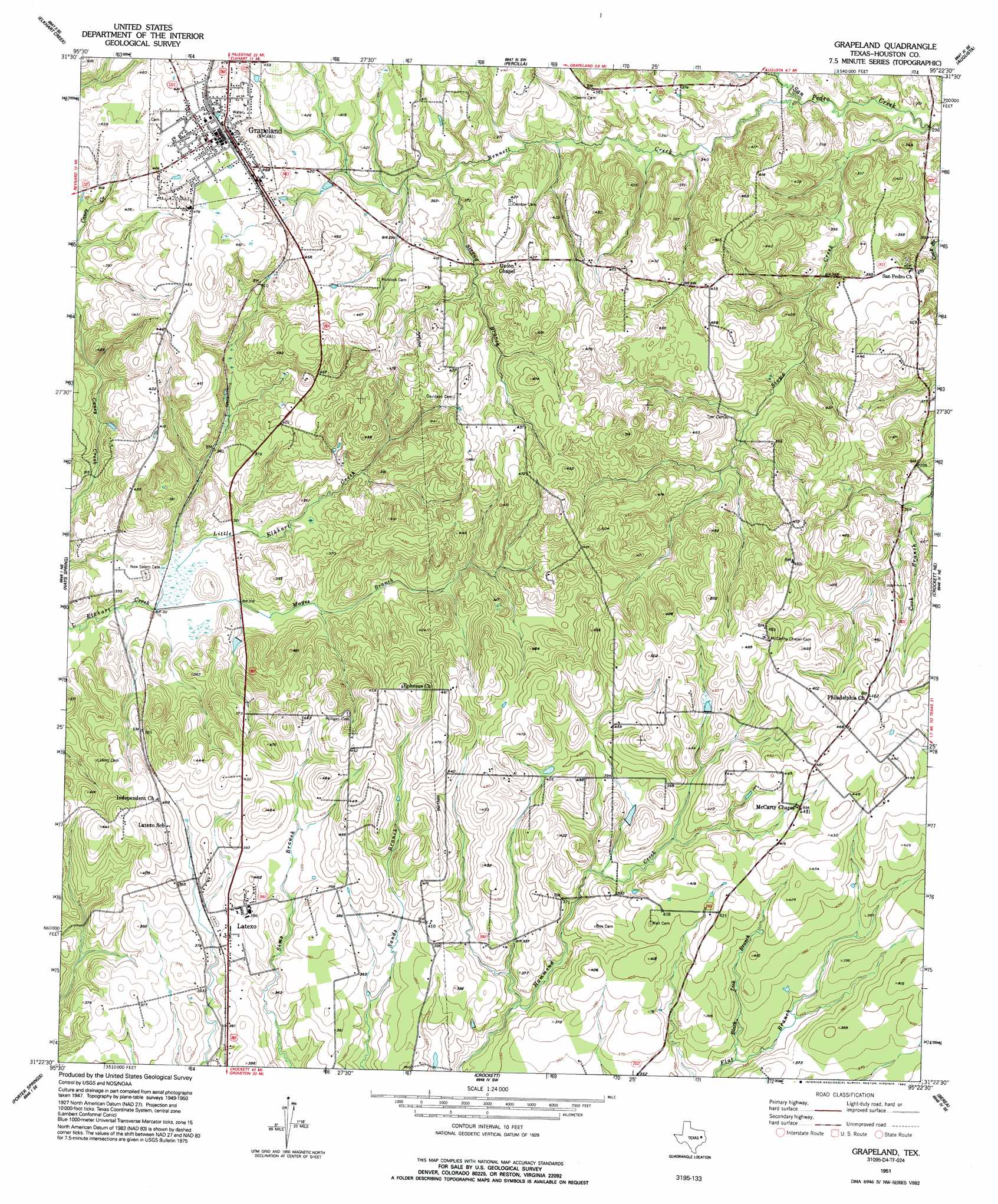
Grapeland Topo Map Texas
To zoom in, hover over the map of Grapeland
USGS Topo Quad 31095d4 - 1:24,000 scale
| Topo Map Name: | Grapeland |
| USGS Topo Quad ID: | 31095d4 |
| Print Size: | ca. 21 1/4" wide x 27" high |
| Southeast Coordinates: | 31.375° N latitude / 95.375° W longitude |
| Map Center Coordinates: | 31.4375° N latitude / 95.4375° W longitude |
| U.S. State: | TX |
| Filename: | o31095d4.jpg |
| Download Map JPG Image: | Grapeland topo map 1:24,000 scale |
| Map Type: | Topographic |
| Topo Series: | 7.5´ |
| Map Scale: | 1:24,000 |
| Source of Map Images: | United States Geological Survey (USGS) |
| Alternate Map Versions: |
Grapeland TX 1951 Download PDF Buy paper map Grapeland TX 1951 Download PDF Buy paper map Grapeland TX 1951, updated 1993 Download PDF Buy paper map Grapeland TX 2010 Download PDF Buy paper map Grapeland TX 2013 Download PDF Buy paper map Grapeland TX 2016 Download PDF Buy paper map |
1:24,000 Topo Quads surrounding Grapeland
Southwest Palestine |
Southeast Palestine |
Slocum |
Denson Springs |
Pryor Mountain |
Indian Lake |
Elkhart Creek |
Percilla |
Augusta |
Weches |
Stanmire Lake |
Hays Spring |
Grapeland |
Crockett Ne |
Ratcliff |
Halls Bluff |
Porter Springs |
Crockett |
Berea |
Kennard |
Austonio |
Pearsons Chapel |
Lovelady North |
Fodice |
Pennington |
> Back to 31095a1 at 1:100,000 scale
> Back to 31094a1 at 1:250,000 scale
> Back to U.S. Topo Maps home
Grapeland topo map: Gazetteer
Grapeland: Airports
Bruner Airport elevation 115m 377′Grapeland: Dams
Barfield Lake Dam elevation 126m 413′Bison Dam elevation 96m 314′
Harold Goar Dam elevation 110m 360′
M R Murchison Dam elevation 91m 298′
Grapeland: Populated Places
El Caney elevation 107m 351′Grapeland elevation 144m 472′
Latexo elevation 121m 396′
Oldham elevation 119m 390′
San Pedro elevation 116m 380′
Grapeland: Post Offices
San Pedro Post Office elevation 120m 393′Grapeland: Reservoirs
Barfield Lake elevation 126m 413′Bison Lake elevation 96m 314′
Harold Goar Lake elevation 110m 360′
M R Murchison Lake elevation 91m 298′
Grapeland: Springs
Boiling Spring elevation 114m 374′Grapeland: Streams
Bennett Creek elevation 91m 298′Black Lick Branch elevation 102m 334′
Mayes Branch elevation 91m 298′
Stowe Branch elevation 100m 328′
Stowe Creek elevation 88m 288′
Stroud Branch elevation 109m 357′
Thomas Creek elevation 94m 308′
Tyer Branch elevation 110m 360′
Whitaker Creek elevation 88m 288′
Grapeland digital topo map on disk
Buy this Grapeland topo map showing relief, roads, GPS coordinates and other geographical features, as a high-resolution digital map file on DVD: