Mustang Creek Topo Map Texas
To zoom in, hover over the map of Mustang Creek
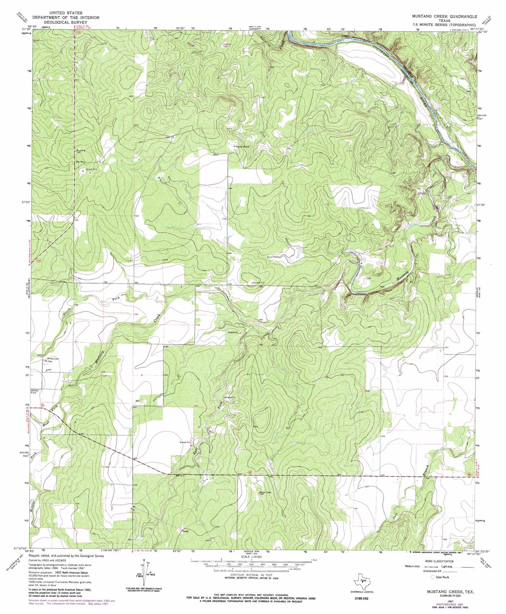
USGS Topo Quad 31099d6 - 1:24,000 scale
| Topo Map Name: | Mustang Creek |
| USGS Topo Quad ID: | 31099d6 |
| Print Size: | ca. 21 1/4" wide x 27" high |
| Southeast Coordinates: | 31.375° N latitude / 99.625° W longitude |
| Map Center Coordinates: | 31.4375° N latitude / 99.6875° W longitude |
| U.S. State: | TX |
| Filename: | o31099d6.jpg |
| Download Map JPG Image: | Mustang Creek topo map 1:24,000 scale |
| Map Type: | Topographic |
| Topo Series: | 7.5´ |
| Map Scale: | 1:24,000 |
| Source of Map Images: | United States Geological Survey (USGS) |
| Alternate Map Versions: |
Mustang Creek TX 1967, updated 1969 Download PDF Buy paper map Mustang Creek TX 1967, updated 1987 Download PDF Buy paper map Mustang Creek TX 1967, updated 1987 Download PDF Buy paper map Mustang Creek TX 2010 Download PDF Buy paper map Mustang Creek TX 2013 Download PDF Buy paper map Mustang Creek TX 2016 Download PDF Buy paper map |
1:24,000 Topo Quads surrounding Mustang Creek
Ballinger |
Buffalo Bluff |
Little Grape Creek |
Bead Mountain |
Fisk |
Paint Rock |
Concho |
Leaday |
Voss |
Gouldbusk |
Millersview Nw |
Millersview |
Mustang Creek |
Doole |
Fife |
Millersview Sw |
Millersview Se |
Doole Sw |
Salt Gap |
Lohn |
Live Oak |
Eden |
Pasche |
Melvin |
West Sweden |
> Back to 31099a1 at 1:100,000 scale
> Back to 31098a1 at 1:250,000 scale
> Back to U.S. Topo Maps home
Mustang Creek topo map: Gazetteer
Mustang Creek: Streams
East Fork Mustang Creek elevation 473m 1551′Middle Fork Mustang Creek elevation 490m 1607′
Mustang Creek elevation 433m 1420′
North Fork Mustang Creek elevation 476m 1561′
West Fork Mustang Creek elevation 490m 1607′
Mustang Creek digital topo map on disk
Buy this Mustang Creek topo map showing relief, roads, GPS coordinates and other geographical features, as a high-resolution digital map file on DVD: