Allamoore Topo Map Texas
To zoom in, hover over the map of Allamoore
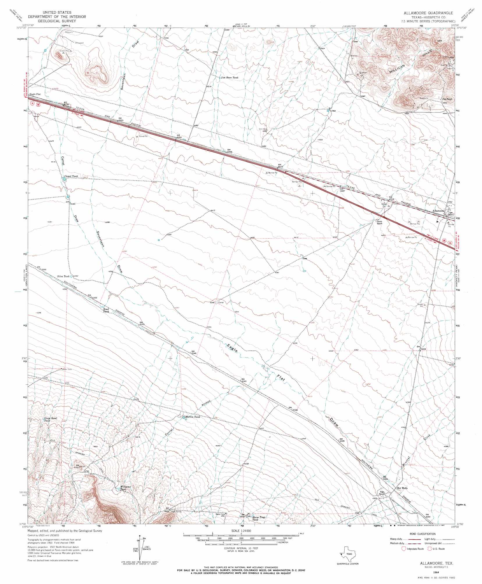
USGS Topo Quad 31105a1 - 1:24,000 scale
| Topo Map Name: | Allamoore |
| USGS Topo Quad ID: | 31105a1 |
| Print Size: | ca. 21 1/4" wide x 27" high |
| Southeast Coordinates: | 31° N latitude / 105° W longitude |
| Map Center Coordinates: | 31.0625° N latitude / 105.0625° W longitude |
| U.S. State: | TX |
| Filename: | o31105a1.jpg |
| Download Map JPG Image: | Allamoore topo map 1:24,000 scale |
| Map Type: | Topographic |
| Topo Series: | 7.5´ |
| Map Scale: | 1:24,000 |
| Source of Map Images: | United States Geological Survey (USGS) |
| Alternate Map Versions: |
Allamoore TX 1964, updated 1967 Download PDF Buy paper map Allamoore TX 2010 Download PDF Buy paper map Allamoore TX 2012 Download PDF Buy paper map Allamoore TX 2016 Download PDF Buy paper map |
1:24,000 Topo Quads surrounding Allamoore
Pierce Ranch |
Movie Mountain |
Sneed Mountain |
Collier Mesa |
Victorio Peak |
Sierra Blanca |
Dome Peak |
Bean Hills |
Sheep Peak |
Nutt Ranch |
Devil Ridge |
Grayton Lake |
Allamoore |
Hackett Peak |
Van Horn |
Cedar Arroyo |
Eagle Mountains Nw |
Eagle Mountains Ne |
Bass Canyon |
Van Horn Wells |
Indian Hot Springs |
Eagle Mountains Sw |
Eagle Mountains Se |
Lobo Sw |
Lobo |
> Back to 31105a1 at 1:100,000 scale
> Back to 31104a1 at 1:250,000 scale
> Back to U.S. Topo Maps home
Allamoore topo map: Gazetteer
Allamoore: Populated Places
Allamoore elevation 1387m 4550′Allamoore: Reservoirs
Camel Tank elevation 1343m 4406′Horse Trap Tank elevation 1383m 4537′
Jim Bean Tank elevation 1380m 4527′
Martin Tank elevation 1354m 4442′
Road Tank elevation 1329m 4360′
Silva Tank elevation 1330m 4363′
Stage Road Tank elevation 1396m 4580′
Williams Tank elevation 1400m 4593′
Allamoore: Streams
Mineral Creek elevation 1305m 4281′Allamoore: Valleys
Camel Draw elevation 1326m 4350′Carral Arroyo elevation 1326m 4350′
Goat Canyon elevation 1420m 4658′
Seventeen Draw elevation 1326m 4350′
Allamoore digital topo map on disk
Buy this Allamoore topo map showing relief, roads, GPS coordinates and other geographical features, as a high-resolution digital map file on DVD: