Pulaski Topo Map Georgia
To zoom in, hover over the map of Pulaski
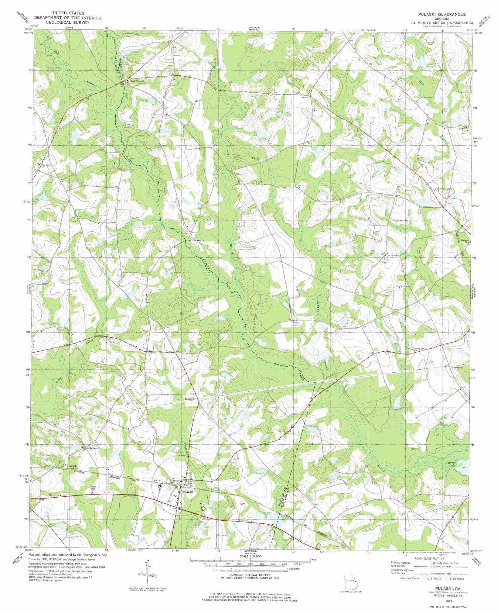
USGS Topo Quad 32081d8 - 1:24,000 scale
| Topo Map Name: | Pulaski |
| USGS Topo Quad ID: | 32081d8 |
| Print Size: | ca. 21 1/4" wide x 27" high |
| Southeast Coordinates: | 32.375° N latitude / 81.875° W longitude |
| Map Center Coordinates: | 32.4375° N latitude / 81.9375° W longitude |
| U.S. State: | GA |
| Filename: | o32081d8.jpg |
| Download Map JPG Image: | Pulaski topo map 1:24,000 scale |
| Map Type: | Topographic |
| Topo Series: | 7.5´ |
| Map Scale: | 1:24,000 |
| Source of Map Images: | United States Geological Survey (USGS) |
| Alternate Map Versions: |
Pulaski GA 1978, updated 1978 Download PDF Buy paper map Pulaski GA 2011 Download PDF Buy paper map Pulaski GA 2014 Download PDF Buy paper map |
1:24,000 Topo Quads surrounding Pulaski
Canoochee |
Garfield |
Four Points |
Rocky Ford |
Sylvania South |
Twin City |
Twin City Se |
Portal |
Hopeulikit |
Dover |
Stillmore |
Metter |
Pulaski |
Statesboro |
Brooklet |
Cobbtown |
Metter Se |
Register |
Nevils |
Denmark |
Ohoopee |
Collins |
Claxton |
Daisy |
Groveland |
> Back to 32081a1 at 1:100,000 scale
> Back to 32080a1 at 1:250,000 scale
> Back to U.S. Topo Maps home
Pulaski topo map: Gazetteer
Pulaski: Bridges
Hendrix Bridge elevation 50m 164′Longford Bridge elevation 55m 180′
Lotts Creek Bridge elevation 57m 187′
Pulaski: Dams
Holland Pond Dam elevation 59m 193′Morf Stanback Estate Lake Dam elevation 52m 170′
Pulaski: Populated Places
Parish elevation 68m 223′Pulaski elevation 64m 209′
Pulaski: Reservoirs
Holland Pond elevation 59m 193′McElveen Pond (historical) elevation 46m 150′
Morf Stanback Estate Lake elevation 52m 170′
Pulaski: Streams
Big Branch elevation 56m 183′Big Branch elevation 51m 167′
Crossway Branch elevation 48m 157′
Pulaski digital topo map on disk
Buy this Pulaski topo map showing relief, roads, GPS coordinates and other geographical features, as a high-resolution digital map file on DVD:
South Carolina, Western North Carolina & Northeastern Georgia
Buy digital topo maps: South Carolina, Western North Carolina & Northeastern Georgia