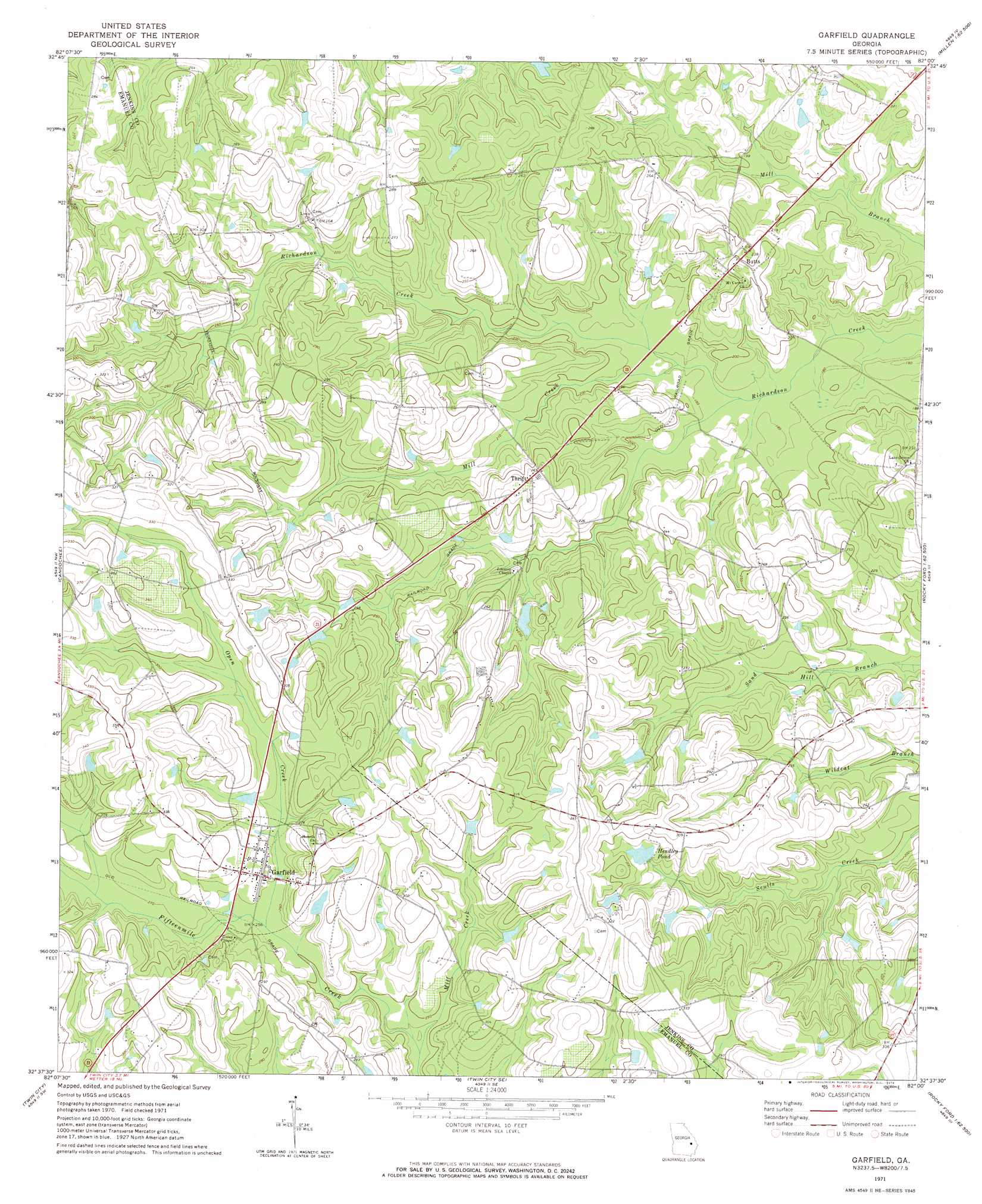
Garfield Topo Map Georgia
To zoom in, hover over the map of Garfield
USGS Topo Quad 32082f1 - 1:24,000 scale
| Topo Map Name: | Garfield |
| USGS Topo Quad ID: | 32082f1 |
| Print Size: | ca. 21 1/4" wide x 27" high |
| Southeast Coordinates: | 32.625° N latitude / 82° W longitude |
| Map Center Coordinates: | 32.6875° N latitude / 82.0625° W longitude |
| U.S. State: | GA |
| Filename: | o32082f1.jpg |
| Download Map JPG Image: | Garfield topo map 1:24,000 scale |
| Map Type: | Topographic |
| Topo Series: | 7.5´ |
| Map Scale: | 1:24,000 |
| Source of Map Images: | United States Geological Survey (USGS) |
| Alternate Map Versions: |
Garfield GA 1971, updated 1973 Download PDF Buy paper map Garfield GA 2011 Download PDF Buy paper map Garfield GA 2014 Download PDF Buy paper map |
1:24,000 Topo Quads surrounding Garfield
Old Town |
Scotts Corner |
Bellevue |
Perkins |
Sardis |
Colemans Lake |
Midville |
Birdsville |
Millen |
Bay Branch |
Summertown |
Canoochee |
Garfield |
Four Points |
Rocky Ford |
Swainsboro |
Twin City |
Twin City Se |
Portal |
Hopeulikit |
Nunez |
Stillmore |
Metter |
Pulaski |
Statesboro |
> Back to 32082e1 at 1:100,000 scale
> Back to 32082a1 at 1:250,000 scale
> Back to U.S. Topo Maps home
Garfield topo map: Gazetteer
Garfield: Dams
Gay Lake Dam elevation 68m 223′Garfield: Populated Places
Butts elevation 76m 249′Garfield elevation 85m 278′
Thrift elevation 84m 275′
Garfield: Reservoirs
Gay Lake elevation 68m 223′Hendley Pond elevation 86m 282′
Garfield: Streams
Mill Creek elevation 54m 177′Mill Creek elevation 72m 236′
Open Creek elevation 77m 252′
Garfield digital topo map on disk
Buy this Garfield topo map showing relief, roads, GPS coordinates and other geographical features, as a high-resolution digital map file on DVD:
South Carolina, Western North Carolina & Northeastern Georgia
Buy digital topo maps: South Carolina, Western North Carolina & Northeastern Georgia