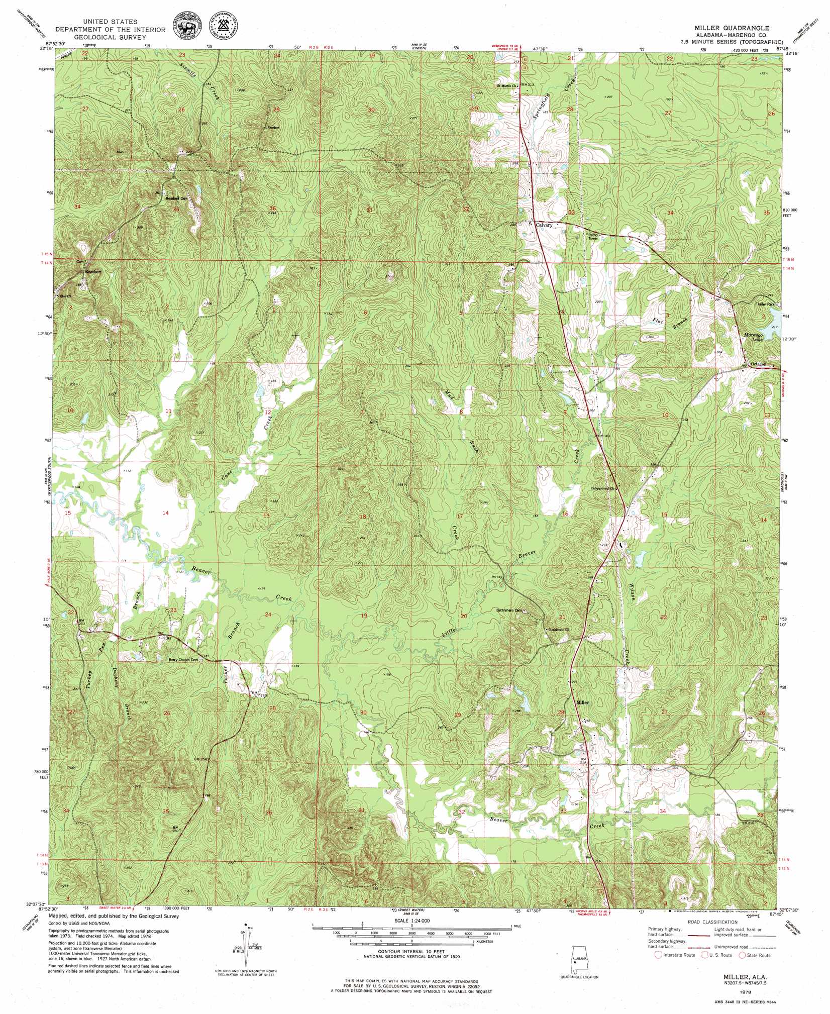
Miller Topo Map Alabama
To zoom in, hover over the map of Miller
USGS Topo Quad 32087b7 - 1:24,000 scale
| Topo Map Name: | Miller |
| USGS Topo Quad ID: | 32087b7 |
| Print Size: | ca. 21 1/4" wide x 27" high |
| Southeast Coordinates: | 32.125° N latitude / 87.75° W longitude |
| Map Center Coordinates: | 32.1875° N latitude / 87.8125° W longitude |
| U.S. State: | AL |
| Filename: | o32087b7.jpg |
| Download Map JPG Image: | Miller topo map 1:24,000 scale |
| Map Type: | Topographic |
| Topo Series: | 7.5´ |
| Map Scale: | 1:24,000 |
| Source of Map Images: | United States Geological Survey (USGS) |
| Alternate Map Versions: |
Miller AL 1978, updated 1979 Download PDF Buy paper map Miller AL 2011 Download PDF Buy paper map Miller AL 2014 Download PDF Buy paper map |
1:24,000 Topo Quads surrounding Miller
Coatopa |
Jefferson |
Old Spring Hill |
Gallion |
Uniontown West |
Whitfield |
Myrtlewood North |
Linden |
Thomaston West |
Thomaston East |
Pennington |
Myrtlewood South |
Miller |
Magnolia |
Flatwood |
Putnam |
Nanafalia |
Sweet Water |
Surginer |
Kimbrough |
Woods Bluff |
Morvin |
Bashi |
Thomasville |
Pine Hill |
> Back to 32087a1 at 1:100,000 scale
> Back to 32086a1 at 1:250,000 scale
> Back to U.S. Topo Maps home
Miller topo map: Gazetteer
Miller: Populated Places
Calvary elevation 79m 259′Miller elevation 81m 265′
Moss (historical) elevation 98m 321′
Octagon elevation 86m 282′
Rembert elevation 96m 314′
Miller: Post Offices
Spencerville Post Office (historical) elevation 89m 291′Miller: Streams
Cane Creek elevation 35m 114′Dapheny Branch elevation 44m 144′
Flat Branch elevation 55m 180′
Little Beaver Creek elevation 40m 131′
Mud Rush Creek elevation 43m 141′
Tucker Branch elevation 37m 121′
Turkey Pen Branch elevation 34m 111′
Wilson Creek elevation 53m 173′
Miller digital topo map on disk
Buy this Miller topo map showing relief, roads, GPS coordinates and other geographical features, as a high-resolution digital map file on DVD:
Gulf Coast (LA, MS, AL, FL) & Southwestern Georgia
Buy digital topo maps: Gulf Coast (LA, MS, AL, FL) & Southwestern Georgia
 & Southwestern Georgia map DVD")