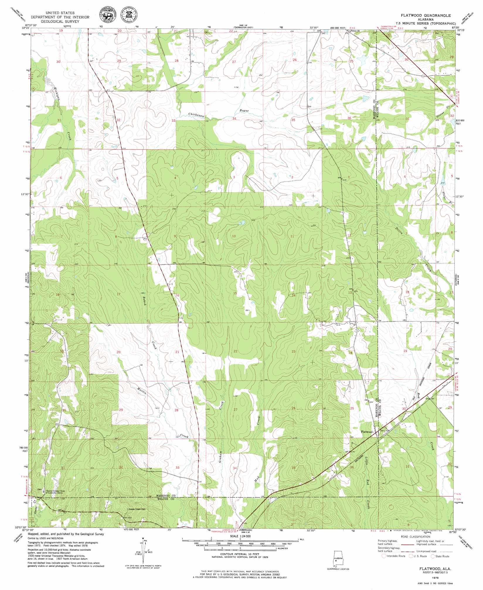
Flatwood Topo Map Alabama
To zoom in, hover over the map of Flatwood
USGS Topo Quad 32087b5 - 1:24,000 scale
| Topo Map Name: | Flatwood |
| USGS Topo Quad ID: | 32087b5 |
| Print Size: | ca. 21 1/4" wide x 27" high |
| Southeast Coordinates: | 32.125° N latitude / 87.5° W longitude |
| Map Center Coordinates: | 32.1875° N latitude / 87.5625° W longitude |
| U.S. State: | AL |
| Filename: | o32087b5.jpg |
| Download Map JPG Image: | Flatwood topo map 1:24,000 scale |
| Map Type: | Topographic |
| Topo Series: | 7.5´ |
| Map Scale: | 1:24,000 |
| Source of Map Images: | United States Geological Survey (USGS) |
| Alternate Map Versions: |
Flatwood AL 1978, updated 1979 Download PDF Buy paper map Flatwood AL 2011 Download PDF Buy paper map Flatwood AL 2014 Download PDF Buy paper map |
1:24,000 Topo Quads surrounding Flatwood
Old Spring Hill |
Gallion |
Uniontown West |
Uniontown East |
Browns |
Linden |
Thomaston West |
Thomaston East |
Central Mills |
Safford |
Miller |
Magnolia |
Flatwood |
Catherine |
Crumptonia |
Sweet Water |
Surginer |
Kimbrough |
Lee Long Bridge |
Camden North |
Bashi |
Thomasville |
Pine Hill |
Coy |
Camden South |
> Back to 32087a1 at 1:100,000 scale
> Back to 32086a1 at 1:250,000 scale
> Back to U.S. Topo Maps home
Flatwood topo map: Gazetteer
Flatwood: Populated Places
Flatwood elevation 61m 200′Flatwood: Streams
Babcock Branch elevation 41m 134′Bokok Creek elevation 39m 127′
Flatwood digital topo map on disk
Buy this Flatwood topo map showing relief, roads, GPS coordinates and other geographical features, as a high-resolution digital map file on DVD:
Gulf Coast (LA, MS, AL, FL) & Southwestern Georgia
Buy digital topo maps: Gulf Coast (LA, MS, AL, FL) & Southwestern Georgia
 & Southwestern Georgia map DVD")