Bentonia Topo Map Mississippi
To zoom in, hover over the map of Bentonia
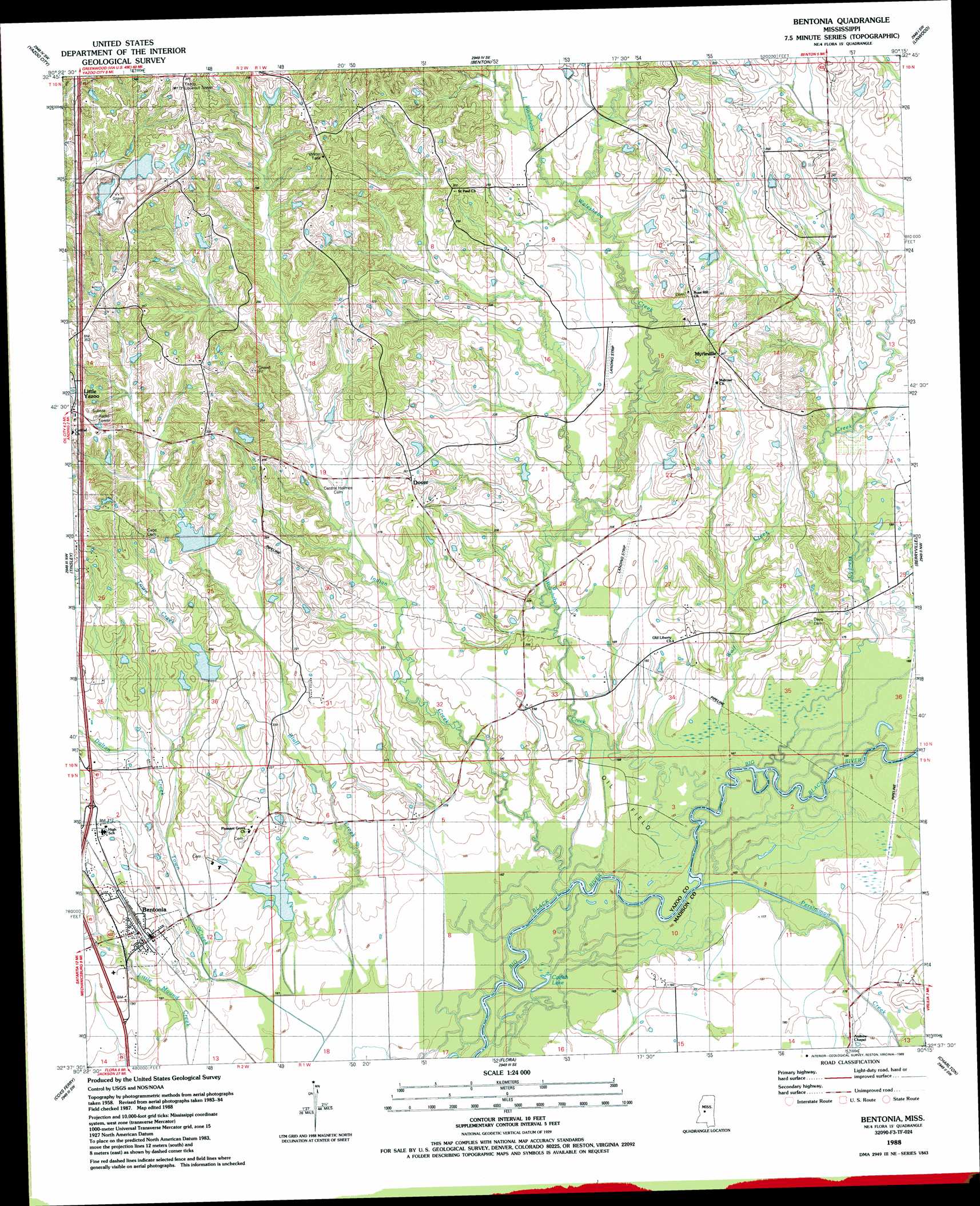
USGS Topo Quad 32090f3 - 1:24,000 scale
| Topo Map Name: | Bentonia |
| USGS Topo Quad ID: | 32090f3 |
| Print Size: | ca. 21 1/4" wide x 27" high |
| Southeast Coordinates: | 32.625° N latitude / 90.25° W longitude |
| Map Center Coordinates: | 32.6875° N latitude / 90.3125° W longitude |
| U.S. State: | MS |
| Filename: | o32090f3.jpg |
| Download Map JPG Image: | Bentonia topo map 1:24,000 scale |
| Map Type: | Topographic |
| Topo Series: | 7.5´ |
| Map Scale: | 1:24,000 |
| Source of Map Images: | United States Geological Survey (USGS) |
| Alternate Map Versions: |
Bentonia MS 1988, updated 1989 Download PDF Buy paper map Bentonia MS 2012 Download PDF Buy paper map Bentonia MS 2015 Download PDF Buy paper map |
1:24,000 Topo Quads surrounding Bentonia
Louise |
Carter |
Eden |
Zeiglerville |
Ebenezer |
Bayland Se |
Yazoo City |
Benton |
Linwood |
Vaughan |
Satartia |
Tinsley |
Bentonia |
Berryville |
Way |
Phoenix |
Coxs Ferry |
Flora |
Charlton |
Canton |
Queens Hill Lake |
Brownsville |
Pocahontas |
Ridgeland |
Madison |
> Back to 32090e1 at 1:100,000 scale
> Back to 32090a1 at 1:250,000 scale
> Back to U.S. Topo Maps home
Bentonia topo map: Gazetteer
Bentonia: Dams
Bentonia Watershed Structure 6 Dam elevation 67m 219′Bentonia Watershed Structure 8 Dam elevation 55m 180′
Bentonia Watershed Structure 9 Dam elevation 73m 239′
Griffis Lake Dam elevation 68m 223′
M S Johnson Pond Dam elevation 65m 213′
W and W Gravel Company Lake Dam elevation 94m 308′
Bentonia: Lakes
Catfish Lake elevation 49m 160′Bentonia: Populated Places
Bentonia elevation 59m 193′Dover elevation 80m 262′
Little Yazoo elevation 107m 351′
Myrleville elevation 80m 262′
Plumville (historical) elevation 61m 200′
Bentonia: Streams
Big Lake Run elevation 49m 160′Cypress Creek elevation 49m 160′
Dalton Creek elevation 59m 193′
Indian Creek elevation 49m 160′
Little Walesheba Creek elevation 67m 219′
Persimmon Creek elevation 49m 160′
Town Creek elevation 48m 157′
Walesheba Creek elevation 47m 154′
Wolf Creek elevation 49m 160′
Bentonia digital topo map on disk
Buy this Bentonia topo map showing relief, roads, GPS coordinates and other geographical features, as a high-resolution digital map file on DVD: