Canton Topo Map Mississippi
To zoom in, hover over the map of Canton
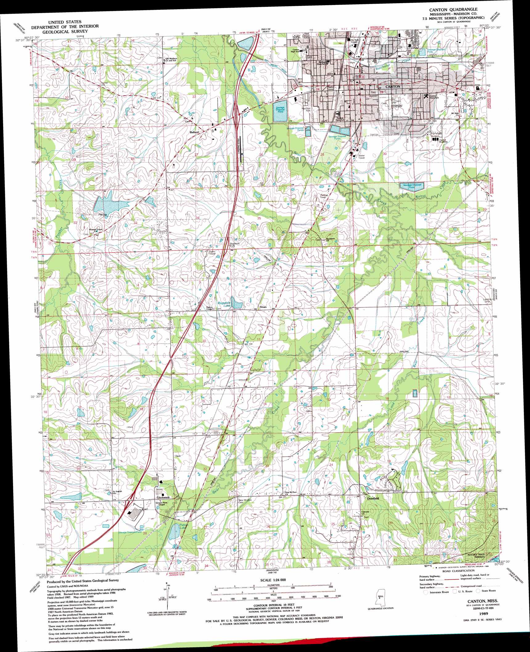
USGS Topo Quad 32090e1 - 1:24,000 scale
| Topo Map Name: | Canton |
| USGS Topo Quad ID: | 32090e1 |
| Print Size: | ca. 21 1/4" wide x 27" high |
| Southeast Coordinates: | 32.5° N latitude / 90° W longitude |
| Map Center Coordinates: | 32.5625° N latitude / 90.0625° W longitude |
| U.S. State: | MS |
| Filename: | o32090e1.jpg |
| Download Map JPG Image: | Canton topo map 1:24,000 scale |
| Map Type: | Topographic |
| Topo Series: | 7.5´ |
| Map Scale: | 1:24,000 |
| Source of Map Images: | United States Geological Survey (USGS) |
| Alternate Map Versions: |
Canton MS 1989, updated 1989 Download PDF Buy paper map Canton MS 2012 Download PDF Buy paper map Canton MS 2015 Download PDF Buy paper map |
1:24,000 Topo Quads surrounding Canton
Benton |
Linwood |
Vaughan |
Cameron |
Camden |
Bentonia |
Berryville |
Way |
Sharon |
Farmhaven |
Flora |
Charlton |
Canton |
Shoccoe |
Sharon Se |
Pocahontas |
Ridgeland |
Madison |
Goshen Springs |
Leesburg |
Clinton |
Jackson |
Jackson Se |
Brandon |
Pelahatchie |
> Back to 32090e1 at 1:100,000 scale
> Back to 32090a1 at 1:250,000 scale
> Back to U.S. Topo Maps home
Canton topo map: Gazetteer
Canton: Canals
Hot Water Ditch elevation 62m 203′Canton: Crossings
Interchange 112 elevation 85m 278′Interchange 119 elevation 67m 219′
Canton: Dams
C A Garbo Lake Dam elevation 83m 272′C M Wade Lake Dam elevation 81m 265′
Hermit Jones Lake Dam elevation 87m 285′
M E Ragsdale Pond Dam elevation 84m 275′
Canton: Parks
Red Bud Park elevation 67m 219′Canton: Populated Places
Ballard elevation 70m 229′Canton elevation 71m 232′
Deerfield elevation 85m 278′
Gluckstadt elevation 85m 278′
Maris Town elevation 75m 246′
Meltonville elevation 82m 269′
Sloan elevation 78m 255′
Canton: Reservoirs
Patton Lake elevation 79m 259′Ragsdale Lake elevation 80m 262′
Canton: Streams
Little Bear Creek elevation 66m 216′Walnut Creek elevation 65m 213′
Canton digital topo map on disk
Buy this Canton topo map showing relief, roads, GPS coordinates and other geographical features, as a high-resolution digital map file on DVD: