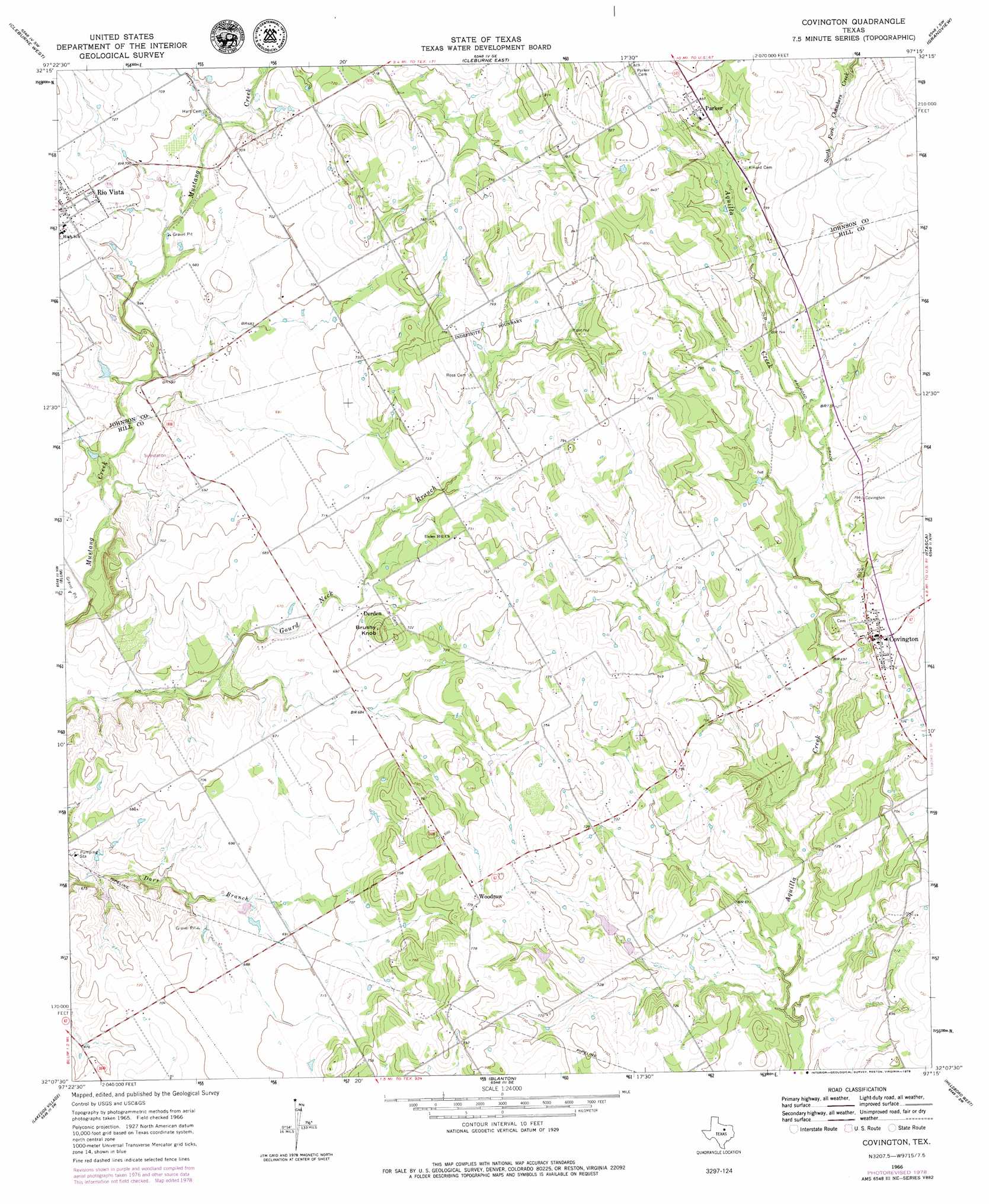
Covington Topo Map Texas
To zoom in, hover over the map of Covington
USGS Topo Quad 32097b3 - 1:24,000 scale
| Topo Map Name: | Covington |
| USGS Topo Quad ID: | 32097b3 |
| Print Size: | ca. 21 1/4" wide x 27" high |
| Southeast Coordinates: | 32.125° N latitude / 97.25° W longitude |
| Map Center Coordinates: | 32.1875° N latitude / 97.3125° W longitude |
| U.S. State: | TX |
| Filename: | o32097b3.jpg |
| Download Map JPG Image: | Covington topo map 1:24,000 scale |
| Map Type: | Topographic |
| Topo Series: | 7.5´ |
| Map Scale: | 1:24,000 |
| Source of Map Images: | United States Geological Survey (USGS) |
| Alternate Map Versions: |
Covington TX 1966, updated 1968 Download PDF Buy paper map Covington TX 1966, updated 1978 Download PDF Buy paper map Covington TX 2010 Download PDF Buy paper map Covington TX 2012 Download PDF Buy paper map Covington TX 2016 Download PDF Buy paper map |
1:24,000 Topo Quads surrounding Covington
Godley |
Joshua |
Keene |
Alvarado |
Venus |
Bono |
Cleburne West |
Cleburne East |
Grandview |
Maypearl |
Brazos Point |
Blum |
Covington |
Itasca |
Files Valley |
Morgan |
Lakeside Village |
Blanton |
Hillsboro West |
Hillsboro East |
Pilot Knob |
Allen Bend |
Whitney |
Peoria |
Abbott |
> Back to 32097a1 at 1:100,000 scale
> Back to 32096a1 at 1:250,000 scale
> Back to U.S. Topo Maps home
Covington topo map: Gazetteer
Covington: Airports
Birdnest Airport elevation 248m 813′Cross Wind Acres Airport elevation 230m 754′
Sky Vista Ranch Airport elevation 238m 780′
Covington: Dams
Gilmer and Walker Lake Dam elevation 221m 725′Soil Conservation Service Site 2 Dam elevation 215m 705′
Soil Conservation Service Site 3 Dam elevation 210m 688′
Covington: Populated Places
Covington elevation 231m 757′Derden elevation 213m 698′
Parker elevation 253m 830′
Rio Vista elevation 223m 731′
Woodrow elevation 238m 780′
Covington: Reservoirs
Gilmer and Walker Lake elevation 221m 725′Soil Conservation Service Site 2 Reservoir elevation 215m 705′
Soil Conservation Service Site 3 Reservoir elevation 210m 688′
Covington: Summits
Brushy Knob elevation 232m 761′Covington digital topo map on disk
Buy this Covington topo map showing relief, roads, GPS coordinates and other geographical features, as a high-resolution digital map file on DVD: