Nolan Topo Map Texas
To zoom in, hover over the map of Nolan
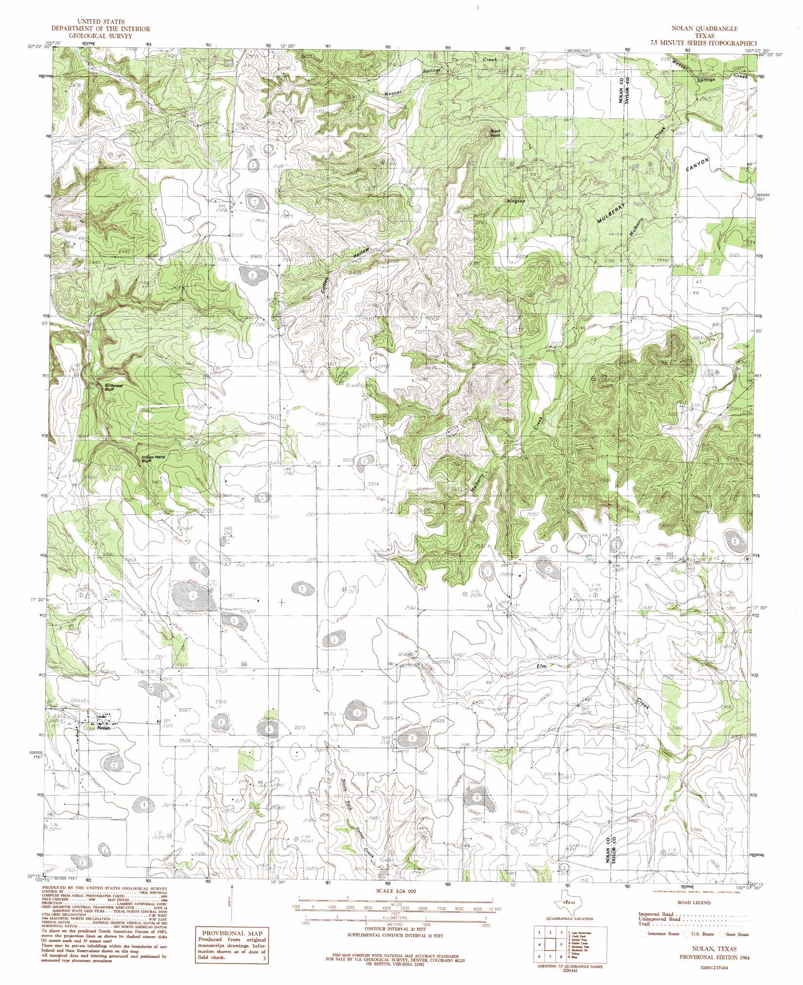
USGS Topo Quad 32100c2 - 1:24,000 scale
| Topo Map Name: | Nolan |
| USGS Topo Quad ID: | 32100c2 |
| Print Size: | ca. 21 1/4" wide x 27" high |
| Southeast Coordinates: | 32.25° N latitude / 100.125° W longitude |
| Map Center Coordinates: | 32.3125° N latitude / 100.1875° W longitude |
| U.S. State: | TX |
| Filename: | o32100c2.jpg |
| Download Map JPG Image: | Nolan topo map 1:24,000 scale |
| Map Type: | Topographic |
| Topo Series: | 7.5´ |
| Map Scale: | 1:24,000 |
| Source of Map Images: | United States Geological Survey (USGS) |
| Alternate Map Versions: |
Nolan TX 1984, updated 1984 Download PDF Buy paper map Nolan TX 2010 Download PDF Buy paper map Nolan TX 2012 Download PDF Buy paper map Nolan TX 2016 Download PDF Buy paper map |
1:24,000 Topo Quads surrounding Nolan
Busby |
Eskota |
Raven Creek South |
Noodle |
Stith |
Sweetwater |
Lake Sweetwater |
Chalk Peak |
Merkel West |
Merkel East |
Lake Trammell |
Holder Creek |
Nolan |
Mountain Pass |
View |
Maryneal |
Blackwell Ne |
Hylton |
Shep |
Lake Abilene |
Blackwell Sw |
Blackwell |
Church Peak |
Wingate |
Bradshaw |
> Back to 32100a1 at 1:100,000 scale
> Back to 32100a1 at 1:250,000 scale
> Back to U.S. Topo Maps home
Nolan topo map: Gazetteer
Nolan: Cliffs
Birdsnest Bluff elevation 738m 2421′Indian Hand Bluff elevation 741m 2431′
Nolan: Populated Places
Nolan elevation 760m 2493′Nolan: Summits
Black Point elevation 725m 2378′Ringtop elevation 697m 2286′
Nolan: Valleys
Coffee Hollow elevation 705m 2312′Nolan digital topo map on disk
Buy this Nolan topo map showing relief, roads, GPS coordinates and other geographical features, as a high-resolution digital map file on DVD: