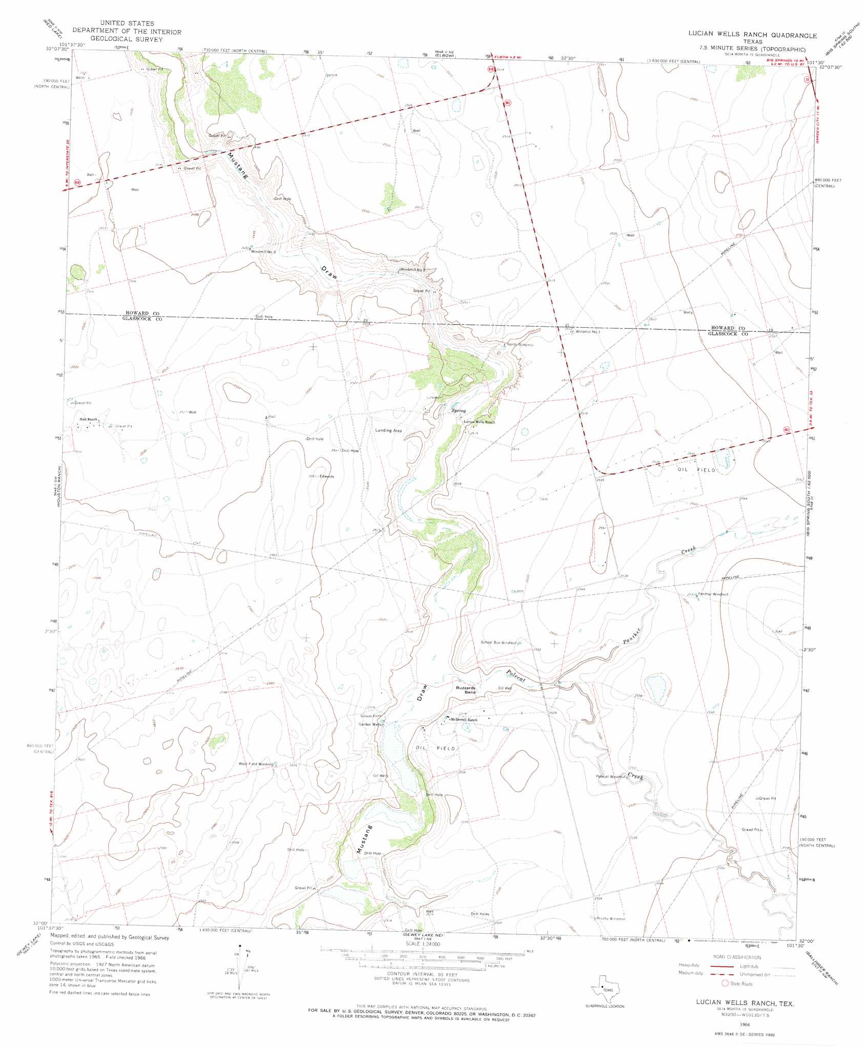
Lucian Wells Ranch Topo Map Texas
To zoom in, hover over the map of Lucian Wells Ranch
USGS Topo Quad 32101a5 - 1:24,000 scale
| Topo Map Name: | Lucian Wells Ranch |
| USGS Topo Quad ID: | 32101a5 |
| Print Size: | ca. 21 1/4" wide x 27" high |
| Southeast Coordinates: | 32° N latitude / 101.5° W longitude |
| Map Center Coordinates: | 32.0625° N latitude / 101.5625° W longitude |
| U.S. State: | TX |
| Filename: | o32101a5.jpg |
| Download Map JPG Image: | Lucian Wells Ranch topo map 1:24,000 scale |
| Map Type: | Topographic |
| Topo Series: | 7.5´ |
| Map Scale: | 1:24,000 |
| Source of Map Images: | United States Geological Survey (USGS) |
| Alternate Map Versions: |
Lucian Wells Ranch TX 1966, updated 1968 Download PDF Buy paper map Lucian Wells Ranch TX 2010 Download PDF Buy paper map Lucian Wells Ranch TX 2012 Download PDF Buy paper map Lucian Wells Ranch TX 2016 Download PDF Buy paper map |
1:24,000 Topo Quads surrounding Lucian Wells Ranch
Lenorah East |
Knott Sw |
Knott Se |
Big Spring North |
Coahoma |
Stanton |
Natural Dam Lake |
Elbow |
Big Spring South |
Moss Creek Lake |
Stanton Se |
Houston Ranch |
Lucian Wells Ranch |
Lees |
Forsan |
Spraberry |
Dewey Lake |
Dewey Lake Ne |
Ballinger Ranch |
Garden City Ne |
Pecks Lake |
Patterson Lake |
Dewey Lake Se |
Garden City |
Currie Reservoir |
> Back to 32101a1 at 1:100,000 scale
> Back to 32100a1 at 1:250,000 scale
> Back to U.S. Topo Maps home
Lucian Wells Ranch topo map: Gazetteer
Lucian Wells Ranch: Airports
Edwards Lucian Wells Ranch Airport elevation 762m 2500′Lucian Wells Ranch: Bends
Buzzards Bend elevation 760m 2493′Lucian Wells Ranch: Streams
Panther Creek elevation 763m 2503′Polecat Creek elevation 758m 2486′
Lucian Wells Ranch: Wells
Garden Wells elevation 758m 2486′Lucian Wells Ranch digital topo map on disk
Buy this Lucian Wells Ranch topo map showing relief, roads, GPS coordinates and other geographical features, as a high-resolution digital map file on DVD: