San Jose Topo Map Arizona
To zoom in, hover over the map of San Jose
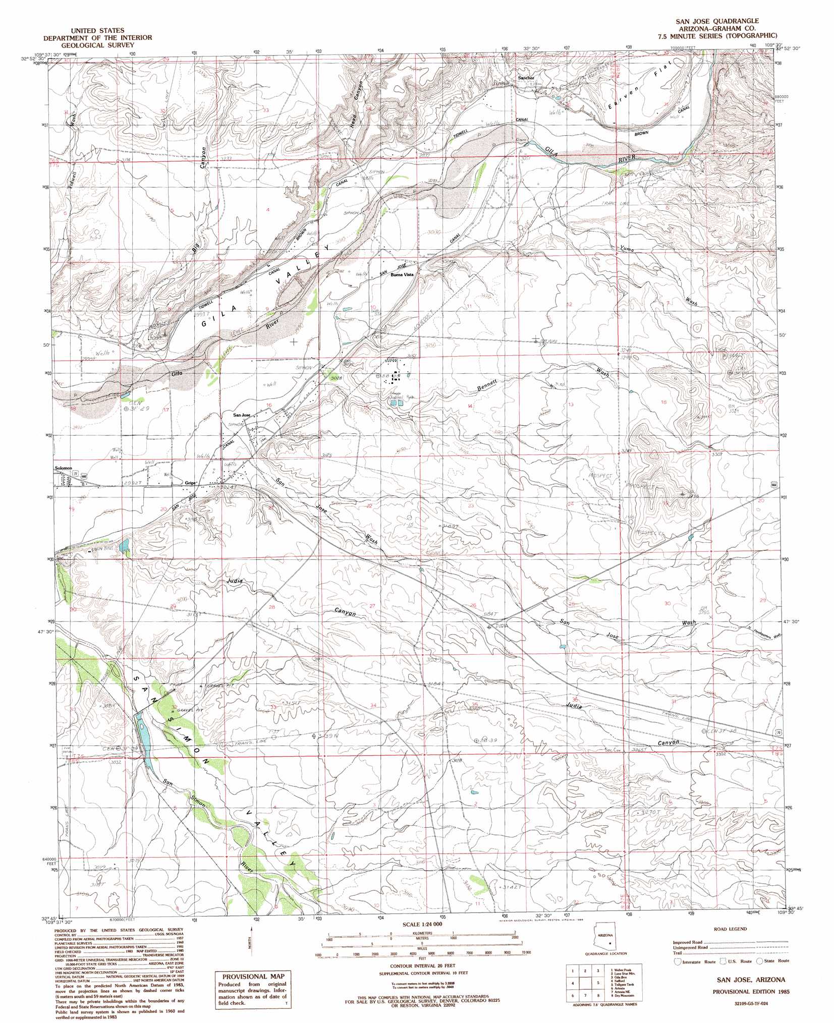
USGS Topo Quad 32109g5 - 1:24,000 scale
| Topo Map Name: | San Jose |
| USGS Topo Quad ID: | 32109g5 |
| Print Size: | ca. 21 1/4" wide x 27" high |
| Southeast Coordinates: | 32.75° N latitude / 109.5° W longitude |
| Map Center Coordinates: | 32.8125° N latitude / 109.5625° W longitude |
| U.S. State: | AZ |
| Filename: | o32109g5.jpg |
| Download Map JPG Image: | San Jose topo map 1:24,000 scale |
| Map Type: | Topographic |
| Topo Series: | 7.5´ |
| Map Scale: | 1:24,000 |
| Source of Map Images: | United States Geological Survey (USGS) |
| Alternate Map Versions: |
San Jose AZ 1985, updated 1986 Download PDF Buy paper map San Jose AZ 2011 Download PDF Buy paper map San Jose AZ 2014 Download PDF Buy paper map |
1:24,000 Topo Quads surrounding San Jose
Markham Creek |
Bryce Mountain |
Bonita Spring |
Copperplate Gulch |
Clifton |
Pima |
Weber Peak |
Lone Star Mountain |
Gila Box |
Guthrie |
Thatcher |
Safford |
San Jose |
Tollgate Tank |
Ash Peak |
Mount Graham |
Artesia |
Artesia Ne |
Dry Mountain |
Whitlock Mountains Ne |
Stockton Pass |
Gillespie Mountain |
Tanque |
Javelina Peak |
Whitlock Cienega |
> Back to 32109e1 at 1:100,000 scale
> Back to 32108a1 at 1:250,000 scale
> Back to U.S. Topo Maps home
San Jose topo map: Gazetteer
San Jose: Arroyos
Judy Wash elevation 933m 3061′San Jose: Canals
Brown Canal elevation 933m 3061′Fourness Canal elevation 923m 3028′
San Jose Canal elevation 0m 0′
Tidwell Canal elevation 923m 3028′
San Jose: Dams
Judy Wash Retarding Dam elevation 933m 3061′Sam Simon Barrier Structure Dam elevation 921m 3021′
San Jose: Flats
Earven Flat elevation 973m 3192′San Jose: Parks
Sanchez Monument elevation 0m 0′San Jose: Populated Places
Buena Vista elevation 927m 3041′Gripe elevation 918m 3011′
San Jose elevation 0m 0′
Sanchez elevation 0m 0′
San Jose: Streams
Bennett Wash elevation 926m 3038′North Headquarters Wash elevation 1011m 3316′
San Jose Wash elevation 0m 0′
Yuma Wash elevation 928m 3044′
San Jose: Valleys
Big Canyon elevation 922m 3024′Head Canyon elevation 935m 3067′
Judia Canyon elevation 933m 3061′
San Jose digital topo map on disk
Buy this San Jose topo map showing relief, roads, GPS coordinates and other geographical features, as a high-resolution digital map file on DVD: