Wahak Hotrontk Topo Map Arizona
To zoom in, hover over the map of Wahak Hotrontk
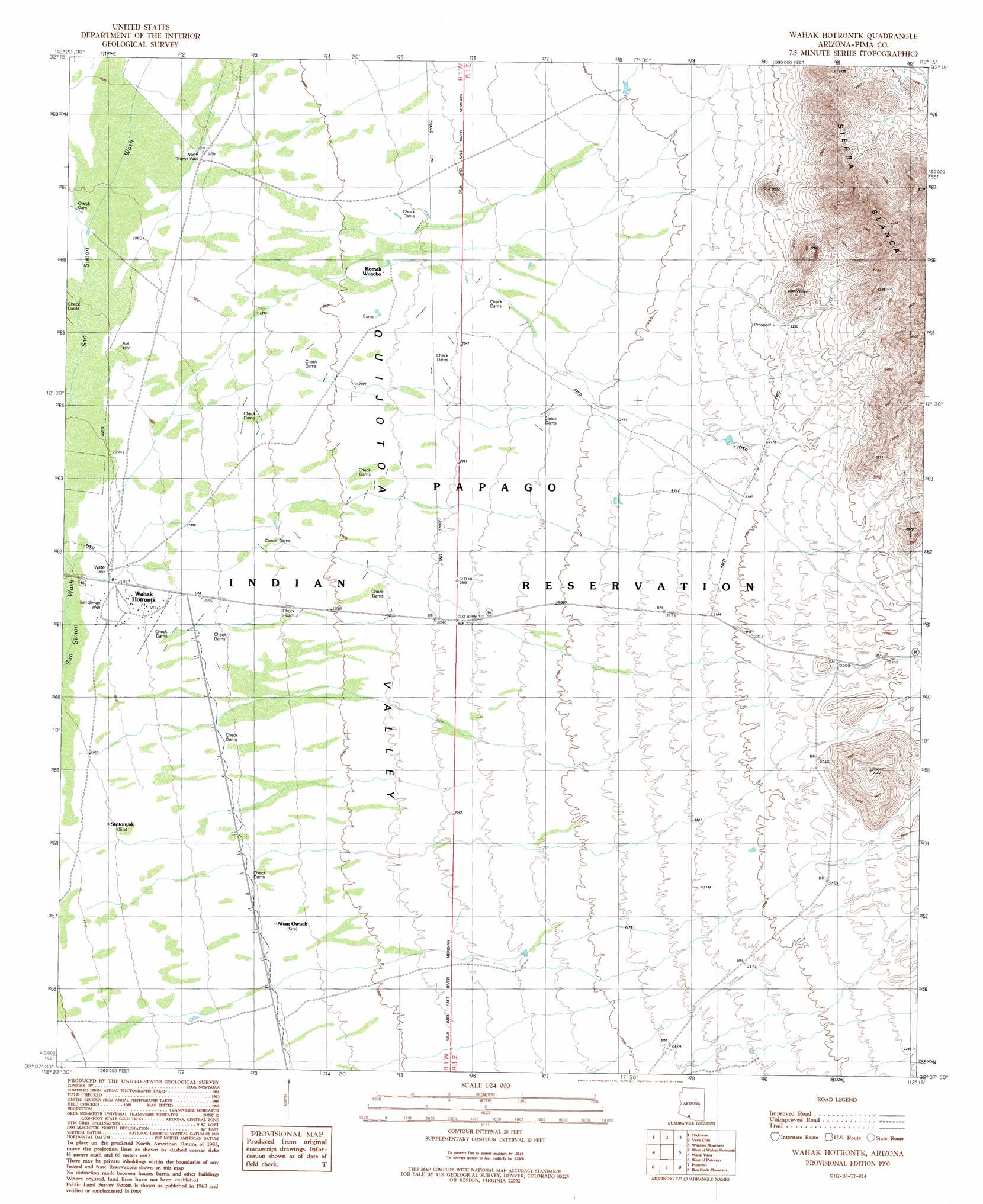
USGS Topo Quad 32112b3 - 1:24,000 scale
| Topo Map Name: | Wahak Hotrontk |
| USGS Topo Quad ID: | 32112b3 |
| Print Size: | ca. 21 1/4" wide x 27" high |
| Southeast Coordinates: | 32.125° N latitude / 112.25° W longitude |
| Map Center Coordinates: | 32.1875° N latitude / 112.3125° W longitude |
| U.S. State: | AZ |
| Filename: | o32112b3.jpg |
| Download Map JPG Image: | Wahak Hotrontk topo map 1:24,000 scale |
| Map Type: | Topographic |
| Topo Series: | 7.5´ |
| Map Scale: | 1:24,000 |
| Source of Map Images: | United States Geological Survey (USGS) |
| Alternate Map Versions: |
Wahak Hotrontk AZ 1990, updated 1990 Download PDF Buy paper map Wahak Hotrontk AZ 1996, updated 2001 Download PDF Buy paper map Wahak Hotrontk AZ 2011 Download PDF Buy paper map Wahak Hotrontk AZ 2014 Download PDF Buy paper map |
1:24,000 Topo Quads surrounding Wahak Hotrontk
Coffeepot Mountain |
Cimarron Peak |
West Of Ventana |
Ventana |
Drew Spring Well |
Gakolik Mountains |
Hickiwan |
Vaya Chin |
Window Mountain |
Gu Achi |
Hotason Vo |
West Of Wahak Hotrontk |
Wahak Hotrontk |
Maish Vaya |
Gurli Put Vo |
Gu Vo |
West Of Pisinimo |
Pisinimo |
Ben Nevis Mountain |
Vainom Kug |
Pia Oik |
Chupan Mountain |
Kom Vo |
Kupk |
Gu Oidak |
> Back to 32112a1 at 1:100,000 scale
> Back to 32112a1 at 1:250,000 scale
> Back to U.S. Topo Maps home
Wahak Hotrontk topo map: Gazetteer
Wahak Hotrontk: Populated Places
Ahan Owuch elevation 600m 1968′Komak Wuacho elevation 613m 2011′
Stotonyak elevation 585m 1919′
Wahak Hotrontk elevation 591m 1938′
Wahak Hotrontk: Wells
North Tracys Well elevation 601m 1971′San Simon Well elevation 0m 0′
Wahak Hotrontk digital topo map on disk
Buy this Wahak Hotrontk topo map showing relief, roads, GPS coordinates and other geographical features, as a high-resolution digital map file on DVD: