Wellton Topo Map Arizona
To zoom in, hover over the map of Wellton
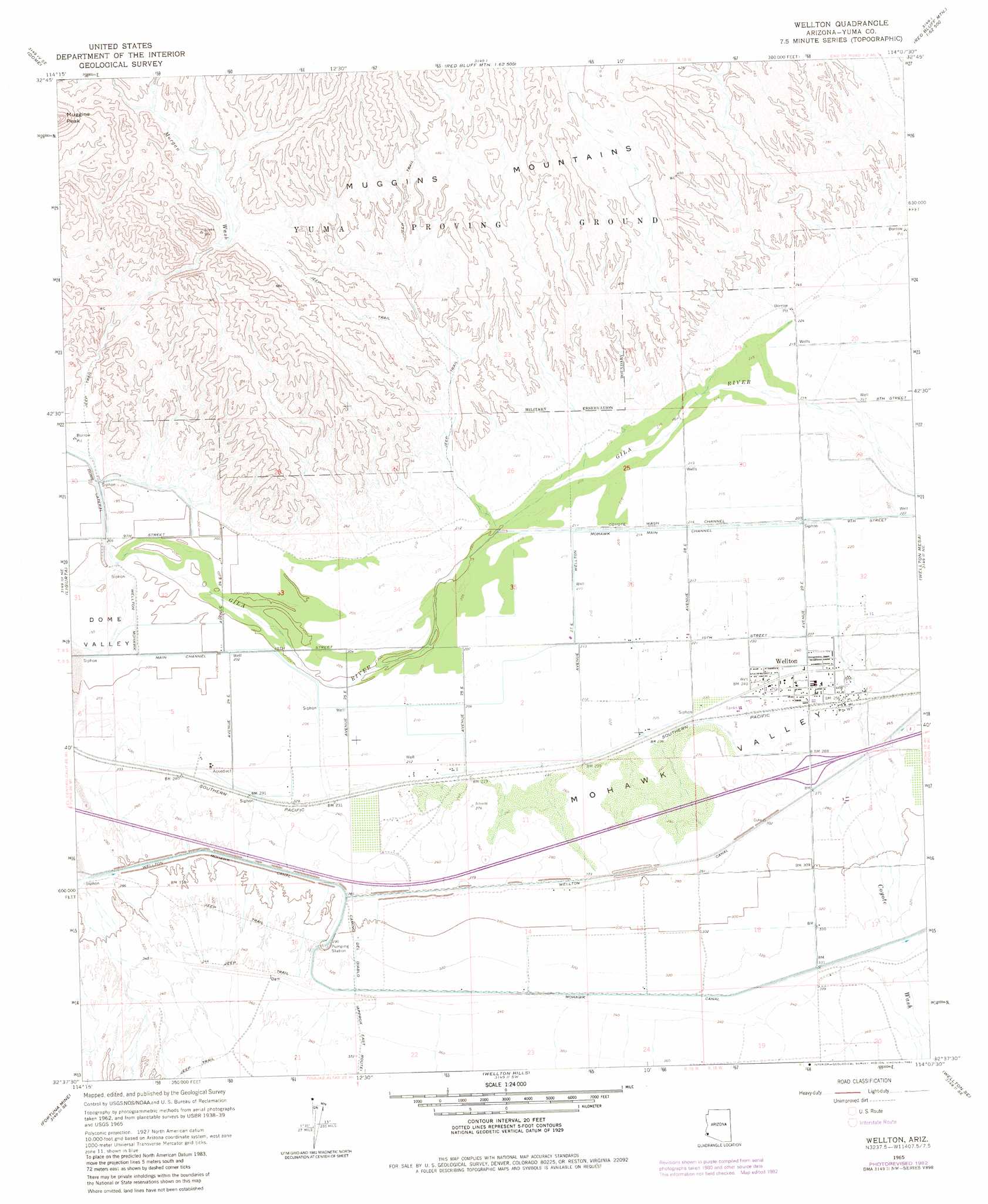
USGS Topo Quad 32114f2 - 1:24,000 scale
| Topo Map Name: | Wellton |
| USGS Topo Quad ID: | 32114f2 |
| Print Size: | ca. 21 1/4" wide x 27" high |
| Southeast Coordinates: | 32.625° N latitude / 114.125° W longitude |
| Map Center Coordinates: | 32.6875° N latitude / 114.1875° W longitude |
| U.S. State: | AZ |
| Filename: | o32114f2.jpg |
| Download Map JPG Image: | Wellton topo map 1:24,000 scale |
| Map Type: | Topographic |
| Topo Series: | 7.5´ |
| Map Scale: | 1:24,000 |
| Source of Map Images: | United States Geological Survey (USGS) |
| Alternate Map Versions: |
Wellton AZ 1965, updated 1966 Download PDF Buy paper map Wellton AZ 1965, updated 1980 Download PDF Buy paper map Wellton AZ 1965, updated 1982 Download PDF Buy paper map Wellton AZ 2011 Download PDF Buy paper map Wellton AZ 2014 Download PDF Buy paper map |
1:24,000 Topo Quads surrounding Wellton
Imperial Reservoir |
Middle Mountains South |
Red Bluff Mountain Nw |
Salton Tanks |
North Of Roll |
Laguna Dam |
Dome |
Red Bluff Mountain West |
Red Bluff Mountain East |
Roll |
Fortuna |
Ligurta |
Wellton |
Wellton Mesa |
Tacna |
Fortuna Sw |
Fortuna Mine |
Wellton Hills |
Wellton Se |
Mohawk Sw |
West Of Vopoki Ridge |
Vopoki Ridge |
Cipriano Pass |
Raven Butte |
Buck Peak |
> Back to 32114e1 at 1:100,000 scale
> Back to 32114a1 at 1:250,000 scale
> Back to U.S. Topo Maps home
Wellton topo map: Gazetteer
Wellton: Canals
Coyote Wash Channel elevation 66m 216′Dome Lateral elevation 62m 203′
Wellton 4.2 Lateral elevation 67m 219′
Wellton Mohawk Main Channel elevation 60m 196′
Wellton: Crossings
Wellton Underpass elevation 82m 269′Wellton: Parks
Butterfield Park elevation 79m 259′Wellton: Populated Places
Wellton elevation 75m 246′Wellton: Ranges
Muggins Mountains elevation 233m 764′Wellton: Streams
Coyote Wash elevation 68m 223′Morgan Wash elevation 66m 216′
Wellton: Valleys
Mohawk Valley elevation 62m 203′Wellton digital topo map on disk
Buy this Wellton topo map showing relief, roads, GPS coordinates and other geographical features, as a high-resolution digital map file on DVD: