Lake Sinclair West Topo Map Georgia
To zoom in, hover over the map of Lake Sinclair West
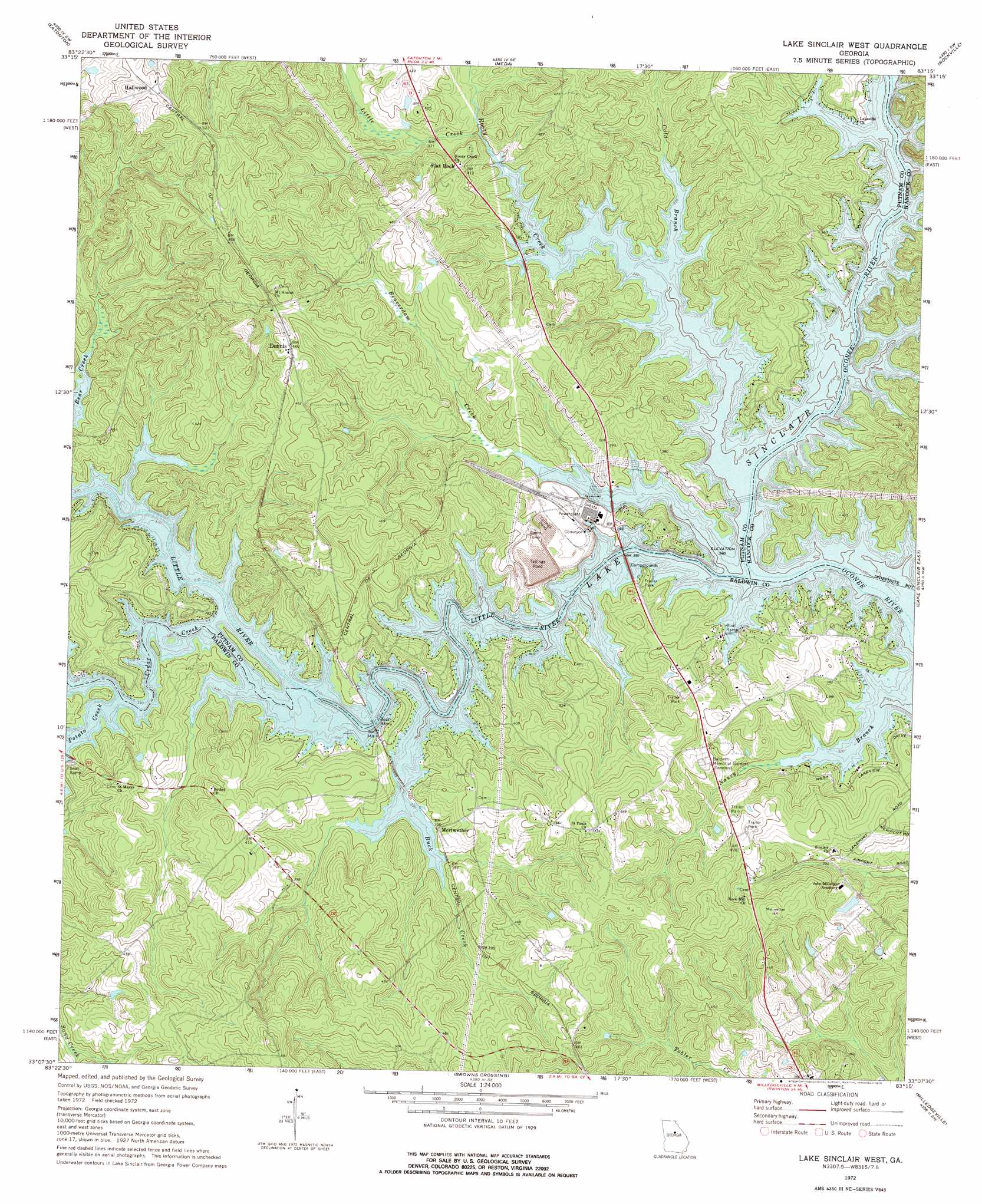
USGS Topo Quad 33083b3 - 1:24,000 scale
| Topo Map Name: | Lake Sinclair West |
| USGS Topo Quad ID: | 33083b3 |
| Print Size: | ca. 21 1/4" wide x 27" high |
| Southeast Coordinates: | 33.125° N latitude / 83.25° W longitude |
| Map Center Coordinates: | 33.1875° N latitude / 83.3125° W longitude |
| U.S. State: | GA |
| Filename: | o33083b3.jpg |
| Download Map JPG Image: | Lake Sinclair West topo map 1:24,000 scale |
| Map Type: | Topographic |
| Topo Series: | 7.5´ |
| Map Scale: | 1:24,000 |
| Source of Map Images: | United States Geological Survey (USGS) |
| Alternate Map Versions: |
Lake Sinclair West GA 1972, updated 1975 Download PDF Buy paper map Lake Sinclair West GA 2011 Download PDF Buy paper map Lake Sinclair West GA 2014 Download PDF Buy paper map |
1:24,000 Topo Quads surrounding Lake Sinclair West
Shady Dale |
Rock Eagle Lake |
Harmony |
Liberty |
White Plains |
Smithboro |
Eatonton |
Meda |
Rockville |
Shoulderbone |
Stanfordville |
Resseaus Crossroads |
Lake Sinclair West |
Lake Sinclair East |
Devereux |
Gray |
Haddock |
Browns Crossing |
Milledgeville |
Friendship |
Macon Ne |
James |
Gordon |
Napier Pond |
Gumm Pond |
> Back to 33083a1 at 1:100,000 scale
> Back to 33082a1 at 1:250,000 scale
> Back to U.S. Topo Maps home
Lake Sinclair West topo map: Gazetteer
Lake Sinclair West: Crossings
Humbers Old Ferry (historical) elevation 103m 337′Lake Sinclair West: Dams
John Milledge Academy Dam elevation 132m 433′Lake Sinclair West: Populated Places
Dennis elevation 138m 452′Flat Rock elevation 120m 393′
Hallwood elevation 155m 508′
Meriwether elevation 110m 360′
Nona elevation 147m 482′
Lake Sinclair West: Reservoirs
John Milledge Academy Lake elevation 132m 433′Lake Sinclair West: Streams
Beaverdam Creek elevation 103m 337′Buck Creek elevation 139m 456′
Cedar Creek elevation 103m 337′
Cold Branch elevation 103m 337′
Little Creek elevation 120m 393′
Little River elevation 103m 337′
Potato Creek elevation 103m 337′
Rooty Creek elevation 103m 337′
Lake Sinclair West digital topo map on disk
Buy this Lake Sinclair West topo map showing relief, roads, GPS coordinates and other geographical features, as a high-resolution digital map file on DVD:
South Carolina, Western North Carolina & Northeastern Georgia
Buy digital topo maps: South Carolina, Western North Carolina & Northeastern Georgia