Grantville Topo Map Georgia
To zoom in, hover over the map of Grantville
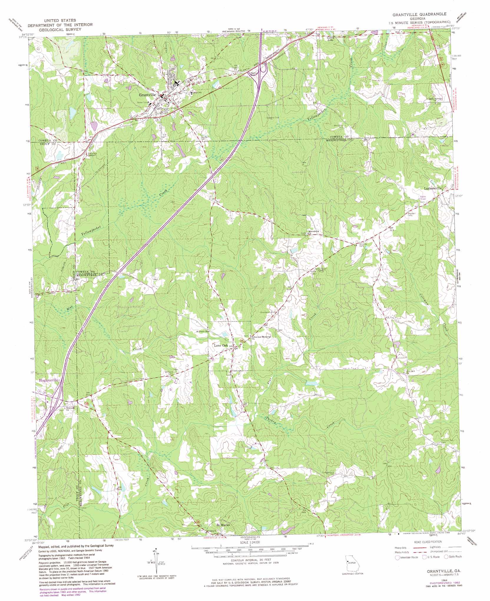
USGS Topo Quad 33084b7 - 1:24,000 scale
| Topo Map Name: | Grantville |
| USGS Topo Quad ID: | 33084b7 |
| Print Size: | ca. 21 1/4" wide x 27" high |
| Southeast Coordinates: | 33.125° N latitude / 84.75° W longitude |
| Map Center Coordinates: | 33.1875° N latitude / 84.8125° W longitude |
| U.S. State: | GA |
| Filename: | o33084b7.jpg |
| Download Map JPG Image: | Grantville topo map 1:24,000 scale |
| Map Type: | Topographic |
| Topo Series: | 7.5´ |
| Map Scale: | 1:24,000 |
| Source of Map Images: | United States Geological Survey (USGS) |
| Alternate Map Versions: |
Grantville GA 1964, updated 1966 Download PDF Buy paper map Grantville GA 1964, updated 1975 Download PDF Buy paper map Grantville GA 1964, updated 1983 Download PDF Buy paper map Grantville GA 2011 Download PDF Buy paper map Grantville GA 2014 Download PDF Buy paper map |
1:24,000 Topo Quads surrounding Grantville
Lowell |
Whitesburg |
Newnan North |
Madras |
Tyrone |
Franklin |
Newnan Sw |
Newnan South |
Sharpsburg |
Senoia |
Hillcrest |
Hogansville |
Grantville |
Luthersville |
Haralson |
La Grange |
Mountville |
Odessadale |
Greenville |
Gay |
Cannonville |
Hilyer |
Durand |
Warm Springs |
Woodbury |
> Back to 33084a1 at 1:100,000 scale
> Back to 33084a1 at 1:250,000 scale
> Back to U.S. Topo Maps home
Grantville topo map: Gazetteer
Grantville: Bridges
Burdette Bridge elevation 231m 757′Grantville: Crossings
Exit 6 elevation 264m 866′Grantville: Dams
Brewer Lake Dam elevation 241m 790′Hilly Lake Dam elevation 247m 810′
Whitehead Lake Dam elevation 249m 816′
Grantville: Parks
Grantville Historic District elevation 267m 875′Grantville: Populated Places
Grantville elevation 265m 869′Lone Oak elevation 261m 856′
Saint Marks elevation 264m 866′
Grantville: Reservoirs
Brewer Lake elevation 241m 790′Colley Lake elevation 251m 823′
Hilly Lake elevation 247m 810′
Whitehead Lake elevation 249m 816′
Grantville: Streams
East Trammel Branch elevation 241m 790′Turkey Creek elevation 230m 754′
West Trammel Branch elevation 239m 784′
Grantville digital topo map on disk
Buy this Grantville topo map showing relief, roads, GPS coordinates and other geographical features, as a high-resolution digital map file on DVD: