Mist Topo Map Arkansas
To zoom in, hover over the map of Mist
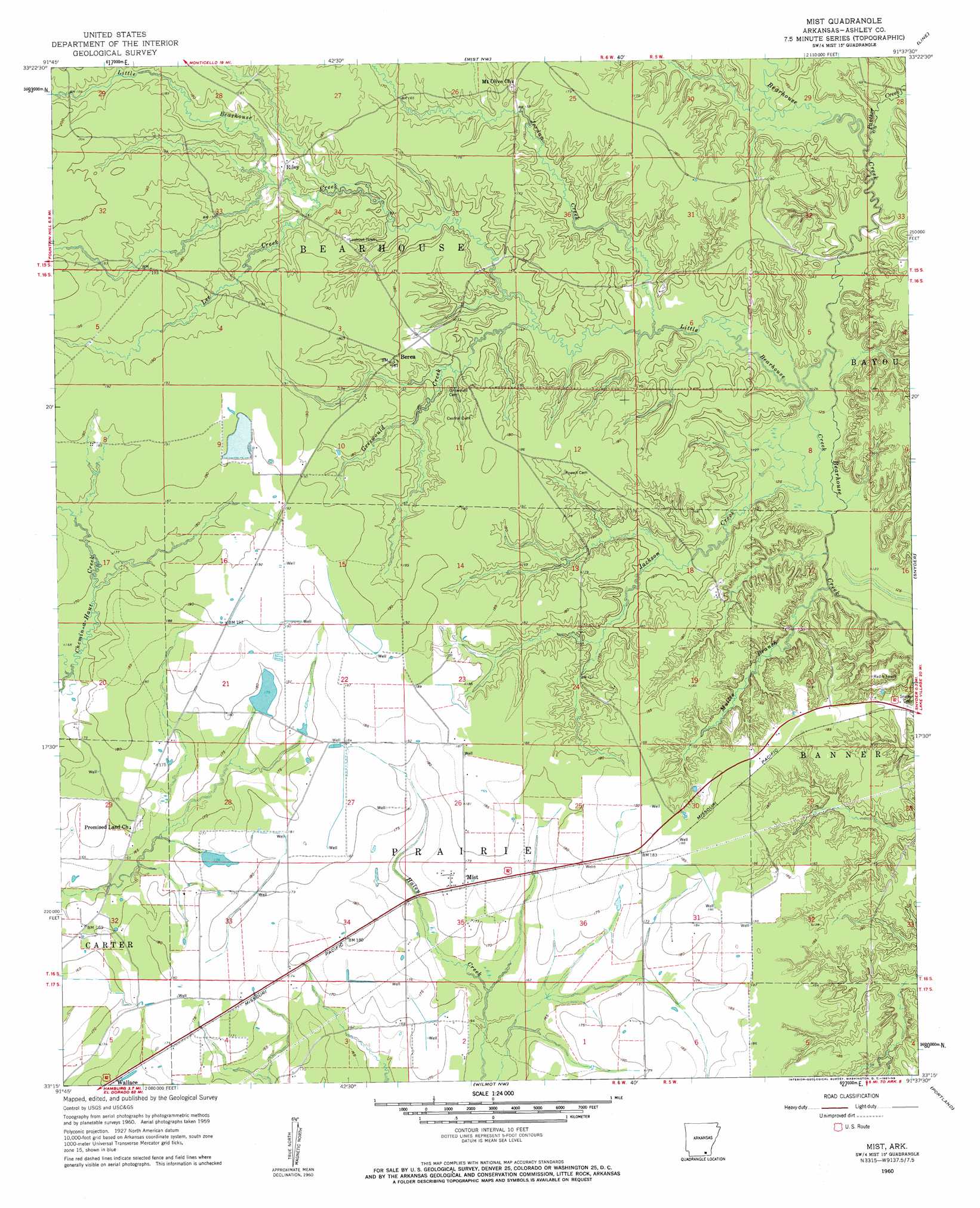
USGS Topo Quad 33091c6 - 1:24,000 scale
| Topo Map Name: | Mist |
| USGS Topo Quad ID: | 33091c6 |
| Print Size: | ca. 21 1/4" wide x 27" high |
| Southeast Coordinates: | 33.25° N latitude / 91.625° W longitude |
| Map Center Coordinates: | 33.3125° N latitude / 91.6875° W longitude |
| U.S. State: | AR |
| Filename: | o33091c6.jpg |
| Download Map JPG Image: | Mist topo map 1:24,000 scale |
| Map Type: | Topographic |
| Topo Series: | 7.5´ |
| Map Scale: | 1:24,000 |
| Source of Map Images: | United States Geological Survey (USGS) |
| Alternate Map Versions: |
Mist AR 1960, updated 1961 Download PDF Buy paper map Mist AR 2011 Download PDF Buy paper map Mist AR 2014 Download PDF Buy paper map |
1:24,000 Topo Quads surrounding Mist
Wilmar South |
Monticello South |
Cominto |
Collins |
Mcgehee South |
Longview |
Ladelle |
Mist Nw |
Line |
Jerome |
Milo |
Fountain Hill |
Mist |
Snyder |
Montrose |
Crossett North |
Hamburg |
Wilmot Nw |
Portland |
Eudora Nw |
Crossett South |
Berlin |
Wilmot Sw |
Wilmot |
Empire |
> Back to 33091a1 at 1:100,000 scale
> Back to 33090a1 at 1:250,000 scale
> Back to U.S. Topo Maps home
Mist topo map: Gazetteer
Mist: Areas
Pine Prairie elevation 53m 173′Mist: Dams
Riley Lake Dam elevation 55m 180′Stone Lake Dam elevation 53m 173′
Mist: Populated Places
Berea elevation 56m 183′Mist elevation 53m 173′
Mount Olive elevation 55m 180′
Phelan (historical) elevation 56m 183′
Promised Land elevation 51m 167′
Riley elevation 55m 180′
Mist: Reservoirs
Riley Lake elevation 55m 180′Stone Lake elevation 53m 173′
Mist: Streams
Griswould Creek elevation 48m 157′Jackson Creek elevation 39m 127′
Jordan Creek elevation 45m 147′
Lee Creek elevation 49m 160′
Little Bearhouse Creek elevation 38m 124′
Mullis Branch elevation 48m 157′
Panther Creek elevation 44m 144′
Mist digital topo map on disk
Buy this Mist topo map showing relief, roads, GPS coordinates and other geographical features, as a high-resolution digital map file on DVD: