Crossett South Topo Map Arkansas
To zoom in, hover over the map of Crossett South
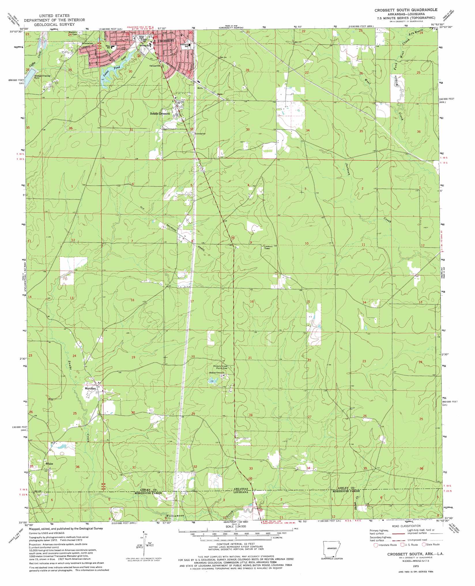
USGS Topo Quad 33091a8 - 1:24,000 scale
| Topo Map Name: | Crossett South |
| USGS Topo Quad ID: | 33091a8 |
| Print Size: | ca. 21 1/4" wide x 27" high |
| Southeast Coordinates: | 33° N latitude / 91.875° W longitude |
| Map Center Coordinates: | 33.0625° N latitude / 91.9375° W longitude |
| U.S. States: | AR, LA |
| Filename: | o33091a8.jpg |
| Download Map JPG Image: | Crossett South topo map 1:24,000 scale |
| Map Type: | Topographic |
| Topo Series: | 7.5´ |
| Map Scale: | 1:24,000 |
| Source of Map Images: | United States Geological Survey (USGS) |
| Alternate Map Versions: |
Crossett South AR 1973, updated 1975 Download PDF Buy paper map Crossett South AR 2002, updated 2003 Download PDF Buy paper map Crossett South AR 2011 Download PDF Buy paper map Crossett South AR 2014 Download PDF Buy paper map |
| FStopo: | US Forest Service topo Crossett South is available: Download FStopo PDF Download FStopo TIF |
1:24,000 Topo Quads surrounding Crossett South
Marsden |
Vick |
Milo |
Fountain Hill |
Mist |
New Union |
Marais Saline |
Crossett North |
Hamburg |
Wilmot Nw |
Huttig |
Felsenthal Dam |
Crossett South |
Berlin |
Wilmot Sw |
Marion East |
Fish Lake |
Beckman |
Twin Oaks |
Bonita |
Haille |
Harrell Lake |
Bastrop |
Mer Rouge |
Bonita Sw |
> Back to 33091a1 at 1:100,000 scale
> Back to 33090a1 at 1:250,000 scale
> Back to U.S. Topo Maps home
Crossett South topo map: Gazetteer
Crossett South: Areas
Frost Prairie elevation 50m 164′Hurricane Prairie elevation 48m 157′
Crossett South: Dams
Lucas Pond Dam elevation 43m 141′Crossett South: Parks
Crossett City Park elevation 46m 150′Crossett South: Populated Places
Cremer elevation 44m 144′Forest Park Addition elevation 50m 164′
Meridian elevation 29m 95′
Oakhurst Addition elevation 46m 150′
South Crossett elevation 41m 134′
White elevation 33m 108′
Crossett South: Reservoirs
Lucas Pond elevation 43m 141′Crossett South: Streams
East Fork West Creek elevation 42m 137′Middle Fork West Creek elevation 40m 131′
Williamson Creek elevation 24m 78′
Williamson Creek elevation 24m 78′
Crossett South digital topo map on disk
Buy this Crossett South topo map showing relief, roads, GPS coordinates and other geographical features, as a high-resolution digital map file on DVD: