Line Topo Map Arkansas
To zoom in, hover over the map of Line
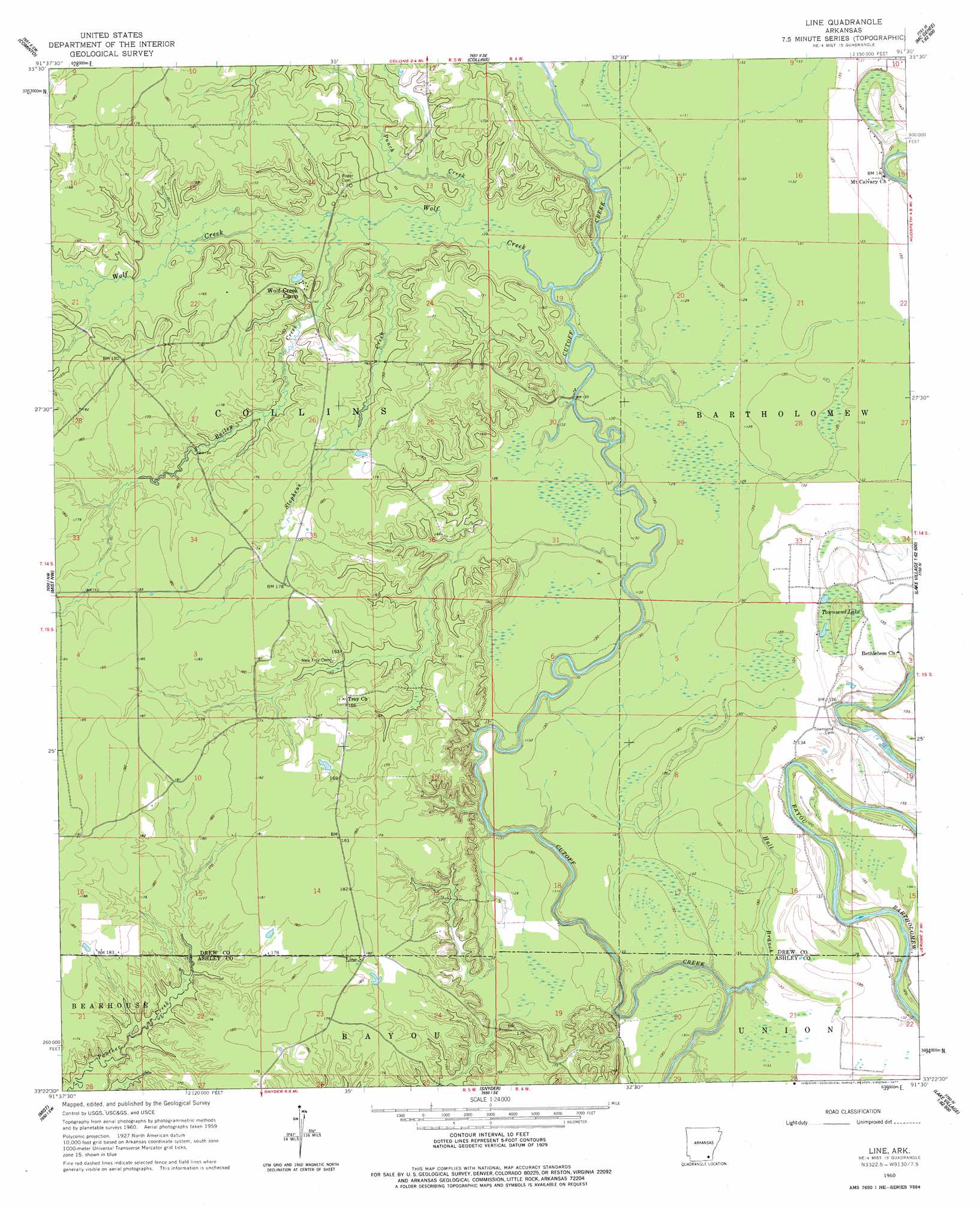
USGS Topo Quad 33091d5 - 1:24,000 scale
| Topo Map Name: | Line |
| USGS Topo Quad ID: | 33091d5 |
| Print Size: | ca. 21 1/4" wide x 27" high |
| Southeast Coordinates: | 33.375° N latitude / 91.5° W longitude |
| Map Center Coordinates: | 33.4375° N latitude / 91.5625° W longitude |
| U.S. State: | AR |
| Filename: | o33091d5.jpg |
| Download Map JPG Image: | Line topo map 1:24,000 scale |
| Map Type: | Topographic |
| Topo Series: | 7.5´ |
| Map Scale: | 1:24,000 |
| Source of Map Images: | United States Geological Survey (USGS) |
| Alternate Map Versions: |
Line AR 1960, updated 1961 Download PDF Buy paper map Line AR 1960, updated 1977 Download PDF Buy paper map Line AR 2011 Download PDF Buy paper map Line AR 2014 Download PDF Buy paper map |
1:24,000 Topo Quads surrounding Line
Monticello North |
Collins Nw |
Selma |
Mcgehee North |
Mcarthur |
Monticello South |
Cominto |
Collins |
Mcgehee South |
Halley |
Ladelle |
Mist Nw |
Line |
Jerome |
Macon Lake |
Fountain Hill |
Mist |
Snyder |
Montrose |
Lake Village |
Hamburg |
Wilmot Nw |
Portland |
Eudora Nw |
Eudora North |
> Back to 33091a1 at 1:100,000 scale
> Back to 33090a1 at 1:250,000 scale
> Back to U.S. Topo Maps home
Line topo map: Gazetteer
Line: Crossings
Hedges Ferry (historical) elevation 37m 121′Line: Parks
Cutoff Creek State Wildlife Management Area elevation 38m 124′Line: Populated Places
Troy (historical) elevation 54m 177′Line: Streams
Bailey Creek elevation 42m 137′Hall Branch elevation 40m 131′
Punch Creek elevation 43m 141′
Stephens Creek elevation 41m 134′
Wolf Creek elevation 39m 127′
Line: Swamps
Townsend Lake elevation 38m 124′Line digital topo map on disk
Buy this Line topo map showing relief, roads, GPS coordinates and other geographical features, as a high-resolution digital map file on DVD: