Lamartine Topo Map Arkansas
To zoom in, hover over the map of Lamartine
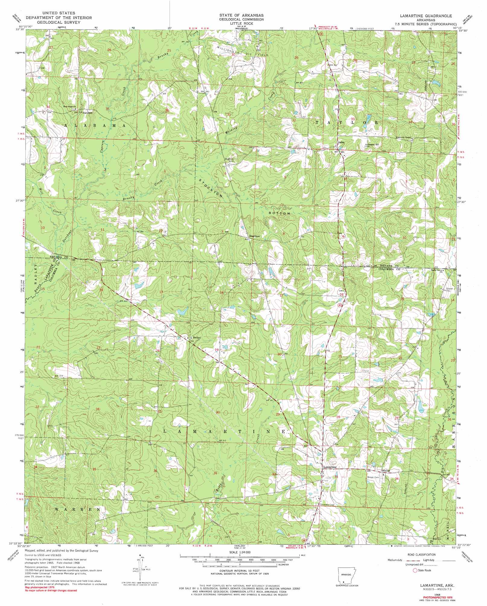
USGS Topo Quad 33093d3 - 1:24,000 scale
| Topo Map Name: | Lamartine |
| USGS Topo Quad ID: | 33093d3 |
| Print Size: | ca. 21 1/4" wide x 27" high |
| Southeast Coordinates: | 33.375° N latitude / 93.25° W longitude |
| Map Center Coordinates: | 33.4375° N latitude / 93.3125° W longitude |
| U.S. State: | AR |
| Filename: | o33093d3.jpg |
| Download Map JPG Image: | Lamartine topo map 1:24,000 scale |
| Map Type: | Topographic |
| Topo Series: | 7.5´ |
| Map Scale: | 1:24,000 |
| Source of Map Images: | United States Geological Survey (USGS) |
| Alternate Map Versions: |
Lamartine AR 1968, updated 1969 Download PDF Buy paper map Lamartine AR 1968, updated 1979 Download PDF Buy paper map Lamartine AR 2011 Download PDF Buy paper map Lamartine AR 2014 Download PDF Buy paper map |
1:24,000 Topo Quads surrounding Lamartine
Hope |
Emmet |
Laneburg |
Bluff City |
Chidester |
Patmos |
Bodcaw |
Willisville |
Waterloo |
Troy |
Old Town |
Falcon |
Lamartine |
Magnolia Nw |
Stephens |
Lewisville |
Buckner |
Waldo |
Magnolia |
Village |
Bradley Ne |
Bussey |
Macedonia |
Calhoun |
Spotville |
> Back to 33093a1 at 1:100,000 scale
> Back to 33092a1 at 1:250,000 scale
> Back to U.S. Topo Maps home
Lamartine topo map: Gazetteer
Lamartine: Flats
Stockton Bottom elevation 89m 291′Lamartine: Oilfields
Willisville Oil Field elevation 104m 341′Lamartine: Populated Places
Beech Creek elevation 107m 351′Bethel elevation 109m 357′
Bright elevation 112m 367′
Delta elevation 111m 364′
Lamartine elevation 110m 360′
Sanders elevation 102m 334′
Shiloh elevation 108m 354′
Stockton elevation 106m 347′
Lamartine: Streams
Brushy Creek elevation 91m 298′Brushy Creek elevation 84m 275′
Cypress Creek elevation 84m 275′
Mill Creek elevation 85m 278′
Waldrep Creek elevation 90m 295′
Lamartine digital topo map on disk
Buy this Lamartine topo map showing relief, roads, GPS coordinates and other geographical features, as a high-resolution digital map file on DVD: