Troy Topo Map Arkansas
To zoom in, hover over the map of Troy
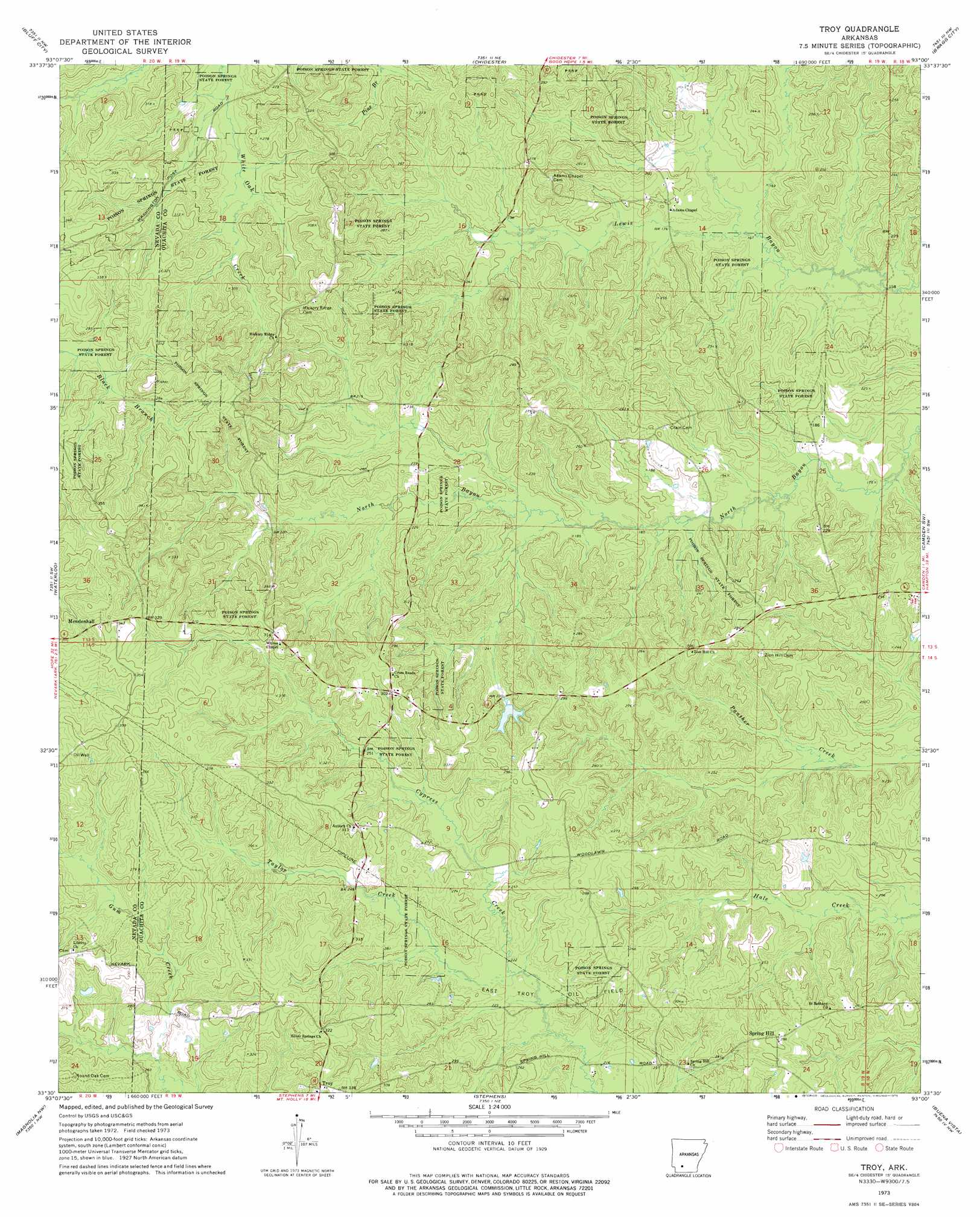
USGS Topo Quad 33093e1 - 1:24,000 scale
| Topo Map Name: | Troy |
| USGS Topo Quad ID: | 33093e1 |
| Print Size: | ca. 21 1/4" wide x 27" high |
| Southeast Coordinates: | 33.5° N latitude / 93° W longitude |
| Map Center Coordinates: | 33.5625° N latitude / 93.0625° W longitude |
| U.S. State: | AR |
| Filename: | o33093e1.jpg |
| Download Map JPG Image: | Troy topo map 1:24,000 scale |
| Map Type: | Topographic |
| Topo Series: | 7.5´ |
| Map Scale: | 1:24,000 |
| Source of Map Images: | United States Geological Survey (USGS) |
| Alternate Map Versions: |
Troy AR 1973, updated 1975 Download PDF Buy paper map Troy AR 2011 Download PDF Buy paper map Troy AR 2014 Download PDF Buy paper map |
1:24,000 Topo Quads surrounding Troy
Prescott East |
Whelen Springs |
Reader |
Tates Bluff |
Ouachita |
Laneburg |
Bluff City |
Chidester |
Bragg City |
Harmony Grove |
Willisville |
Waterloo |
Troy |
Camden Sw |
Camden |
Lamartine |
Magnolia Nw |
Stephens |
Buena Vista |
Louann |
Waldo |
Magnolia |
Village |
Mount Holly |
Lisbon |
> Back to 33093e1 at 1:100,000 scale
> Back to 33092a1 at 1:250,000 scale
> Back to U.S. Topo Maps home
Troy topo map: Gazetteer
Troy: Dams
Pace Lake Dam elevation 70m 229′Troy: Oilfields
East Troy Oil Field elevation 69m 226′Troy: Populated Places
Spring Hill elevation 92m 301′Troy elevation 101m 331′
Woodlawn (historical) elevation 96m 314′
Troy: Reservoirs
Pace Lake elevation 70m 229′Troy: Streams
Taylor Creek elevation 67m 219′Troy digital topo map on disk
Buy this Troy topo map showing relief, roads, GPS coordinates and other geographical features, as a high-resolution digital map file on DVD: