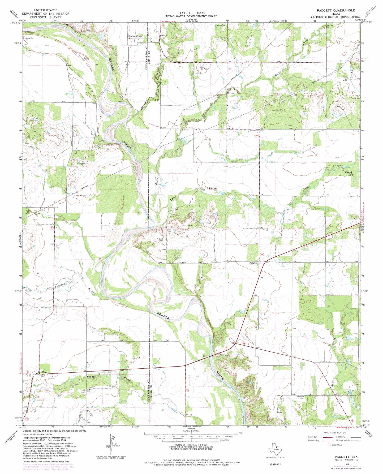
Padgett Topo Map Texas
To zoom in, hover over the map of Padgett
USGS Topo Quad 33098c8 - 1:24,000 scale
| Topo Map Name: | Padgett |
| USGS Topo Quad ID: | 33098c8 |
| Print Size: | ca. 21 1/4" wide x 27" high |
| Southeast Coordinates: | 33.25° N latitude / 98.875° W longitude |
| Map Center Coordinates: | 33.3125° N latitude / 98.9375° W longitude |
| U.S. State: | TX |
| Filename: | o33098c8.jpg |
| Download Map JPG Image: | Padgett topo map 1:24,000 scale |
| Map Type: | Topographic |
| Topo Series: | 7.5´ |
| Map Scale: | 1:24,000 |
| Source of Map Images: | United States Geological Survey (USGS) |
| Alternate Map Versions: |
Padgett TX 1964, updated 1967 Download PDF Buy paper map Padgett TX 1964, updated 1982 Download PDF Buy paper map Padgett TX 2010 Download PDF Buy paper map Padgett TX 2013 Download PDF Buy paper map Padgett TX 2016 Download PDF Buy paper map |
1:24,000 Topo Quads surrounding Padgett
Seymour East |
Cope Branch |
Dundee Sw |
Dundee Se |
Archer City West |
Rock Canyon |
Westover |
Megargel |
Lake Olney |
Bobcat Bluff |
Westover Sw |
Westover Se |
Padgett |
Olney |
True |
Throckmorton |
Throckmorton Ne |
Proffitt Crossing |
Proffitt |
Newcastle |
Sibley Creek |
Woodson |
Murray |
Tackett Mountain |
South Bend |
> Back to 33098a1 at 1:100,000 scale
> Back to 33098a1 at 1:250,000 scale
> Back to U.S. Topo Maps home
Padgett topo map: Gazetteer
Padgett: Airports
Bob D Bailes Airport elevation 341m 1118′Padgett: Populated Places
Elbert elevation 352m 1154′Padgett elevation 370m 1213′
Spring Creek elevation 366m 1200′
Padgett: Streams
Bitter Creek elevation 343m 1125′Camp Creek elevation 344m 1128′
Leopard Creek elevation 342m 1122′
Spring Creek elevation 347m 1138′
Watson Creek elevation 348m 1141′
Padgett digital topo map on disk
Buy this Padgett topo map showing relief, roads, GPS coordinates and other geographical features, as a high-resolution digital map file on DVD: