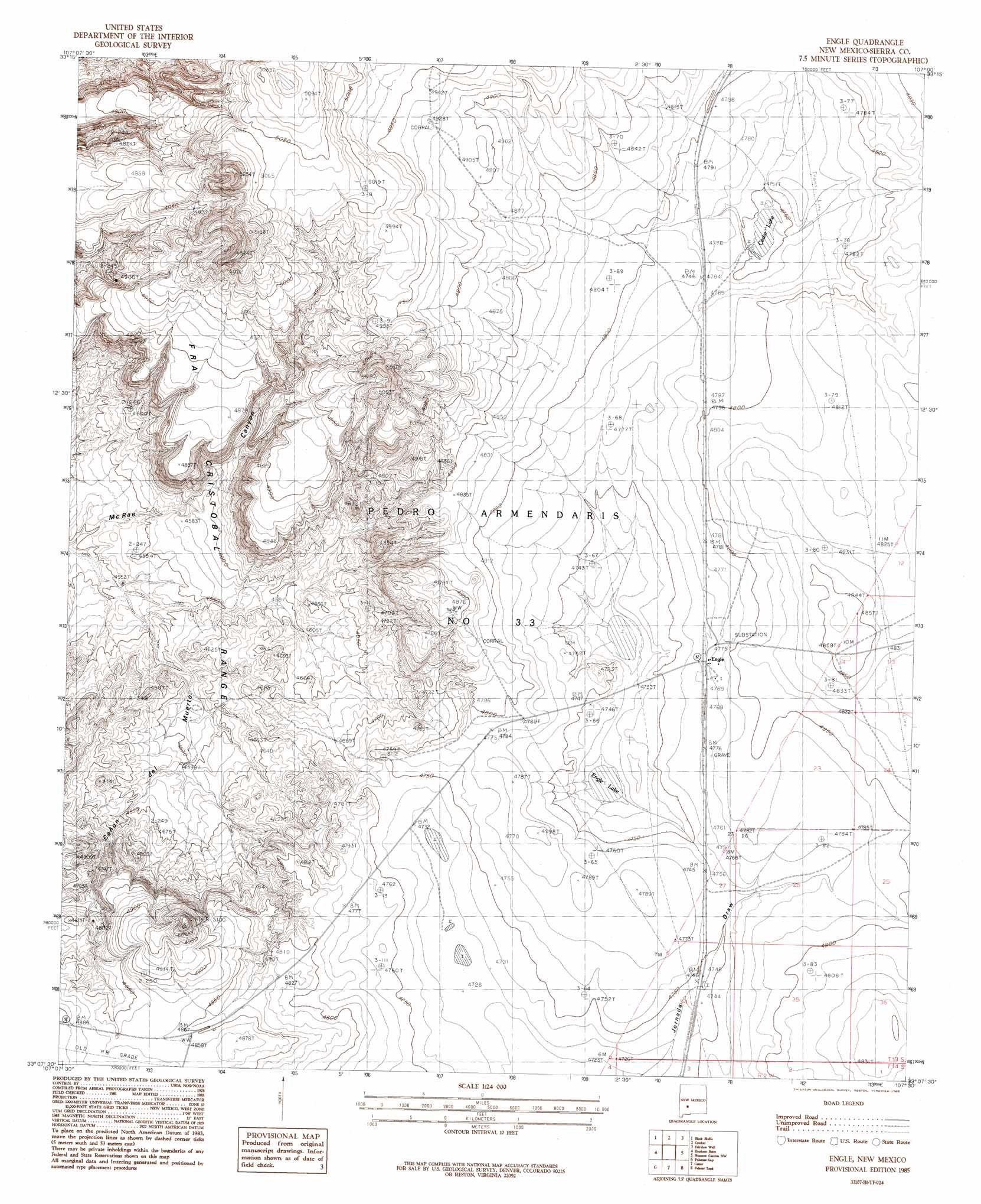
Engle Topo Map New Mexico
To zoom in, hover over the map of Engle
USGS Topo Quad 33107b1 - 1:24,000 scale
| Topo Map Name: | Engle |
| USGS Topo Quad ID: | 33107b1 |
| Print Size: | ca. 21 1/4" wide x 27" high |
| Southeast Coordinates: | 33.125° N latitude / 107° W longitude |
| Map Center Coordinates: | 33.1875° N latitude / 107.0625° W longitude |
| U.S. State: | NM |
| Filename: | o33107b1.jpg |
| Download Map JPG Image: | Engle topo map 1:24,000 scale |
| Map Type: | Topographic |
| Topo Series: | 7.5´ |
| Map Scale: | 1:24,000 |
| Source of Map Images: | United States Geological Survey (USGS) |
| Alternate Map Versions: |
Engle NM 1985, updated 1985 Download PDF Buy paper map Engle NM 1996, updated 2002 Download PDF Buy paper map Engle NM 2010 Download PDF Buy paper map Engle NM 2013 Download PDF Buy paper map Engle NM 2017 Download PDF Buy paper map |
1:24,000 Topo Quads surrounding Engle
Sierra Fijardo |
Romero Canyon |
Lava |
Tucson Spring |
Fuller Ranch |
Huerfano Hill |
Black Bluffs |
Crocker |
Fairview Well |
Fence Canyon |
Cuchillo |
Elephant Butte |
Engle |
Shannon Canyon Nw |
Shannon Canyon |
Williamsburg |
Palomas Gap |
Cutter |
Polecat Tank |
Dugout Canyon |
Caballo |
Apache Gap |
Upham |
Prisor Hill |
Prisor Well |
> Back to 33107a1 at 1:100,000 scale
> Back to 33106a1 at 1:250,000 scale
> Back to U.S. Topo Maps home
Engle topo map: Gazetteer
Engle: Lakes
Cedar Lake elevation 1447m 4747′Engle Lake elevation 1437m 4714′
Engle: Populated Places
Engle elevation 1456m 4776′Engle: Post Offices
Engle Post Office (historical) elevation 1456m 4776′Engle: Valleys
Cañon de Muerto elevation 1373m 4504′Conon Del Muerto elevation 1394m 4573′
Engle digital topo map on disk
Buy this Engle topo map showing relief, roads, GPS coordinates and other geographical features, as a high-resolution digital map file on DVD: