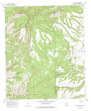
Alma Mesa Topo Map Arizona
To zoom in, hover over the map of Alma Mesa
USGS Topo Quad 33109d1 - 1:24,000 scale
| Topo Map Name: | Alma Mesa |
| USGS Topo Quad ID: | 33109d1 |
| Print Size: | ca. 21 1/4" wide x 27" high |
| Southeast Coordinates: | 33.375° N latitude / 109° W longitude |
| Map Center Coordinates: | 33.4375° N latitude / 109.0625° W longitude |
| U.S. States: | AZ, NM |
| Filename: | o33109d1.jpg |
| Download Map JPG Image: | Alma Mesa topo map 1:24,000 scale |
| Map Type: | Topographic |
| Topo Series: | 7.5´ |
| Map Scale: | 1:24,000 |
| Source of Map Images: | United States Geological Survey (USGS) |
| Alternate Map Versions: |
Alma Mesa AZ 1967, updated 1970 Download PDF Buy paper map Alma Mesa AZ 1967, updated 1978 Download PDF Buy paper map Alma Mesa AZ 1997, updated 2000 Download PDF Buy paper map Alma Mesa AZ 2005, updated 2006 Download PDF Buy paper map Alma Mesa AZ 2011 Download PDF Buy paper map Alma Mesa AZ 2014 Download PDF Buy paper map |
| FStopo: | US Forest Service topo Alma Mesa is available: Download FStopo PDF Download FStopo TIF |
1:24,000 Topo Quads surrounding Alma Mesa
> Back to 33109a1 at 1:100,000 scale
> Back to 33108a1 at 1:250,000 scale
> Back to U.S. Topo Maps home
Alma Mesa topo map: Gazetteer
Alma Mesa: Benches
Charlie Moore Mesa elevation 1816m 5958′Alma Mesa: Populated Places
Charlie Moore Place elevation 1781m 5843′Alma Mesa: Reservoirs
Antelope Tank elevation 1693m 5554′Basin Tank elevation 1842m 6043′
Beaver Tank elevation 1819m 5967′
Beaver Tank elevation 1739m 5705′
Beaver Tank elevation 1728m 5669′
Beaver Tank Number Two elevation 1821m 5974′
Big High Tank elevation 1949m 6394′
Buck Tank elevation 2005m 6578′
Buzzard Tank elevation 1909m 6263′
Camp Tank elevation 1843m 6046′
Camp Tank Number One elevation 1843m 6046′
Camp Tank Number Two elevation 1841m 6040′
Cap Tank elevation 1893m 6210′
Cobblestone Tank elevation 1725m 5659′
Cradle Mesa Tank elevation 1930m 6332′
Deep Tank elevation 1822m 5977′
Ditch Tank elevation 1737m 5698′
Dry Tank elevation 1702m 5583′
Eva Tank elevation 1744m 5721′
Five Tank elevation 1766m 5793′
Four Tank elevation 1739m 5705′
Hobbled Steer Tank elevation 1886m 6187′
Hunter Tank elevation 1740m 5708′
Hunter Tank elevation 1826m 5990′
Little High Tank elevation 1972m 6469′
Little Tank elevation 1902m 6240′
Mesa Tank elevation 1938m 6358′
Middle Tank elevation 1830m 6003′
Morgan Tank elevation 1619m 5311′
New Hobbled Steer Tank elevation 1862m 6108′
North Sixshooter Tank elevation 1809m 5935′
One Tank elevation 1814m 5951′
Pit Tank elevation 1779m 5836′
Round Tank elevation 1763m 5784′
Six Tank elevation 1741m 5711′
Sixshooter Flat Tank elevation 1792m 5879′
South Sixshooter Flat Tank elevation 1876m 6154′
Sox Taml elevation 1741m 5711′
Stateline Number One Tank elevation 1872m 6141′
Stateline Number Two Tank elevation 1867m 6125′
Stateline Tank elevation 1874m 6148′
Sunflower Mesa Tank elevation 1724m 5656′
Three Tank elevation 1759m 5770′
Tomcat Tank elevation 1833m 6013′
Two Tank elevation 1778m 5833′
White Rocks Tank elevation 1996m 6548′
Alma Mesa: Springs
Bear Valley Spring elevation 2039m 6689′Canyon Spring elevation 1706m 5597′
Charlie Moore Spring elevation 1785m 5856′
Dirty Hannah Creek Spring elevation 1669m 5475′
Hannah Canyon Springs elevation 1634m 5360′
Hard Rock Spring elevation 1789m 5869′
Horse Spring elevation 1706m 5597′
Little Blue Spring elevation 1606m 5269′
Long Ears Spring elevation 2093m 6866′
Magnet Spring elevation 1805m 5921′
Mesa Spring elevation 1793m 5882′
Moore Spring elevation 1787m 5862′
Mud Spring elevation 1748m 5734′
Two-Timing Spring elevation 1810m 5938′
Uee Spring elevation 1897m 6223′
White Yams Spring elevation 2047m 6715′
Yam Spring elevation 1999m 6558′
Zuni Spring elevation 1753m 5751′
Alma Mesa: Summits
Alma Mesa elevation 1900m 6233′Bonehead Mesa elevation 1990m 6528′
Horse Mesa elevation 1997m 6551′
Horse Mountain elevation 2387m 7831′
Mud Spring Mesa elevation 1871m 6138′
Pinyon Knob elevation 2177m 7142′
Alma Mesa: Trails
Little Blue Creek Forty-one Trail elevation 1909m 6263′Alma Mesa: Valleys
Banjo Canyon elevation 1784m 5853′Long Canyon elevation 1992m 6535′
Mud Spring Canyon elevation 1632m 5354′
Yam Canyon elevation 1914m 6279′
Alma Mesa digital topo map on disk
Buy this Alma Mesa topo map showing relief, roads, GPS coordinates and other geographical features, as a high-resolution digital map file on DVD:


