Chandler Heights Topo Map Arizona
To zoom in, hover over the map of Chandler Heights
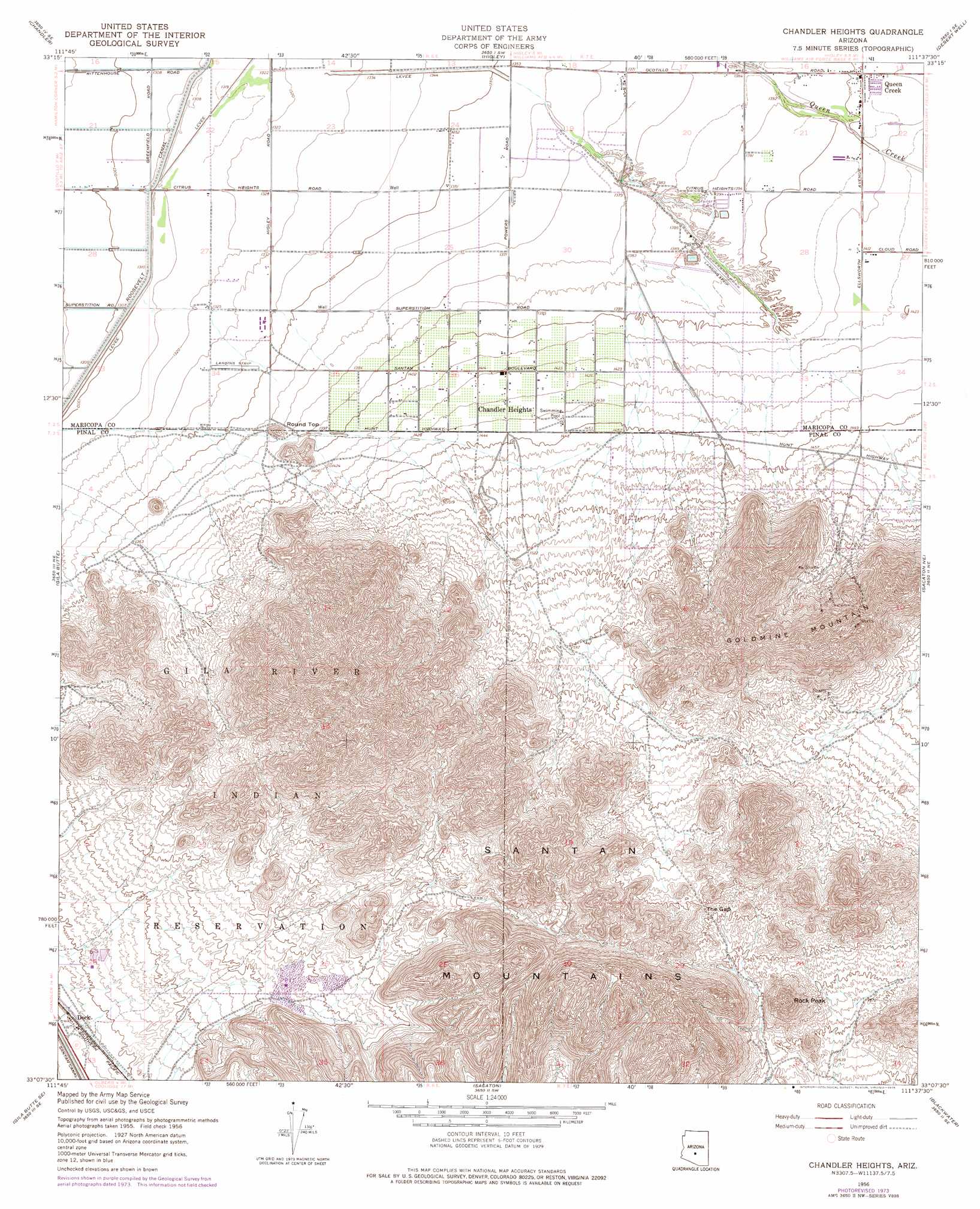
USGS Topo Quad 33111b6 - 1:24,000 scale
| Topo Map Name: | Chandler Heights |
| USGS Topo Quad ID: | 33111b6 |
| Print Size: | ca. 21 1/4" wide x 27" high |
| Southeast Coordinates: | 33.125° N latitude / 111.625° W longitude |
| Map Center Coordinates: | 33.1875° N latitude / 111.6875° W longitude |
| U.S. State: | AZ |
| Filename: | o33111b6.jpg |
| Download Map JPG Image: | Chandler Heights topo map 1:24,000 scale |
| Map Type: | Topographic |
| Topo Series: | 7.5´ |
| Map Scale: | 1:24,000 |
| Source of Map Images: | United States Geological Survey (USGS) |
| Alternate Map Versions: |
Chandler Heights AZ 1956, updated 1959 Download PDF Buy paper map Chandler Heights AZ 1956, updated 1971 Download PDF Buy paper map Chandler Heights AZ 1956, updated 1975 Download PDF Buy paper map Chandler Heights AZ 1956, updated 1975 Download PDF Buy paper map Chandler Heights AZ 1971, updated 1972 Download PDF Buy paper map Chandler Heights AZ 2011 Download PDF Buy paper map Chandler Heights AZ 2014 Download PDF Buy paper map |
1:24,000 Topo Quads surrounding Chandler Heights
Tempe |
Mesa |
Buckhorn |
Apache Junction |
Goldfield |
Guadalupe |
Chandler |
Higley |
Desert Well |
Superstition Mountains Sw |
Gila Butte Nw |
Gila Butte |
Chandler Heights |
Sacaton Ne |
Magma |
Sacaton Butte |
Gila Butte Se |
Sacaton |
Blackwater |
Florence |
Stanfield |
Casa Grande West |
Casa Crande East |
Coolidge |
Valley Farms |
> Back to 33111a1 at 1:100,000 scale
> Back to 33110a1 at 1:250,000 scale
> Back to U.S. Topo Maps home
Chandler Heights topo map: Gazetteer
Chandler Heights: Canals
Santan Canal elevation 0m 0′Chandler Heights: Gaps
The Gap elevation 561m 1840′Chandler Heights: Parks
San Tan Mountain Regional Park elevation 591m 1938′Chandler Heights: Populated Places
Chandler Heights elevation 433m 1420′Queen Creek elevation 428m 1404′
Sanokai Village elevation 421m 1381′
Chandler Heights: Post Offices
Chandler Heights Post Office elevation 427m 1400′Chandler Heights: Summits
Goldmine Mountain elevation 720m 2362′Malpais Hills elevation 756m 2480′
Rock Peak elevation 641m 2103′
Round Top elevation 0m 0′
Santan Mountain elevation 931m 3054′
Santan Mountains elevation 0m 0′
Chandler Heights digital topo map on disk
Buy this Chandler Heights topo map showing relief, roads, GPS coordinates and other geographical features, as a high-resolution digital map file on DVD: