Mobile Ne Topo Map Arizona
To zoom in, hover over the map of Mobile Ne
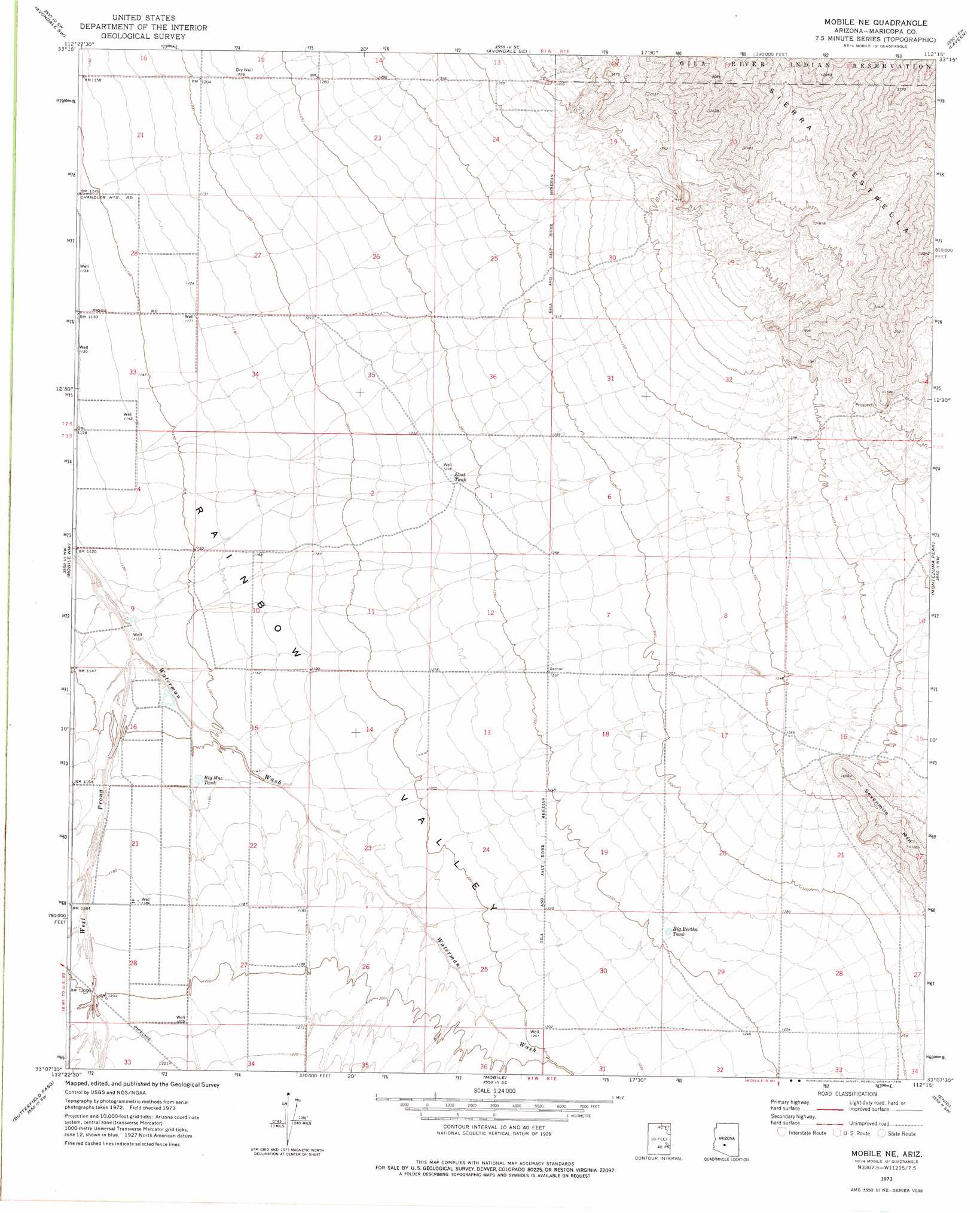
USGS Topo Quad 33112b3 - 1:24,000 scale
| Topo Map Name: | Mobile Ne |
| USGS Topo Quad ID: | 33112b3 |
| Print Size: | ca. 21 1/4" wide x 27" high |
| Southeast Coordinates: | 33.125° N latitude / 112.25° W longitude |
| Map Center Coordinates: | 33.1875° N latitude / 112.3125° W longitude |
| U.S. State: | AZ |
| Filename: | o33112b3.jpg |
| Download Map JPG Image: | Mobile Ne topo map 1:24,000 scale |
| Map Type: | Topographic |
| Topo Series: | 7.5´ |
| Map Scale: | 1:24,000 |
| Source of Map Images: | United States Geological Survey (USGS) |
| Alternate Map Versions: |
Mobile NE AZ 1973, updated 1976 Download PDF Buy paper map Mobile NE AZ 1973, updated 1976 Download PDF Buy paper map Mobile NE AZ 2011 Download PDF Buy paper map Mobile NE AZ 2014 Download PDF Buy paper map |
1:24,000 Topo Quads surrounding Mobile Ne
Valencia |
Perryville |
Tolleson |
Fowler |
Phoenix |
Buckeye |
Avondale Sw |
Avondale Se |
Laveen |
Lone Butte |
Margies Peak |
Mobile Nw |
Mobile Ne |
Montezuma Peak |
Pima Butte |
Cotton Center Se |
Butterfield Pass |
Mobile |
Enid |
Maricopa |
Bosque |
Estrella |
Conley Well |
Haley Hills |
Antelope Peak Ne |
> Back to 33112a1 at 1:100,000 scale
> Back to 33112a1 at 1:250,000 scale
> Back to U.S. Topo Maps home
Mobile Ne topo map: Gazetteer
Mobile Ne: Airports
Flying A Ranch Airport elevation 396m 1299′Mobile Ne: Reservoirs
Big Bertha Tank elevation 383m 1256′Big Mac Tank elevation 353m 1158′
East Tank elevation 378m 1240′
Mobile Ne: Streams
West Prong Waterman Wash elevation 345m 1131′Mobile Ne: Summits
Sevenmile Mountain elevation 0m 0′Mobile Ne digital topo map on disk
Buy this Mobile Ne topo map showing relief, roads, GPS coordinates and other geographical features, as a high-resolution digital map file on DVD: