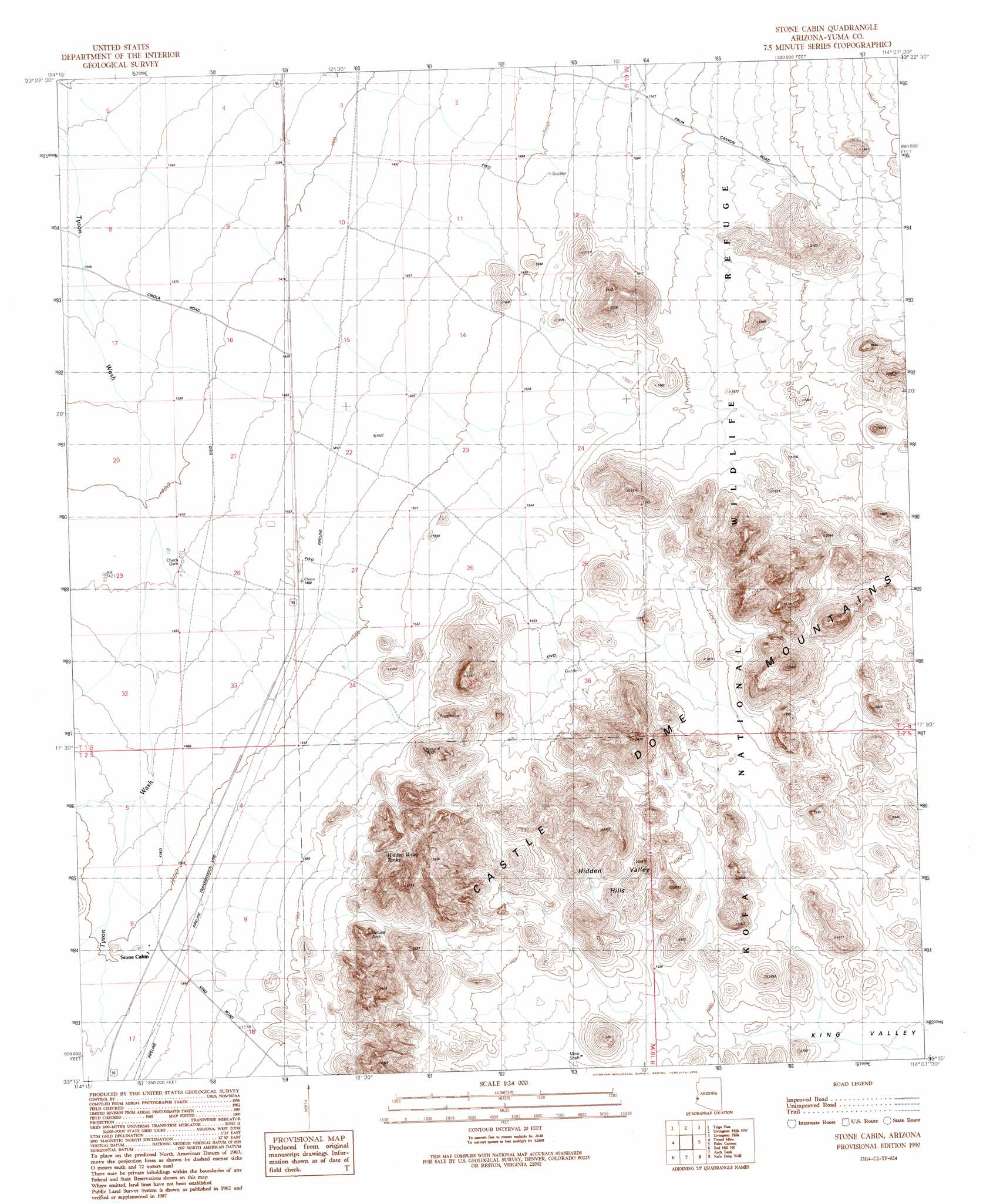
Stone Cabin Topo Map Arizona
To zoom in, hover over the map of Stone Cabin
USGS Topo Quad 33114c2 - 1:24,000 scale
| Topo Map Name: | Stone Cabin |
| USGS Topo Quad ID: | 33114c2 |
| Print Size: | ca. 21 1/4" wide x 27" high |
| Southeast Coordinates: | 33.25° N latitude / 114.125° W longitude |
| Map Center Coordinates: | 33.3125° N latitude / 114.1875° W longitude |
| U.S. State: | AZ |
| Filename: | o33114c2.jpg |
| Download Map JPG Image: | Stone Cabin topo map 1:24,000 scale |
| Map Type: | Topographic |
| Topo Series: | 7.5´ |
| Map Scale: | 1:24,000 |
| Source of Map Images: | United States Geological Survey (USGS) |
| Alternate Map Versions: |
Stone Cabin AZ 1990, updated 1990 Download PDF Buy paper map Stone Cabin AZ 2011 Download PDF Buy paper map Stone Cabin AZ 2014 Download PDF Buy paper map |
1:24,000 Topo Quads surrounding Stone Cabin
Dome Rock Mountains Sw |
Cunningham Mountain |
South Of Quartzsite |
Crystal Hill |
New Water Mountains |
North Trigo Peaks |
Trigo Pass |
Livingston Hills Nw |
Livingston Hills |
Owl Head |
Mohave Peak |
Tweed Mine |
Stone Cabin |
Palm Canyon |
Kofa Butte |
Red Hill |
Red Hill Ne |
Arch Tank |
Kofa Deep Well |
Charlie Died Tank |
Red Hill Sw |
Middle Mountains North |
Castle Dome Peak |
Slumgullion Pass |
Engesser Pass Sw |
> Back to 33114a1 at 1:100,000 scale
> Back to 33114a1 at 1:250,000 scale
> Back to U.S. Topo Maps home
Stone Cabin topo map: Gazetteer
Stone Cabin: Arches
Natural Arch elevation 565m 1853′Natural Arch elevation 615m 2017′
Stone Cabin: Reservoirs
Hidden Valley Tanks elevation 540m 1771′Stone Cabin: Summits
Hidden Valley Hills elevation 574m 1883′High Peak elevation 808m 2650′
Stone Cabin: Wells
Clarks Well elevation 435m 1427′Stone Cabin digital topo map on disk
Buy this Stone Cabin topo map showing relief, roads, GPS coordinates and other geographical features, as a high-resolution digital map file on DVD: