Castle Dome Peak Topo Map Arizona
To zoom in, hover over the map of Castle Dome Peak
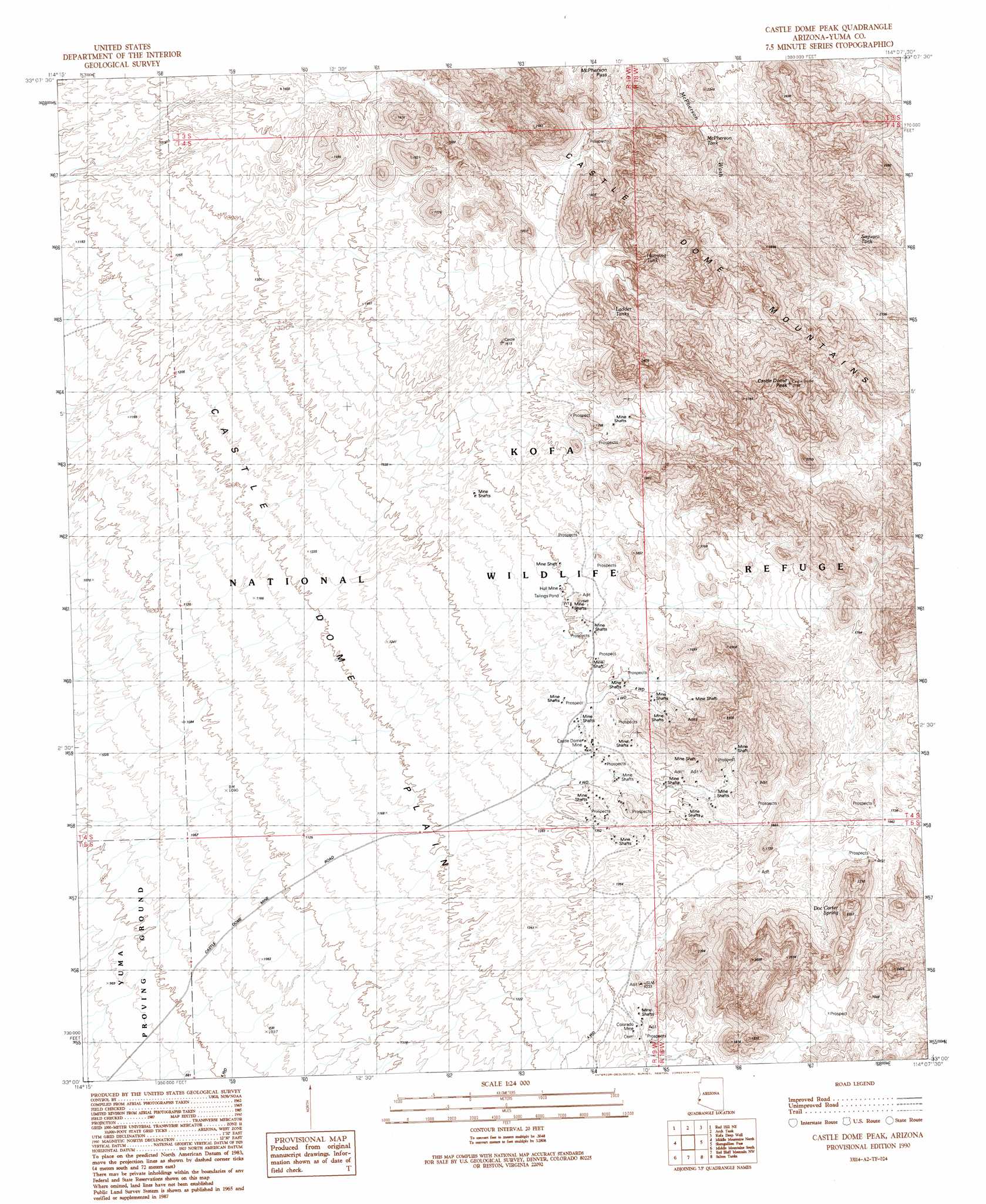
USGS Topo Quad 33114a2 - 1:24,000 scale
| Topo Map Name: | Castle Dome Peak |
| USGS Topo Quad ID: | 33114a2 |
| Print Size: | ca. 21 1/4" wide x 27" high |
| Southeast Coordinates: | 33° N latitude / 114.125° W longitude |
| Map Center Coordinates: | 33.0625° N latitude / 114.1875° W longitude |
| U.S. State: | AZ |
| Filename: | o33114a2.jpg |
| Download Map JPG Image: | Castle Dome Peak topo map 1:24,000 scale |
| Map Type: | Topographic |
| Topo Series: | 7.5´ |
| Map Scale: | 1:24,000 |
| Source of Map Images: | United States Geological Survey (USGS) |
| Alternate Map Versions: |
Castle Dome Peak AZ 1990, updated 1990 Download PDF Buy paper map Castle Dome Peak AZ 2011 Download PDF Buy paper map Castle Dome Peak AZ 2014 Download PDF Buy paper map |
1:24,000 Topo Quads surrounding Castle Dome Peak
Mohave Peak |
Tweed Mine |
Stone Cabin |
Palm Canyon |
Kofa Butte |
Red Hill |
Red Hill Ne |
Arch Tank |
Kofa Deep Well |
Charlie Died Tank |
Red Hill Sw |
Middle Mountains North |
Castle Dome Peak |
Slumgullion Pass |
Engesser Pass Sw |
Imperial Reservoir |
Middle Mountains South |
Red Bluff Mountain Nw |
Salton Tanks |
North Of Roll |
Laguna Dam |
Dome |
Red Bluff Mountain West |
Red Bluff Mountain East |
Roll |
> Back to 33114a1 at 1:100,000 scale
> Back to 33114a1 at 1:250,000 scale
> Back to U.S. Topo Maps home
Castle Dome Peak topo map: Gazetteer
Castle Dome Peak: Mines
Castle Dome Mine elevation 406m 1332′Colorado Mine elevation 385m 1263′
Hull Mine elevation 423m 1387′
Castle Dome Peak: Ranges
Castle Dome Mountains elevation 1145m 3756′Castle Dome Peak: Reservoirs
Hanging Tank elevation 576m 1889′Ladder Tank elevation 595m 1952′
McPherson Tank elevation 766m 2513′
Saguaro Tank elevation 0m 0′
Castle Dome Peak: Springs
Doc Carter Spring elevation 676m 2217′Castle Dome Peak: Summits
Castle Dome Peak elevation 1151m 3776′Castle Dome Peak digital topo map on disk
Buy this Castle Dome Peak topo map showing relief, roads, GPS coordinates and other geographical features, as a high-resolution digital map file on DVD: