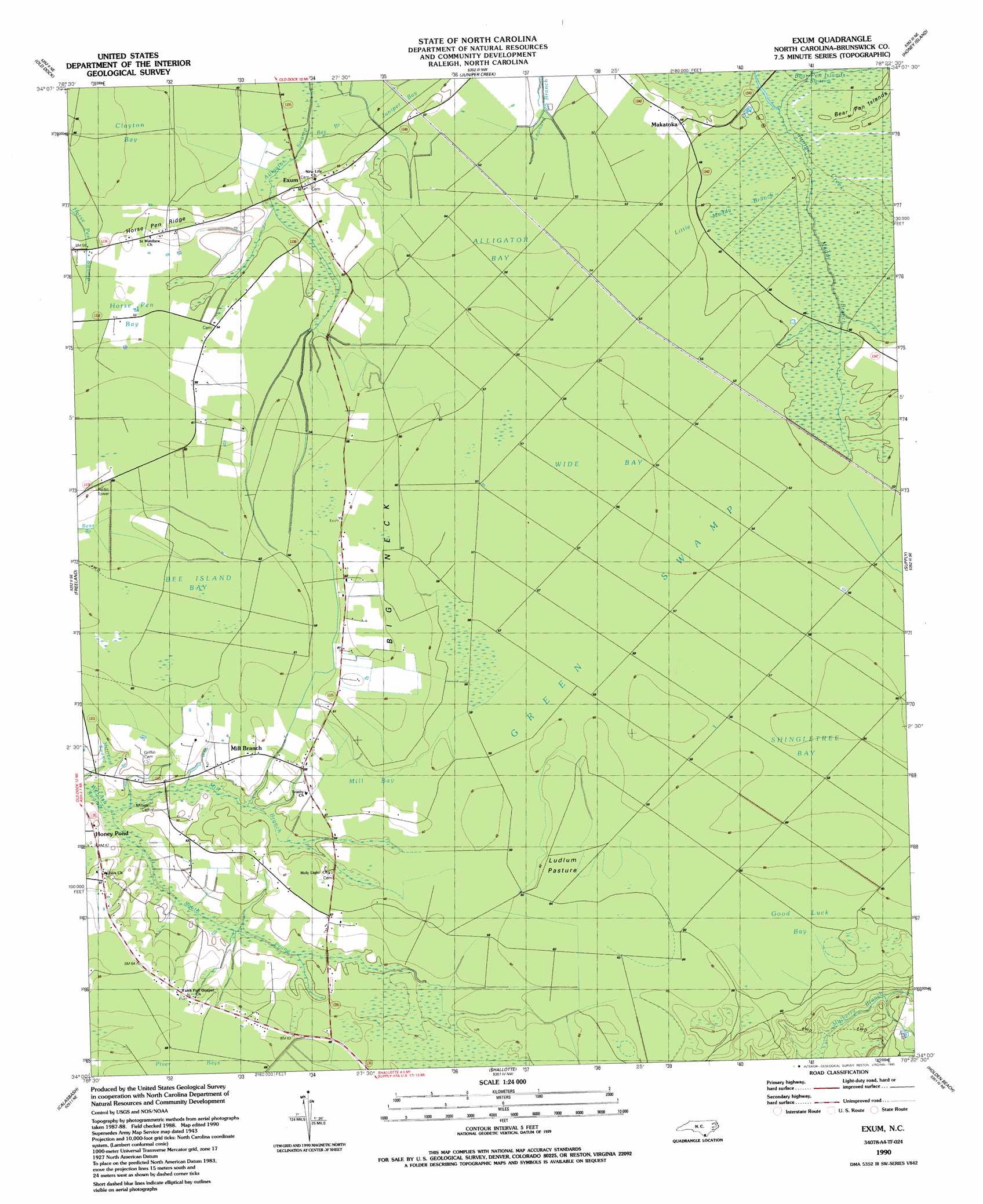
Exum Topo Map North Carolina
To zoom in, hover over the map of Exum
USGS Topo Quad 34078a4 - 1:24,000 scale
| Topo Map Name: | Exum |
| USGS Topo Quad ID: | 34078a4 |
| Print Size: | ca. 21 1/4" wide x 27" high |
| Southeast Coordinates: | 34° N latitude / 78.375° W longitude |
| Map Center Coordinates: | 34.0625° N latitude / 78.4375° W longitude |
| U.S. State: | NC |
| Filename: | o34078a4.jpg |
| Download Map JPG Image: | Exum topo map 1:24,000 scale |
| Map Type: | Topographic |
| Topo Series: | 7.5´ |
| Map Scale: | 1:24,000 |
| Source of Map Images: | United States Geological Survey (USGS) |
| Alternate Map Versions: |
Exum NC 1943, updated 1962 Download PDF Buy paper map Exum NC 1990, updated 1990 Download PDF Buy paper map Exum NC 2002, updated 2002 Download PDF Buy paper map Exum NC 2010 Download PDF Buy paper map Exum NC 2013 Download PDF Buy paper map Exum NC 2016 Download PDF Buy paper map |
1:24,000 Topo Quads surrounding Exum
Whiteville |
Lake Waccamaw West |
Lake Waccamaw East |
Freeman |
Acme |
Nakina |
Old Dock |
Juniper Creek |
Honey Island |
Lewis Swamp |
Pireway |
Freeland |
Exum |
Supply |
Bolivia |
Longs |
Calabash |
Shallotte |
Holden Beach |
Lockwoods Folly |
Wampee |
Little River |
> Back to 34078a1 at 1:100,000 scale
> Back to 34078a1 at 1:250,000 scale
> Back to U.S. Topo Maps home
Exum topo map: Gazetteer
Exum: Capes
Big Neck elevation 19m 62′Exum: Flats
Head o' th' Forks elevation 21m 68′Ludlum Pasture elevation 18m 59′
Exum: Populated Places
Exum elevation 14m 45′Honey Pond elevation 14m 45′
Makatoka elevation 15m 49′
Mill Branch elevation 17m 55′
Exum: Ridges
Horse Pen Ridge elevation 18m 59′Exum: Streams
Bay Branch elevation 12m 39′Little Muddy Branch elevation 13m 42′
Mill Branch elevation 11m 36′
Muddy Branch elevation 16m 52′
South Prong Wet Ash Swamp elevation 11m 36′
Exum: Swamps
Alligator Bay elevation 16m 52′Bee Island Bay elevation 18m 59′
Clayton Bay elevation 13m 42′
Good Luck Bay elevation 18m 59′
Horse Pen Bay elevation 17m 55′
Mill Bay elevation 18m 59′
Shingletree Bay elevation 17m 55′
Wide Bay elevation 16m 52′
Exum digital topo map on disk
Buy this Exum topo map showing relief, roads, GPS coordinates and other geographical features, as a high-resolution digital map file on DVD:
South Carolina, Western North Carolina & Northeastern Georgia
Buy digital topo maps: South Carolina, Western North Carolina & Northeastern Georgia