Baldwin Topo Map Georgia
To zoom in, hover over the map of Baldwin
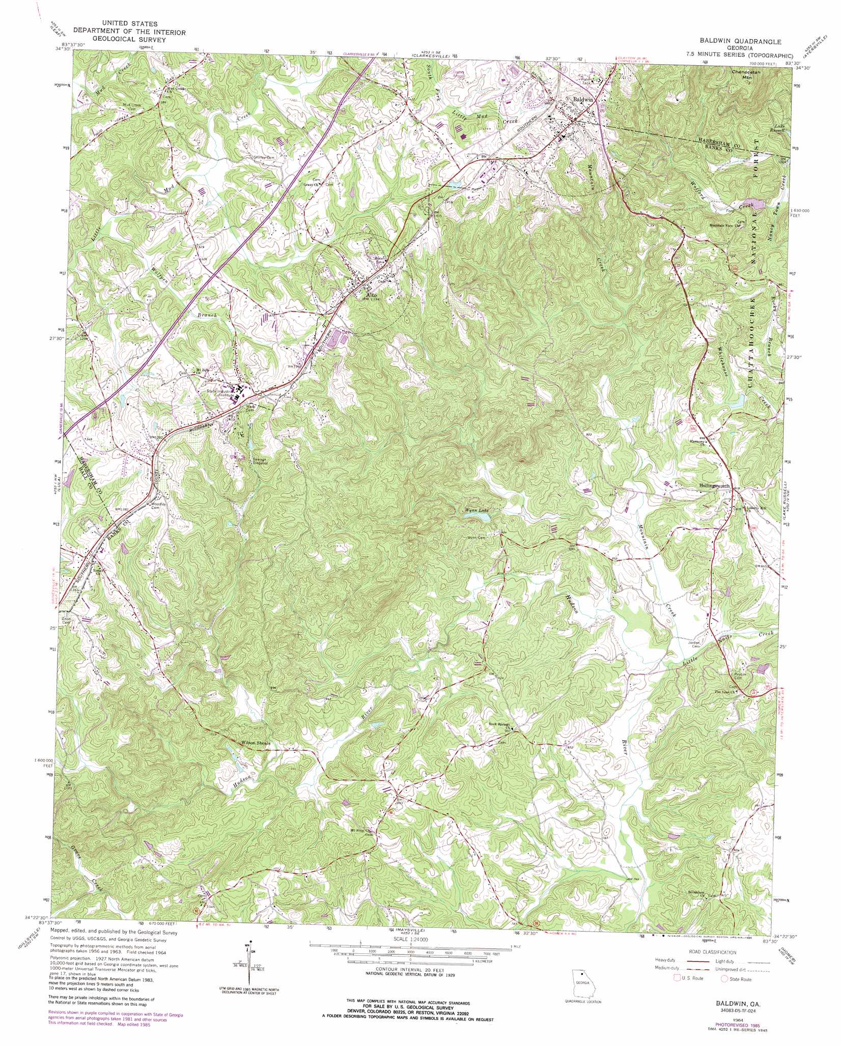
USGS Topo Quad 34083d5 - 1:24,000 scale
| Topo Map Name: | Baldwin |
| USGS Topo Quad ID: | 34083d5 |
| Print Size: | ca. 21 1/4" wide x 27" high |
| Southeast Coordinates: | 34.375° N latitude / 83.5° W longitude |
| Map Center Coordinates: | 34.4375° N latitude / 83.5625° W longitude |
| U.S. State: | GA |
| Filename: | o34083d5.jpg |
| Download Map JPG Image: | Baldwin topo map 1:24,000 scale |
| Map Type: | Topographic |
| Topo Series: | 7.5´ |
| Map Scale: | 1:24,000 |
| Source of Map Images: | United States Geological Survey (USGS) |
| Alternate Map Versions: |
Baldwin GA 1964, updated 1965 Download PDF Buy paper map Baldwin GA 1964, updated 1977 Download PDF Buy paper map Baldwin GA 1964, updated 1986 Download PDF Buy paper map Baldwin GA 2011 Download PDF Buy paper map Baldwin GA 2014 Download PDF Buy paper map |
| FStopo: | US Forest Service topo Baldwin is available: Download FStopo PDF Download FStopo TIF |
1:24,000 Topo Quads surrounding Baldwin
Cowrock |
Helen |
Clarkesville Ne |
Tallulah Falls |
Tugaloo Lake |
Cleveland |
Leaf |
Clarkesville |
Ayersville |
Toccoa |
Clermont |
Lula |
Baldwin |
Russell Lake |
Red Hill |
Gainesville |
Gillsville |
Maysville |
Homer |
Ashland |
Chestnut Mountain |
Pendergrass |
Apple Valley |
Commerce |
Ila |
> Back to 34083a1 at 1:100,000 scale
> Back to 34082a1 at 1:250,000 scale
> Back to U.S. Topo Maps home
Baldwin topo map: Gazetteer
Baldwin: Bridges
Acreys Bridge elevation 242m 793′Baldwin: Dams
Middle Fork Broad River Structure Two Dam elevation 293m 961′Wise Lake Dam elevation 249m 816′
Wynn Lake Dam elevation 258m 846′
Baldwin: Populated Places
Alto elevation 426m 1397′Baldwin elevation 466m 1528′
Hollingsworth elevation 281m 921′
Hughesboro (historical) elevation 415m 1361′
Longview elevation 426m 1397′
Raoul elevation 433m 1420′
Wilbanks Corner elevation 434m 1423′
Woffords Settlement (historical) elevation 292m 958′
Baldwin: Post Offices
Alto Post Office elevation 424m 1391′Baldwin: Reservoirs
Reservoir Two elevation 293m 961′Wise Lake elevation 249m 816′
Wynn Lake elevation 258m 846′
Baldwin: Streams
Little Nails Creek elevation 233m 764′Mountain Creek elevation 235m 770′
Wofford Creek elevation 288m 944′
Wolfpen Branch elevation 363m 1190′
Wooten Branch elevation 377m 1236′
Baldwin digital topo map on disk
Buy this Baldwin topo map showing relief, roads, GPS coordinates and other geographical features, as a high-resolution digital map file on DVD:
South Carolina, Western North Carolina & Northeastern Georgia
Buy digital topo maps: South Carolina, Western North Carolina & Northeastern Georgia