Toney Topo Map Alabama
To zoom in, hover over the map of Toney
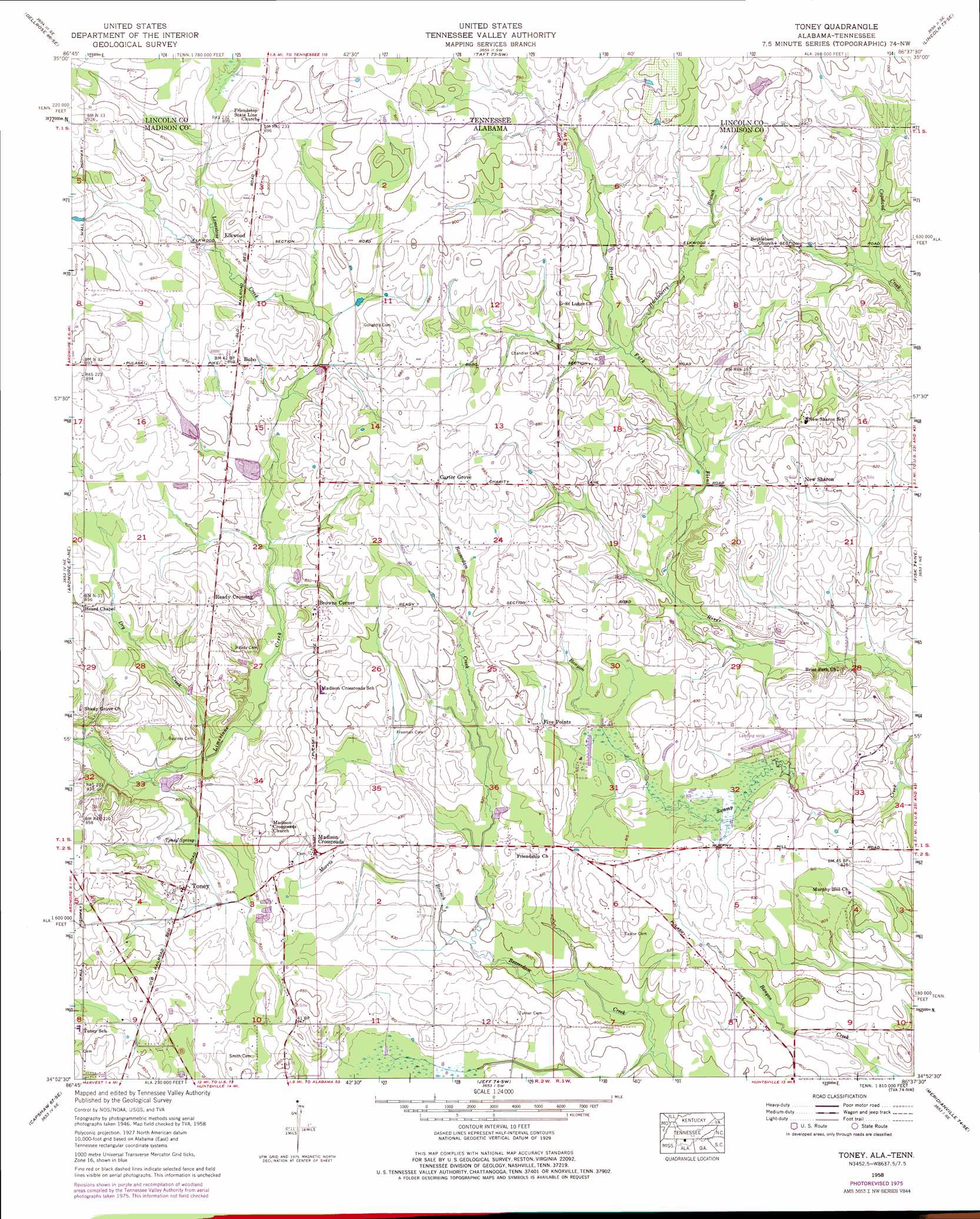
USGS Topo Quad 34086h6 - 1:24,000 scale
| Topo Map Name: | Toney |
| USGS Topo Quad ID: | 34086h6 |
| Print Size: | ca. 21 1/4" wide x 27" high |
| Southeast Coordinates: | 34.875° N latitude / 86.625° W longitude |
| Map Center Coordinates: | 34.9375° N latitude / 86.6875° W longitude |
| U.S. States: | AL, TN |
| Filename: | o34086h6.jpg |
| Download Map JPG Image: | Toney topo map 1:24,000 scale |
| Map Type: | Topographic |
| Topo Series: | 7.5´ |
| Map Scale: | 1:24,000 |
| Source of Map Images: | United States Geological Survey (USGS) |
| Alternate Map Versions: |
Toney AL 1936 Download PDF Buy paper map Toney AL 1958, updated 1959 Download PDF Buy paper map Toney AL 1958, updated 1975 Download PDF Buy paper map Toney AL 1958, updated 1977 Download PDF Buy paper map Toney AL 2010 Download PDF Buy paper map Toney AL 2011 Download PDF Buy paper map Toney AL 2014 Download PDF Buy paper map |
1:24,000 Topo Quads surrounding Toney
Tarpley |
Frankewing |
Boonshill |
Fayetteville |
Mulberry |
Elkton |
Dellrose |
Taft |
Lincoln |
Flintville |
Elkmont |
Ardmore |
Toney |
Fisk |
New Market |
Athens |
Capshaw |
Jeff |
Meridianville |
Maysville |
Tanner |
Greenbrier |
Madison |
Huntsville |
Moontown |
> Back to 34086e1 at 1:100,000 scale
> Back to 34086a1 at 1:250,000 scale
> Back to U.S. Topo Maps home
Toney topo map: Gazetteer
Toney: Airports
Hazel Green Airport elevation 247m 810′Toney: Dams
Randall Mullins Lake Dam elevation 250m 820′Toney: Populated Places
Bobo elevation 265m 869′Browns Corner elevation 262m 859′
Carter Grove elevation 269m 882′
Elkwood elevation 272m 892′
Five Points elevation 254m 833′
Madison Crossroads elevation 254m 833′
New Sharon elevation 254m 833′
Ready Crossing elevation 266m 872′
Toney elevation 252m 826′
Toney: Post Offices
Elkwood Post Office (historical) elevation 272m 892′Toney Post Office elevation 253m 830′
Toney: Reservoirs
Randall Mullins Lake elevation 250m 820′Toney: Springs
Toney Spring elevation 245m 803′Toney: Streams
Dry Creek elevation 243m 797′Huckleberry Branch elevation 252m 826′
Huckleberry Branch elevation 252m 826′
Morris Branch elevation 242m 793′
Toney digital topo map on disk
Buy this Toney topo map showing relief, roads, GPS coordinates and other geographical features, as a high-resolution digital map file on DVD: